
more stats
2.3 miles
Distance
353 ft
Climb
-178 ft
Descent
00:24:23
Avg time
176 ft
Altitude change
5,251 ft
Altitude min
5,519 ft
Altitude max
5,251 ft
Altitude start
5,427 ft
Altitude end
1.5%
Grade
-27.2%
Grade max
27%
Grade min
1 mile
Distance climb
3,743 ft
Distance down
479 ft
Distance flat
00:24:23
Avg time

Pine Mountain Trail Details

  • Activities
    • Mountain Bike
    • Hike
    • Trail Running
  • Riding Area
  • Ref Number
    #5e08
  • Difficulty Rating
  • Local Popularity
    35 in Mountain Biking heatmap [+]
    • 70 in Trail Running
    • 25 in Hiking
  • Global Ranking
    #124224 in Mountain Biking [+]
    • #122545 in Trail Running
    • #331788 in Hiking
  • State Ranking
    #4,597 in Mountain Biking · California [+]
    • #6,039 in Trail Running
    • #14,211 in Hiking
  • Trail Type
    Singletrack
  • Bike Type
    AM, XC
  • Direction
    Both Directions
  • Climb Difficulty
    Blue
  • Physical Rating
    Moderate
  • Dogs Allowed
    Yes
  • Land Owner

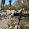
The trail begins across Sunrise Highway from the Pioneer Mail equestrian parking area in the Laguna Mountain Recreation Area, part of Cleveland National Forest. The Pioneer Mail area is home to a historic route that stagecoach’s once traveled.

Across the highway from that parking area and immediately to the north is an unnamed road that drops into the valley to the west. Its gates are usually open. The trail head begins immediately to the north of those gates; look for the Pine Mountain Trail’s wooden marker.


Best time to visit is spring through fall. Chaparral with some oak woodland. Panoramic view of oak and pine surrounded meadow 500 ft. below the trail. The trail connects to the Indian Creek Trail, the Noble Canyon Trail, and the Pacific Crest Trail for a loop back to Pioneer Mail Trailhead.

Access Info

Directions: I-8 east to Sunrise Highway as far as the Pioneer Mail Trailhead at the north end of the Laguna Recreation Area. Parking is available for equestrian and passenger vehicles. There is a picnic area with barbecue stoves and a pit toilet, but no water is available at this site. In the summer there is water available for equestrian use on the Pacific Crest Trail near the trailhead.

Tags
MeadowViews

Trail Supporters

Local Trail Association

Traditionally Indigenous Territory

Recent Activity on Trail

Past Week
  • 0 rides
  •  
6 Months
  • 11 rides
  • 27 miles avg distance
All
  • 151 rides
  • Last: Nov 8, 2026
c1c2c3c4
January
February
March
April
May
June
July
August
September
October
November
December
update trails status or condition

Pine Mountain Trail Trail Reports

statusdatedescription
Jun 28, 2026 @ 9:11am (America/Los_Angeles)
Jun 28, 2026
Pretty overgrown and sharp
Mar 23, 2025 @ 12:54pm
Mar 23, 2025
Rode the southern half and it was great.
Aug 3, 2024 @ 10:35am
Aug 3, 2024
Major portions of high weeds and confident shrubs that need a lesson. Still fun. Obvious trail work was done in some sections- thank you!
Jan 14, 2024 @ 8:51am
Jan 14, 2024
Great condition right now, loose rock as usual but in good riding shape
Sep 7, 2023 @ 1:50pm
Sep 7, 2023
Problem fixwed
more »
Status:
on Jun 28, 2026
Very Dry
Avg: 3.99 (5 votes)
Your vote: 0

view (628)
close
      Directions to pine-mountain-trail trailhead (32.923810, -116.481060)

      Photos

      44 more »
      mtb
      139 |
      Mar 26, 2016 @ 10:39am
      Mar 26, 2016
      mtb
      44 |
      Mar 31, 2025 @ 9:40am
      Mar 31, 2025
      mtb
      53 |
      Aug 3, 2024 @ 1:39pm
      Aug 3, 2024
      mtb
      45 |
      Aug 3, 2024 @ 1:39pm
      Aug 3, 2024

      Videos

      no videos have been added for Pine Mountain Trail yet, add a video.

      Routes with this trail

      more »
      ★ 5.0 • 111 miles • 7,111 ft • 26 • Point to Point •
      A wonderful 3 day / 2 night bikepacking adventure through remote areas of San Diego County. We are...
      4.0 ★★★★★
      5 Ratings
      5 ★
      4 ★ 100%
      3 ★
      2 ★
      1 ★

      3 Reviews & Comments

      bikespot360 bikespot360
      Plenty of dispersed camping spots off of Pine Valley Road.
      gymclasshero gymclasshero
      Want to come hit this and others in Noble Cyn - can someone reco a good legal/easy 4WD/BLM/dispersed camping/non campground spot? 2 day stay likely.

      We hope you've been enjoying Trailforks!

      Create a FREE account to view all trail reviews and much more.

      • By stoker1223 & contributors
      • #29042 - 2,801 views

      Frequently Asked Questions

      ▼ Where is Pine Mountain Trail located?
      Pine Mountain Trail is located in Cleveland National Forest (San Diego County), Mount Laguna, California, United States. It is part of the Cleveland National Forest (San Diego County) trail network. The trailhead is located at coordinates 32.92381, -116.48106.
      ▼ How hard is Pine Mountain Trail?
      Pine Mountain Trail is rated as Blue difficulty. The physical rating is Moderate. The average grade is 1.5%. The climb difficulty is rated Blue.
      ▼ What is the elevation gain for Pine Mountain Trail?
      Pine Mountain Trail has 353 ft of elevation gain. The trail has 178 ft of elevation descent. The elevation ranges from 5,251 ft to 5,519 ft.
      ▼ Is Pine Mountain Trail a point to point trail?
      Pine Mountain Trail is not a point to point trail. The direction is Both Directions. The trail type is singletrack.
      ▼ How long is Pine Mountain Trail?
      Pine Mountain Trail is 2.3 miles long. The trail type is singletrack.
      ▼ Are dogs allowed on Pine Mountain Trail?
      Yes, dogs are allowed on Pine Mountain Trail. Please keep dogs on a leash where required and clean up after them.
      ▼ When is the best time of year to ride Pine Mountain Trail?
      Based on activity log data, the most popular months to ride Pine Mountain Trail are:
      • October (9 activities)
      • June (8 activities)
      • August (5 activities)
      Check the reports page for current trail conditions.
      ▼ How do I access Pine Mountain Trail? Where is the closest parking trailhead?
      The closest parking and trailhead locations to Pine Mountain Trail are: View all parking locations in the area.
      ▼ How long does it take to ride Pine Mountain Trail?
      Based on recorded activities, it takes an average of 24 minutes to ride Pine Mountain Trail. The trail is 2.3 miles long. Actual times will vary based on fitness level, conditions, and pace. View recent activity logs for more details.
      ▼ How busy is Pine Mountain Trail?
      Pine Mountain Trail is a less popular trail with lighter traffic. There have been 629 recorded activities on this trail. The trail has received 628 check-ins. View recent activity on this trail.

      Hit the Trail

      Open in App

      Get this trail on your phone instantly.

      open trail in app

      Download Trail

      Save to wishlist, Garmin & download.
      save the trail

      Find Related Routes

      Find routes and users activities that include this trail.
      find routes for this trail

      You must enter a description before submitting.