more stats
4,852 ft
Distance
221 ft
Climb
-87 ft
Descent
00:10:35
Avg time
135 ft
Altitude change
815 ft
Altitude min
1,015 ft
Altitude max
879 ft
Altitude start
1,014 ft
Altitude end
2.8%
Grade
-24.6%
Grade max
20.1%
Grade min
2,877 ft
Distance climb
1,512 ft
Distance down
463 ft
Distance flat
00:10:35
Avg time

Pipedream Details

  • Activities
    • Mountain Bike
    • E-Bike
  • Riding Area
  • Difficulty Rating
  • Voted Difficulty
    Blue (3 votes)
  • Local Popularity
    100 in Mountain Biking [+]
    • 95 in E-Biking
  • Global Ranking
    #32241 in Mountain Biking [+]
    • #5157 in E-Biking
  • Trail Type
    Singletrack
  • Bike Type
    AM, XC
  • Climb Difficulty
    Blue
  • Physical Rating
    Moderate
  • Trail Visibility
    Always easy to follow
  • eBike Allowed
    Yes up to Class 1

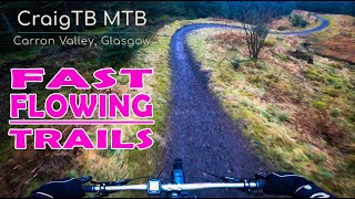
Moderate, swoopy singletrack breaks up the gentle climb through the forest, and there are superb views across the valley from the viewpoint. The fast exit into the quarry through Stoney Broke sets you up for the ascent to Eas Dubh.

Starts at the edge of the dam. Follow the forest road out of the car park to the start of the trail. See the trail map for details. Singletrack climb. Includes track features like drop-offs and stony sections.

Recent Activity on Trail

Past Week
  • 0 rides
  •  
6 Months
  • 37 rides
  • 13 miles avg distance
All
  • 334 rides
  • Last: Jun 23, 2026
c1c2c3c4
January
February
March
April
May
June
July
August
September
October
November
December
Status:
on May 16, 2026
Dry
Avg: 3.24 (10 votes)
Your vote: 0

view (6,094)
close
3D
Trail Conditions
  • Unknown
  • Snow Groomed
  • Snow Packed
  • Snow Covered
  • Snow Cover Partial
  • Freeze/thaw Cycle
  • Icy
  • Prevalent Mud
  • Wet
  • Variable
  • Ideal
  • Dry
  • Very Dry
Trail Flow (Ridden Direction)
Trailforks scans users ridelogs to determine the most popular direction each trail is ridden. A good flowing trail network will have most trails flowing in a single direction according to their intension.
The colour categories are based on what percentage of riders are riding a trail in its intended direction.
  • > 96%
  • > 90%
  • > 80%
  • > 70%
  • > 50%
  • < 50%
  • bi-directional trail
  • no data
Trail Last Ridden
Trailforks scans ridelogs to determine the last time a trail was ridden.
  • < 2 days
  • < 1 week
  • < 2 weeks
  • < 1 month
  • < 6 months
  • > 6 months
Trail Ridden Direction
The intended direction a trail should be ridden.
  • Downhill Only
  • Downhill Primary
  • Both Directions
  • Uphill Primary
  • Uphill Only
  • One Direction
Contribute Details
Colors indicate trail is missing specified detail.
  • Description
  • Photos
  • Description & Photos
  • Videos
Trail Popularity ?
Trailforks scans ridelogs to determine which trails are ridden the most in the last 9 months. Trails are compared with nearby trails in the same city region with a possible 25 colour shades. Think of this as a heatmap, more rides = more kinetic energy = warmer colors.
  • most popular
  • popular
  • less popular
  • not popular
ATV/ORV/OHV Filter
Max Vehicle Width
inches
US Cell Coverage
Legend
cell carrier legend

Radar Time
Activity Recordings
Trailforks uses anonymized public activity data. ?
Activity Recordings
Trailforks uses anonymized public activity data. ?
Personal Heatmap
Activity Types
all / none
Options
2
Date range month
Winter Trails
Warning A routing network for winter maps does not exist. Selecting trails using the winter trails layer has been disabled.
Missing Trails
Most Popular
Least Popular
Trails are colored based on popularity. The more popular a trail is, the more red. Less popular trails trend towards green.
Jump Magnitude Heatmap
Heatmap of where riders jump on trails. Zoom in to see individual jumps, click circles to view jump details.
BC Backroad Status

Service Road Atlas is a free to use, community-driven service for viewing and creating reports on the numerous back-country service roads around B.C. and Alberta.

map legend
Slope Aspect
Direction the slope faces
Flat N NE E SE S SW W NW
Trails Deemphasized
Trails are shown in grey.
disable
Only show trails with no bike usage.
Enable
Suggested Layers
Based on selected activity type

    Save the current map location and zoom level as your default home location whenever this page is loaded.

    Save
        Directions to pipedream-21710 trailhead (56.025380, -4.060770)

        Photos

        4 more »
        71 |
        Sep 12, 2021 @ 5:57am
        Sep 12, 2021
        72 |
        Oct 4, 2020 @ 6:10am
        Oct 4, 2020
        100 |
        Dec 26, 2018 @ 8:18am
        Dec 26, 2018
        108 |
        Dec 26, 2018 @ 8:17am
        Dec 26, 2018

        Videos

        2 more »
        youtuber Carron Valley mtb trails. Part 1. Pipedream....
        13:21 | 265 | Jun 7, 2023 , Denny
        FAST & FLOWING LOCKDOWN MTB TRAILS -...
        5:26 | 354 | Mar 17, 2021 , Denny

        3 Reviews & Comments


        We hope you've been enjoying Trailforks!

        Create a FREE account to view trail comments and much more.

        Nearby Trails

        Frequently Asked Questions About Pipedream

        Where is Pipedream located?
        Pipedream is located in Carron Valley, Denny, United Kingdom. It is part of the Carron Valley trail network. The trailhead is located at coordinates 56.02538, -4.06077.
        How hard is Pipedream?
        Pipedream is rated as Red difficulty. The physical rating is Moderate. The average grade is 2.8%. The climb difficulty is rated Blue.
        What is the elevation gain for Pipedream?
        Pipedream has 67 m of elevation gain. The trail has 27 m of elevation descent. The elevation ranges from 248 m to 309 m.
        How long is Pipedream?
        Pipedream is 1.5 km long. The trail type is singletrack.

        Hit the Trail

        Open in App

        Get this trail on your phone instantly.
        open trail in app

        Download Trail

        Save to wishlist, Garmin & download.
        save the trail

        Find Related Routes

        Find routes and users activities that include this trail.
        find routes for this trail

        You must enter a description before submitting.