
more stats
1.3 miles
Distance
-464 ft
Descent
00:14:25
Avg time
-465 ft
Altitude change
5,398 ft
Altitude min
5,863 ft
Altitude max
5,863 ft
Altitude start
5,397 ft
Altitude end
-6.7%
Grade
-20.8%
Grade max
-0.8%
Grade min
1 mile
Distance down
10 ft
Distance flat
00:14:25
Avg time

PJParty, Upper Details

  • Activities
    • Mountain Bike
  • Riding Area
    Cliffrose Trail System
    St. George, Utah
  • Difficulty Rating
  • Voted Difficulty
    Black Diamond (1 vote)
  • Local Popularity
    55 in Mountain Biking heatmap
  • Global Ranking
    #7710 in Mountain Biking
  • State Ranking
    #166 in Mountain Biking · Utah
  • Trail Type
    Singletrack
  • Bike Type
    DH, AM, XC
  • Direction
    Downhill Only
    Popular Direction Shown
  • Trail Visibility
    Sometimes hard to follow
  • Dogs Allowed
    Yes
  • TTFs on Trail
    Berm, Drop, Rock Face, Rock Garden
  • Land Owner
    Pine Valley Ranger District

A spicy DH trail which is worth the work to get to. Generally this gets easier the lower you are on the trail. The upper section is definitely black, middle dark blue, bottom section is green.

Disclaimer

THIS IS A DOWNHILL ONLY TRAIL!

Local Trail Association

Traditionally Indigenous Territory

Recent Activity on Trail

Past Week
  • 2 rides
  • 22.1 km average
6 Months
  • 10 rides
  • 25.6 km avg distance
All
  • 104 rides
  • Last: Nov 13, 2026
c1c2c3c4
January
February
March
April
May
June
July
August
September
October
November
December
Status:
on Oct 6, 2026
Dry
Avg: 4.21 (8 votes)
Your vote: 0

view (355)
close
      Directions to pjparty-upper trailhead (37.263210, -113.557720)

      Photos

      2 more »
      mtb
      84 |
      Apr 7, 2026 @ 7:04pm
      Apr 7, 2026
      mtb
      252 |
      Jan 9, 2025 @ 7:25am
      Jan 9, 2025

      Videos

      3 more »
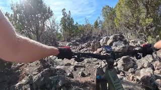
      PJParty - Full Trail
      mtb
      21:19 | 47 | Jun 6, 2026 , St. George
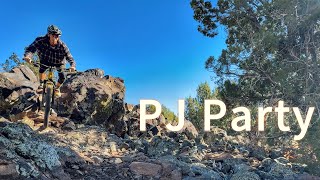
      PJ party
      mtb
      8:15 | 204 | Nov 9, 2025 , St. George
      youtuber PJ Party & new Cliffrose Trails are...
      mtb
      25:57 | 303 | Jan 10, 2025 , St. George
      4.4 ★★★★★
      8 Ratings
      5 ★ 63%
      4 ★ 13%
      3 ★ 25%
      2 ★
      1 ★

      12 Reviews & Comments

      utskier utskier
      Very chunky and techy. At times the grass looked semi-matted as if wheels don't hit the trail very often. This trail isn't flowy but nice and raw. It's a fun advanced black trail.
      CCS414
      Very different from trails like Zen and Gooseberry where you generally have smooth pedaling with intermittent gnarly technical sections. Upper PJ just has lots of bothersome, pesky chunk. I had to keep my seat up most of the way down because of all the necessary pedaling. Everything rolls so just go for it. Amazing views of Zion to the East and the Beaver Dam mountains to the south. A couple of medium sized jumps and some small rocks to pop off of. Will ride again.
      Mikemad3 Mikemad3
      Very chunky and techy on the upper part. Really gotta pick your lines and be focused. The further down the trail the easier it gets. Really fun if you like chunk. I prefer the new hollow point trail to this if you have to choose.

      We hope you've been enjoying Trailforks!

      Create a FREE account to view all trail reviews and much more.

      • By UtahJohnTF Pro TRAILFORKS & contributors
      • #814946 - 1,187 views

      Frequently Asked Questions

      ▼ Where is PJParty, Upper located?
      PJParty, Upper is located in Cliffrose Trail System, St. George, Utah, United States. It is part of the Cliffrose Trail System trail network. The trailhead is located at coordinates 37.26321, -113.55772.
      ▼ How hard is PJParty, Upper?
      PJParty, Upper is rated as Black Diamond difficulty. The average grade is 6.7%.
      ▼ What is the elevation gain for PJParty, Upper?
      The trail has 464 ft of elevation descent. The elevation ranges from 5,398 ft to 5,863 ft.
      ▼ Is PJParty, Upper a point to point trail?
      Yes, PJParty, Upper is a point to point trail. The direction is Downhill Only. The trail type is singletrack.
      ▼ How long is PJParty, Upper?
      PJParty, Upper is 1.3 miles long. The trail type is singletrack.
      ▼ Are dogs allowed on PJParty, Upper?
      Yes, dogs are allowed on PJParty, Upper. Please keep dogs on a leash where required and clean up after them.
      ▼ When is the best time of year to ride PJParty, Upper?
      Based on activity log data, the most popular months to ride PJParty, Upper are:
      • April (22 activities)
      • March (16 activities)
      • January (15 activities)
      Check the reports page for current trail conditions.
      ▼ How do I access PJParty, Upper? Where is the closest parking trailhead?
      The closest parking and trailhead locations to PJParty, Upper are: View all parking locations in the area.
      ▼ How long does it take to ride PJParty, Upper?
      Based on recorded activities, it takes an average of 14 minutes to ride PJParty, Upper. The trail is 1.3 miles long. Actual times will vary based on fitness level, conditions, and pace. View recent activity logs for more details.
      ▼ How busy is PJParty, Upper?
      PJParty, Upper is a moderately popular trail. There have been 355 recorded activities on this trail. The trail has received 355 check-ins. View recent activity on this trail.

      Hit the Trail

      Open in App

      Get this trail on your phone instantly.

      open trail in app

      Download Trail

      Save to wishlist, Garmin & download.
      save the trail

      Find Related Routes

      Find routes and users activities that include this trail.
      find routes for this trail

      You must enter a description before submitting.