
close
3D
Trail Conditions
- Unknown
- Snow Groomed
- Snow Packed
- Snow Covered
- Snow Cover Partial
- Freeze/thaw Cycle
- Icy
- Prevalent Mud
- Wet
- Variable
- Ideal
- Dry
- Very Dry
Trail Flow (Ridden Direction)
Trailforks scans users activity logs to determine the most popular direction each trail is ridden. A good flowing trail network will have most trails flowing in a single direction according to their intension.
The colour categories are based on what percentage of users are riding a trail in its intended direction.
The colour categories are based on what percentage of users are riding a trail in its intended direction.
- > 96%
- > 90%
- > 80%
- > 70%
- > 50%
- < 50%
- bi-directional trail
- no data
Trail Last Used
Trailforks scans activity logs to determine the last time a trail was ridden.
- < 2 days
- < 1 week
- < 2 weeks
- < 1 month
- < 6 months
- > 6 months
Trail Ridden Direction
The intended direction a trail should be ridden.
- Downhill Only
- Downhill Primary
- Both Directions
- Uphill Primary
- Uphill Only
- One Direction
Contribute Details
Colors indicate trail is missing specified detail.
- Description
- Photos
- Description & Photos
- Videos
Trail Popularity ?
Trailforks scans activity logs to determine which trails are ridden the most in the last 9 months.
Trails are compared with nearby trails in the same city region with a possible 25 colour shades.
Think of this as a heatmap, more activities = more kinetic energy = warmer colors.
- most popular
- popular
- less popular
- not popular
ATV/ORV/OHV Filter
Max Vehicle Width
inches
US Cell Coverage
Legend

Radar Time
Activity Recordings
Trailforks uses anonymized public activity data.
?
Activity Recordings
Trailforks uses anonymized public activity data.
?
Winter Trails
Warning
A routing network for winter maps does not exist. Selecting trails using the winter trails layer has been disabled.
Missing Trails
Most Popular
Least Popular
Trails are colored based on popularity. The more popular a trail is, the more red. Less popular trails trend towards green.
Jump Magnitude Heatmap
Heatmap of where users jump on trails. Zoom in to see individual jumps, click circles to view jump details.
BC Backroad Status
![map legend]()
Service Road Atlas is a free to use, community-driven service for viewing and creating reports on the numerous back-country service roads around B.C. and Alberta.

Slope Aspect
Direction the slope faces
Trails Deemphasized
Trails are shown in grey.
Only show trails with no bike usage.
Suggested Layers
Based on selected activity type
Save the current map location and zoom level as your default home location whenever this page is loaded.
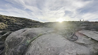
SaveSt. George includes many riding areas and combined with it's neighbors of Hurricane and Virgin provides every riding style and option. Known best for it's Green Valley and the iconic Zen trail, St.George serves up classic desert riding over interesting rock formations and amazing views from the Bloomington Hills Ridge. More popular for fast and fun flow for intermediate and beginners is the Bearclaw Poppy Trail
AKA: Saint George, St George
Trail info last updated
Activities Click to view
- Mountain Bike
299 trails
- E-Bike
120 trails
- Gravel Bike
81 trails
- Adaptive Bike
85 trails
- Winter Fat Bike
6 trails
- Horse
15 trails
- Hike
334 trails
- Trail Running
327 trails
- Dirtbike/Moto
14 trails
- ATV/ORV/OHV
17 trails
Region Details
- 42
- 25
- 70
- 103
- 51
- 8
Region Status
Open as of Nov 14, 2026
Stats
- Avg Trail Rating
- Trails (view details)
- 368
- Trails Mountain Bike
- 299
- Trails E-Bike
- 120
- Trails Gravel Bike
- 81
- Trails Adaptive Bike
- 85
- Trails Winter Fat Bike
- 6
- Trails Horse
- 15
- Trails Hike
- 334
- Trails Trail Running
- 327
- Trails Dirtbike/Moto
- 14
- Trails Observed Trials
- 1
- Trails ATV/ORV/OHV
- 17
- Total Distance
- 449 miles
- Total Descent
- 47,826 ft
- Total Vertical
- 5,239 ft
- Highest Trailhead
- 7,678 ft
- Reports
- 4,317
- Photos
- 1,455
- Completed Counter
- 225,825
Articles
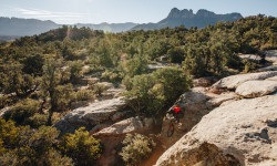
Destination Showcase - Greater Zion, UT
Jan 4, 2022 from pinkbike.com
Everything you need to know before you head to the Greater Zion area in Southwestern Utah.

Video: Jaxson Riddle Rips Utah to Prepare for Rampage Proving Grounds
Sep 4, 2019 from pinkbike.com
With the first Red Bull Rampage qualifier on the horizon, Utah local Jaxson Riddle is one to watch.
Sub Regions
-
Arizona Strip
-
Cliffrose Trail System
- 8
- 10
- 2
-
Desert Canyons
- 13
- 10
- 10
-
Green Valley
- 2
- 14
- 38
- 13
- 4
-
Kayenta Pickleball
- 1
- 9
-
Revenant Bike Park
- 4
- 2
- 1
- 1
-
Santa Clara River Reserve
- 2
- 4
- 18
- 8
-
Snow Canyon State Park
- 2
- 7
- 4
-
White Dome Nature Preserve
- 8
- 1
Popular St. George Mountain Biking Trails
• 100 ★ 4.3 • 2 miles • 0 ft • 5,858 •
Fast, smooth descent on hard-pack clay that’s a blast for all ages and ability levels. This is one of the most popular beginner trails in North America. The “main” trail is delineated by a series of wooden fences and trail markers...
• 95 ★ 4.3 • 5 miles • 787 ft • 5,149 •
The Zen Trail is easily the best trail in Green Valley. The trail starts with a short grind up an old ATV track to give you some altitude, and then you quickly start climbing up a combination of sandstone, packed dirt and smooth black...
• 100 ★ 4.5 • 427 ft • 49 ft • 4,541 •
This alt part of the trail hugs close to the cliff edge and is generally more rocky and technical than the other line. I feel like this is actually the main trail and the other is something of a created ride-around.
• 100 ★ 4.4 • 784 ft • 0 ft • 4,060 •
Series of steep, rocky rolls and drops with lines that range from beginner to advanced. There’s poor line of sight in places on this section of trail so descend in control and yield to uphill riders. This is not an “open freeride...
• 100 ★ 3.8 • 6 miles • 571 ft • 3,669 •
Great flowing singletrack, with some fun and tricky rocky sections
• 100 ★ 3.3 • 1,296 ft • 52 ft • 3,661 •
Bi-directional segment of Bearclaw Poppy Trail that provides connectivity for the lower, one-way BCP loop and the Stucki Springs Trail. It also allows for easy laps on Clavicle Hill or to continue north onto the Acid Drops segment....
• 100 ★ 3.4 • 2 miles • 259 ft • 3,594 •
Easy, directional climb that ascends the lower Bearclaw Poppy loop. The sanctioned trail is delineated by a series of wooden fences and trail markers installed to define the intended path of travel and protect the habitat of the Dwarf...
• 100 ★ 4.0 • 4,928 ft • 67 ft • 3,334 •
Bi-directional segment of Bearclaw Poppy Trail between the infamous 3 Fingers of Death and Acid Drops that’s suitable for beginner riders. A series of wooden fences along the trail were installed to define the intended path of travel...
St. George Mountain Bike Routes
★ 4.0 • 7 miles • 514 ft • 6 • Loop •
This is the green Flo Mo loop. It's green and a great ride for beginners or NICA training, but don't...
★ 5.0 • 6 miles • 615 ft • 4 • Loop •
This is the shortest loop to ride Ricks Ridge
Photos of St. George Mountain Bike
Videos of St. George Mountain Bike




Current Trail Warnings
| status | trail | date | condition | user | info |
|---|---|---|---|---|---|
| Blue Barrel | Nov 12, 2026 @ 11:09am (America/Denver) Nov 12, 2026 | Dry | Skiingh406 | ||
| Ringo | Oct 25, 2026 @ 11:31am (America/Denver) Oct 25, 2026 | Variable | UtahJohn TRAILFORKS | Duck ponds full of water, so have to work... |
Recent Trail Reports
| status | trail | date | condition | info | user |
|---|---|---|---|---|---|
| Coyote Crossing | Nov 14, 2026 @ 1:16pm (America/Denver) Nov 14, 2026 | Ideal | Nraiger | ||
| Rock Hound | Nov 14, 2026 @ 1:16pm (America/Denver) Nov 14, 2026 | Ideal | Nraiger | ||
| Hollowpoint | Nov 13, 2026 @ 10:32am (America/Phoenix) Nov 13, 2026 | Variable | PapaChip WTF | ||
| High Plains Drifter | Nov 13, 2026 @ 10:32am (America/Phoenix) Nov 13, 2026 | Variable | PapaChip WTF | ||
| Dirt Robber | Nov 13, 2026 @ 10:32am (America/Phoenix) Nov 13, 2026 | Variable | PapaChip WTF | ||
| Pillow Fight | Nov 13, 2026 @ 10:32am (America/Phoenix) Nov 13, 2026 | Variable | PapaChip WTF | ||
| Just My Pinyon, Upper | Nov 13, 2026 @ 10:32am (America/Phoenix) Nov 13, 2026 | Variable | PapaChip WTF | ||
| Just My Pinyon, Middle | Nov 13, 2026 @ 10:32am (America/Phoenix) Nov 13, 2026 | Variable | PapaChip WTF | ||
| Just My Pinyon, Lower | Nov 13, 2026 @ 10:32am (America/Phoenix) Nov 13, 2026 | Variable | PapaChip WTF | ||
| Get It Together | Nov 13, 2026 @ 10:32am (America/Phoenix) Nov 13, 2026 | Variable | PapaChip WTF |
Activity Feed
| username | action | type | title | date |
|---|---|---|---|---|
| melissamw25 | wishlist | trail | activity #108071053 | Nov 19, 2026 @ 8:50pm 12 hours |
| melissamw25 | wishlist | route | activity #108070830 | Nov 19, 2026 @ 8:36pm 13 hours |
| melissamw25 | wishlist | trail | activity #108070686 | Nov 19, 2026 @ 8:28pm 13 hours |
| melissamw25 | wishlist | route | activity #108069716 and 1 more | Nov 19, 2026 @ 7:32pm 14 hours |
| stephenrau | wishlist | route | activity #108066955 | Nov 19, 2026 @ 5:41pm 16 hours |
Recent Comments
| username | type | title | comment | date |
|---|---|---|---|---|
| trail | Head scratcher for the State and Regional race... | Nov 10, 2026 @ 6:37am Nov 10, 2026 | ||
| trail | If you like the middle section of Zen and wish... | Nov 5, 2026 @ 7:34pm Nov 5, 2026 | ||
| trail | Appears to be a new trail system. No route... | Nov 5, 2026 @ 3:10pm Nov 5, 2026 | ||
| trail | The main parking area is past Desert Colors... | Oct 29, 2026 @ 4:26pm Oct 29, 2026 | ||
| trail | 1000 different lines, 0 features. Definitely... | Oct 27, 2026 @ 1:04pm Oct 27, 2026 |
Local Badges
-

Completionist0 awarded -

Big Ride 30k15,633 awarded -

Epic Ride 50k6,309 awarded -

Top 10 Trails47 awarded -
Completionist0 awarded -
Completionist0 awarded
Bike & Skill Parks
| name | type | city | rating |
|---|---|---|---|
| Snake Hollow St. George Bike Park | skill park | St. George | |
| Santa Clara BMX Track | skill park | St. George | |
| St. George MX | skill park | St. George |




Local Products

Activity Type Stats
| activitytype | trails | distance | descent | descent distance | total vertical | rating | global rank | state rank | photos | reports | routes | activity logs |
|---|---|---|---|---|---|---|---|---|---|---|---|---|
| Mountain Bike | 299 | 374 miles | 40,984 ft | 163 miles | 3,747 ft | #60 | #4 | 1,359 | 4,313 | 87 | 132,146 | |
| E-Bike | 120 | 191 miles | 18,432 ft | 79 miles | 3,612 ft | #227 | #7 | 7 | 3,772 | 5 | 11,177 | |
| Gravel Bike | 81 | 197 miles | 17,300 ft | 77 miles | 5,194 ft | #183 | #5 | 589 | 1 | 282 | ||
| Adaptive Bike | 85 | 130 miles | 11,188 ft | 51 miles | 2,828 ft | #80 | #3 | 1 | 1,170 | 1 | 6 | |
| Winter Fat Bike | 6 | 3 miles | 194 ft | 3,996 ft | 2,356 ft | #950 | #8 | 146 | 3 | |||
| Horse | 15 | 16 miles | 2,060 ft | 6 miles | 3,225 ft | #872 | #34 | 6 | 731 | 1 | 2 | |
| Hike | 334 | 425 miles | 43,045 ft | 170 miles | 5,240 ft | #105 | #4 | 62 | 4,270 | 57 | 10,247 | |
| Trail Running | 327 | 420 miles | 42,687 ft | 168 miles | 5,240 ft | #143 | #5 | 20 | 4,255 | 57 | 6,763 | |
| Dirtbike/Moto | 14 | 86 miles | 8,570 ft | 35 miles | 5,118 ft | #122 | #8 | 726 | 257 | |||
| Observed Trials | 1 | 4,797 ft | 348 ft | 3,914 ft | 322 ft | 5 | 24 | |||||
| ATV/ORV/OHV | 17 | 91 miles | 8,973 ft | 37 miles | 5,118 ft | #54 | #6 | 726 | 1 | 62 |
Frequently Asked Questions
▼
What are the best places to ride in St. George?
St. George has 10 areas to explore for mountain biking. The top rated areas are:
▼
What are the highest rated mountain biking trails in St. George?
The highest rated mountain biking trails in St. George are:
- Rooster, Upper (4.6/5)
- Turtle Wall (4.5/5)
- Rooster, Lower (4.5/5)
- Quick Draw (4.5/5)
- Just My Pinyon, Upper (4.5/5)
▼
What is the best time of the year to ride in St. George?
Based on activity log data, the most popular months to ride in St. George are:
- March (1,458 activities)
- April (1,318 activities)
- October (1,269 activities)
▼
Where can I park to ride in St. George?
There are 41 parking locations listed in St. George. The most popular parking spots are: View all parking and trailhead locations on the map to plan your visit.
▼
What is the longest trail in St. George?
The longest trail in St. George is Virgin River Bike Path at 13.7 miles. View all trails sorted by distance.
▼
What are the best & highest rated hiking trails in St. George?
The best hiking trails in St. George are:
- Pioneer Park Overlook Rock
- Scout Cave - Johnson Canyon
- Butterfly Trail
- Hidden Pinyon Overlook
- Petrified Dunes
▼
What are the best & highest rated trail running trails in St. George?
The best trail running trails in St. George are: View all trail running trails sorted by popularity score.
▼
What are the best & highest rated dirtbiking trails in St. George?
The best dirtbiking trails in St. George are: View all dirtbiking trails sorted by popularity score.
▼
How many trails are in St. George?
St. George has a total of 368 trails. Of those, 299 are designated for mountain biking. Browse top mountain biking trails in St. George to find detailed information including difficulty ratings, distances, and trail conditions.
▼
Which trail has the most elevation gain in St. George?
The trail with the most elevation gain in St. George is Honeymoon Pack Trail with 1,513 ft of elevation gain. View all trails sorted by elevation gain.
▼
Which trail has the most elevation descent in St. George?
The trail with the most elevation descent in St. George is Hell Hole DH with 1,265 ft of elevation descent. View all trails sorted by elevation descent.
▼
What activities are most popular in St. George?
St. George supports the following activities: Mountain Biking, E-Biking, Gravel Biking, Adaptive Biking, Winter Fat Biking, Horseback, Hiking, Trail Running, Dirtbiking, ATVing/Offroading.
▼
What bike services are there in St. George?
The following bike services are available in St. George:
- Bike Shop (5)
- Guides & Tours (3)
- Trail Association (1)
- Other (1)
▼
What are the steepest mountain biking trails in St. George?
The steepest mountain biking trail in St. George is U-waiv Conn with an average grade of 13%. View all trails sorted by grade.
▼
Are there any trails with scenic viewpoints in St. George?
Yes, there are 2 scenic viewpoints marked along trails in St. George. Some popular viewpoints include: Explore more points of interest to find trails with the best views.
▼
What trails have the biggest jumps in St. George?
The trails with the biggest jumps in St. George are: Browse all mountain bike trails to find trails with jumps and technical features.
▼
Are the trails open in St. George?
The overall region status for St. George is Clear / Green. Out of 282 trails:
- Clear / Green: 257
- Minor Issue / Yellow: 18
- Significant Issue / Amber: 6
- Closed: 1
▼
What are the trail conditions in St. George?
Based on trail reports from the past week in St. George:
- Variable: 10 trails
- Dry: 2 trails
- Ideal: 2 trails
▼
Can I ride an ebike in St. George?
Yes, St. George supports e-bike riding. There are 104 trails in St. George that allow e-bikes. Check the e-bike trails listing for specific trail access details and any local regulations.
▼
What are the most popular mountain biking routes in St. George?
The most popular mountain biking routes in St. George are: View all mountain biking routes in St. George.
▼
What type of bike is most common in St. George?
Based on activity log data, the most common bike types used in St. George are:
- AM (1,199 activities)
- XC (89 activities)
- DH (13 activities)
- RD (11 activities)
- Adaptive MTB (6 activities)
▼
What is the highest summit in St. George?
The highest summit in St. George is West Mountain Peak at 7,697 ft elevation.
▼
What are the top sights to see in St. George?
There are 9 notable sights in St. George. Some of the top sights include: Explore all points of interest in St. George.
▼
What are the most popular Strava Segments in St. George?
The most popular Strava segments in St. George are:
- Down the poppy (23,622 athletes)
- U-Turn up Bearclaw Poppi (18,334 athletes)
- Techy Zen Cliff (17,994 athletes)
▼
What are some popular technical trail features in St. George?
There are 11 technical trail features (TTFs) in St. George. Some popular features include:
- Barrel Jump 2 (Jump)
- Barrel Jump 3 (Jump)
- Barrel Step Up (Jump)
- Barrel Jump 1 (Jump)
- Large Step Down Drop (Drop)
▼
What trails are closed in St. George?
There are currently 1 closed trails in St. George. The breakdown of all trail statuses is:
- Clear / Green: 257
- Minor Issue / Yellow: 18
- Significant Issue / Amber: 6
- Closed: 1
▼
Are there accessible or adaptive trails in St. George?
Yes, there are 84 accessible/adaptive trails in St. George. View all adaptive trails in St. George for specific accessibility information.
▼
Are there local clubs or events in St. George?
There are 3 local clubs or associations listed in the St. George directory. Browse the local directory for details.
▼
Are there any mountain biking guiding or tour operators in St. George?
Yes, there are mountain biking guiding and tour operators in St. George: Browse all guiding and tour operators in St. George.
▼
What are the most popular mountain biking trails in St. George?
The most popular mountain biking trails in St. George are: View all mountain biking trails sorted by popularity.
▼
What are the best beginner ride trails in St. George?
The best beginner mountain biking trails in St. George are:
- Bearclaw Poppy (Downhill) (4.3/5)
- Get It Together (4.6/5)
- Get It Together (4.7/5)
Activities
- St. George Mountain Biking Trails
- St. George E-Biking Trails
- St. George Gravel Biking Trails
- St. George Adaptive Biking Trails
- St. George Winter Fat Biking Trails
- St. George Horseback Trails
- St. George Hiking Trails
- St. George Trail Running Trails
- St. George Dirtbiking Trails
- St. George ATVing/Offroading Trails
Trails
- By clos8
 & contributors
- Admins: TASU, SUBA
- #3412 - 139,589 views
- st. george activity log | embed map of St. George mountain bike trails | st. george mountain biking points of interest polygons
Downloading of trail gps tracks in kml & gpx formats is enabled for St. George.
You must login to download files.
