

more stats
1.1 miles
Distance
58 ft
Climb
-999 ft
Descent
00:20:04
Avg time
-942 ft
Altitude change
1,289 ft
Altitude min
2,230 ft
Altitude max
2,230 ft
Altitude start
1,289 ft
Altitude end
-16.002%
Grade
-40.879%
Grade max
15.231%
Grade min
752 ft
Distance climb
5,119 ft
Distance down
14 ft
Distance flat
00:20:04
Avg time

Plešiny Details

  • Activities
    • Hike
    • Mountain Bike
    • Trail Running
  • Riding Area
    Polom
    Žilina
  • AKA
    Špičák
  • Difficulty Rating
  • Voted Difficulty
    Double Black Diamond (1 vote)
  • Local Popularity
    30 in Mountain Biking [+]
    • 40 in Trail Running
    • 70 in Hiking
  • Global Ranking
    #114882 in Mountain Biking [+]
    • #61114 in Trail Running
    • #89424 in Hiking
  • Hiking SAC Scale
    T1 Hiking
  • Blaze Color
  • Trail Type
    Singletrack
  • Bike Type
    DH, AM
  • Direction
    Downhill Primary
    Popular Direction Shown
  • Climb Difficulty
    Black Diamond
  • Physical Rating
    Hard
  • Dogs Allowed
    Yes
  • OSM Way

Žltá TZ zo sedla Kojšová do Strečna. Pekný scenerický singletrail bočným hrebeňom, ktorý má asi všetko, čo má zabavný trail ponúkať: odklopené pasáže, prírodné skoky, krátke a prudké výšľapy, prudký zjazd s pár skalkami a pár zavretých swtichbackov na záver. Od roku 2018 je na záverečnej DH pasáži vyhliadka, ktorá priťahuje mnoštvo turistov, doporučuje sa jazdiť prevažne cez týždeň. Počas víkendov buďte opatrný

Yellow hiking trail from "sedlo Kojšová" to "Strečno". Very sceneric singletrail that has some various features: off-camber, natural jumps, short and steep uphills, steep downhill with some rocks and tight switchbacks as well. There is small observation tower in the final part of the trail since 2018, therefore it's highly recomended to ride this trail during the workdays. If you're riding it during weekends, you'll probably meet a lot of hikers, please be careful.

This trail is unsanctioned.

Recent Activity on Trail

Past Week
  • 0 rides
  •  
6 Months
  • 1 rides
  • 21 miles avg distance
All
  • 19 rides
  • Last: May 9, 2026
c1c2c3c4
January
February
March
April
May
June
July
August
September
October
November
December
Status:
on Sep 14, 2025
Ideal
Avg: 4.31 (13 votes)
Your vote: 0

view (358)
close
      Directions to plesiny trailhead (49.165820, 18.847540)

      Photos

      8 more »
      mtb
      221 |
      Aug 4, 2019 @ 11:05am
      Aug 4, 2019
      mtb
      228 |
      May 9, 2019 @ 6:16am
      May 9, 2019
      mtb
      210 |
      May 9, 2019 @ 6:14am
      May 9, 2019
      mtb
      184 |
      May 9, 2019 @ 6:12am
      May 9, 2019

      Videos

      3 more »
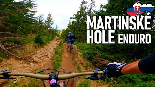
      Enduro Martinské Hole - SK | SEASON 2k21 e03
      mtb
      17:19 | 456 | Jun 22, 2021 , Žilina
      Poď ty satan! Hole, Minčol, Strečno
      mtb
      13:25 | 596 | Aug 29, 2019 , Žilina
      Zjazd od rozhľadne Špicák
      mtb
      3:37 | 230 | May 10, 2019 , Žilina

      Routes with this trail

      ★ 5.0 • 13 miles • 3,130 ft • 8 • Point to Point •
      AM/EN route from Turie to Strecno.
      ★ 3.0 • 31 miles • 7,992 ft • 31 • Loop •
      Ride plan - we'll see how it goes
      38 miles • 5,754 ft • 10 •
      Hreben Martinskych holi od Hornej Luky
      4.5 ★★★★★
      13 Ratings
      5 ★ 54%
      4 ★ 38%
      3 ★ 8%
      2 ★
      1 ★

      1 Review & Comments

      arczii arczii
      the best in this area.It is a pity that they built this tower at the top.

      We hope you've been enjoying Trailforks!

      Create a FREE account to view all trail reviews and much more.

      • #50334 - 2,744 views

      Frequently Asked Questions

      ▼ Where is Plešiny located?
      Plešiny is located in Polom, Žilina, Slovakia. It is part of the Polom trail network. The trailhead is located at coordinates 49.16582, 18.84754.
      ▼ How hard is Plešiny?
      Plešiny is rated as Black Diamond difficulty. The physical rating is Hard. The average grade is 16.002%. The climb difficulty is rated Black Diamond.
      ▼ What is the elevation gain for Plešiny?
      Plešiny has 58 ft of elevation gain. The trail has 999 ft of elevation descent. The elevation ranges from 1,289 ft to 2,230 ft.
      ▼ Is Plešiny a point to point trail?
      Plešiny is not a point to point trail. The direction is Downhill Primary. The trail type is singletrack.
      ▼ How long is Plešiny?
      Plešiny is 1.1 miles long. The trail type is singletrack.
      ▼ Are dogs allowed on Plešiny?
      Yes, dogs are allowed on Plešiny. Please keep dogs on a leash where required and clean up after them.
      ▼ How do I access Plešiny? Where is the closest parking trailhead?
      The closest parking and trailhead locations to Plešiny are: View all parking locations in the area.
      ▼ How long does it take to ride Plešiny?
      Based on recorded activities, it takes an average of 21 minutes to ride Plešiny. The trail is 1.1 miles long. Actual times will vary based on fitness level, conditions, and pace. View recent activity logs for more details.
      ▼ How busy is Plešiny?
      Plešiny is a less popular trail with lighter traffic. There have been 368 recorded activities on this trail. The trail has received 358 check-ins. View recent activity on this trail.

      Hit the Trail

      Open in App

      Get this trail on your phone instantly.

      open trail in app

      Download Trail

      Save to wishlist, Garmin & download.
      save the trail

      Find Related Routes

      Find routes and users activities that include this trail.
      find routes for this trail

      You must enter a description before submitting.



