more stats
1.4 miles
Distance
2 ft
Climb
-484 ft
Descent
00:05:03
Avg time
-482 ft
Altitude change
2,445 ft
Altitude min
2,927 ft
Altitude max
2,927 ft
Altitude start
2,445 ft
Altitude end
-6.388%
Grade
-30.842%
Grade max
4.087%
Grade min
197 ft
Distance climb
1 mile
Distance down
450 ft
Distance flat
00:05:03
Avg time

POW Details

  • Activities
    • Mountain Bike
    • Hike
    • Trail Running
  • Riding Area
    Bootleg Canyon
    Boulder City, Nevada
  • Difficulty Rating
  • Voted Difficulty
    Blue (1 vote)
  • Local Popularity
    95 in Mountain Biking [+]
    • 95 in Trail Running
    • 5 in Hiking
  • Global Ranking
    #37910 in Mountain Biking [+]
    • #22453 in Trail Running
    • #224208 in Hiking
  • Trail Type
    Singletrack
  • Bike Type
    DH, AM
  • Direction
    Downhill Primary
  • Physical Rating
    Moderate
  • Dogs Allowed
    Yes
  • TTFs on Trail
    Berm, Jump, Rock Garden, Roller Coaster

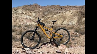
Really fun and flowy downhill trail. The start of this trail is at the top,you will want to ride DOWN the hill on POW.

You can ride this down to the veterans building and shuttle back up, or take the Par None back up.

Access Info

Park at the gazebo and take Mother, IMBA, or Mother connector via Girl Scout/West Leg to access POW

Local Trail Association
Traditionally Indigenous Territory

Recent Activity on Trail

Past Week
  • 2 rides
  • 16 miles average
6 Months
  • 87 rides
  • 13 miles avg distance
All
  • 867 rides
  • Last: Jun 28, 2026
c1c2c3c4
January
February
March
April
May
June
July
August
September
October
November
December
Status:
on May 19, 2026
Ideal
Avg: 4.29 (19 votes)
Your vote: 0

view (5,225)
close
3D
Trail Conditions
  • Unknown
  • Snow Groomed
  • Snow Packed
  • Snow Covered
  • Snow Cover Partial
  • Freeze/thaw Cycle
  • Icy
  • Prevalent Mud
  • Wet
  • Variable
  • Ideal
  • Dry
  • Very Dry
Trail Flow (Ridden Direction)
Trailforks scans users ridelogs to determine the most popular direction each trail is ridden. A good flowing trail network will have most trails flowing in a single direction according to their intension.
The colour categories are based on what percentage of riders are riding a trail in its intended direction.
  • > 96%
  • > 90%
  • > 80%
  • > 70%
  • > 50%
  • < 50%
  • bi-directional trail
  • no data
Trail Last Ridden
Trailforks scans ridelogs to determine the last time a trail was ridden.
  • < 2 days
  • < 1 week
  • < 2 weeks
  • < 1 month
  • < 6 months
  • > 6 months
Trail Ridden Direction
The intended direction a trail should be ridden.
  • Downhill Only
  • Downhill Primary
  • Both Directions
  • Uphill Primary
  • Uphill Only
  • One Direction
Contribute Details
Colors indicate trail is missing specified detail.
  • Description
  • Photos
  • Description & Photos
  • Videos
Trail Popularity ?
Trailforks scans ridelogs to determine which trails are ridden the most in the last 9 months. Trails are compared with nearby trails in the same city region with a possible 25 colour shades. Think of this as a heatmap, more rides = more kinetic energy = warmer colors.
  • most popular
  • popular
  • less popular
  • not popular
ATV/ORV/OHV Filter
Max Vehicle Width
inches
US Cell Coverage
Legend
cell carrier legend

Radar Time
Activity Recordings
Trailforks uses anonymized public activity data. ?
Activity Recordings
Trailforks uses anonymized public activity data. ?
Personal Heatmap
Activity Types
all / none
Options
2
Date range month
Winter Trails
Warning A routing network for winter maps does not exist. Selecting trails using the winter trails layer has been disabled.
Missing Trails
Most Popular
Least Popular
Trails are colored based on popularity. The more popular a trail is, the more red. Less popular trails trend towards green.
Jump Magnitude Heatmap
Heatmap of where riders jump on trails. Zoom in to see individual jumps, click circles to view jump details.
BC Backroad Status

Service Road Atlas is a free to use, community-driven service for viewing and creating reports on the numerous back-country service roads around B.C. and Alberta.

map legend
Slope Aspect
Direction the slope faces
Flat N NE E SE S SW W NW
Trails Deemphasized
Trails are shown in grey.
disable
Only show trails with no bike usage.
Enable
Suggested Layers
Based on selected activity type

    Save the current map location and zoom level as your default home location whenever this page is loaded.

    Save
        Directions to pow trailhead (35.986430, -114.876140)

        Photos

        6 more »
        112 |
        Nov 7, 2022 @ 1:18pm
        Nov 7, 2022
        133 |
        Mar 13, 2022 @ 10:47pm
        Mar 13, 2022
        115 |
        Dec 26, 2020 @ 9:44am
        Dec 26, 2020
        151 |
        Aug 27, 2019 @ 3:28pm
        Aug 27, 2019

        Videos

        14 more »
        youtuber Best MTB flow trails in Boulder City, NV - POW...
        14:02 | 133 | May 23, 2025 , Boulder City
        Bootleg Canyon mtb POW trail
        2:56 | 67 | Apr 6, 2026 , Boulder City
        youtuber Bighorn Sheep & Enduro Trails at Bootleg...
        40:08 | 51 | Feb 9, 2026 , Boulder City
        Bootleg Canyon MTB! My Favorite 5 Mile Loop!
        5:58 | 208 | Mar 26, 2023 , Boulder City

        Routes with this trail

        7 miles 802 ft 2
        my favorite route @ bootleg, had a nice 2.7mi warmup before you get into the goat climbing with great...
        14 miles 1,586 ft 3 Loop
        Fun ebike route. CW Inner CCW
        6 miles 811 ft 8
        Awesome night ride, I Love Bootleg Canyon, if ever in the area head to All Mountain and check out Bootleg...

        3 Reviews & Comments


        We hope you've been enjoying Trailforks!

        Create a FREE account to view trail comments and much more.

        Nearby Trails

        Frequently Asked Questions About POW

        Where is POW located?
        POW is located in Bootleg Canyon, Boulder City, Nevada, United States. It is part of the Bootleg Canyon trail network. The trailhead is located at coordinates 35.98643, -114.87614.
        How hard is POW?
        POW is rated as Blue difficulty. The physical rating is Moderate. The average grade is 6.388%.
        What is the elevation gain for POW?
        POW has 2 ft of elevation gain. The trail has 484 ft of elevation descent. The elevation ranges from 2,445 ft to 2,927 ft.
        Is POW a point to point trail?
        POW is not a point to point trail. The direction is Downhill Primary. The trail type is singletrack.

        Hit the Trail

        Open in App

        Get this trail on your phone instantly.
        open trail in app

        Download Trail

        Save to wishlist, Garmin & download.
        save the trail

        Find Related Routes

        Find routes and users activities that include this trail.
        find routes for this trail

        You must enter a description before submitting.