

more stats
1.2 miles
Distance
166 ft
Climb
-126 ft
Descent
00:14:18
Avg time
40 ft
Altitude change
275 ft
Altitude min
400 ft
Altitude max
275 ft
Altitude start
315 ft
Altitude end
0.624%
Grade
-96.434%
Grade max
67.463%
Grade min
3,223 ft
Distance climb
1,978 ft
Distance down
1,257 ft
Distance flat
00:14:18
Avg time

Powerline Details

  • Activities
    • Mountain Bike
    • Horse
    • Hike
    • Trail Running
    • Dirtbike/Moto
    • ATV/ORV/OHV
    • Snowmobile
    • Snowshoe
    • Nordic Ski
  • Riding Area
    Whopper Dropper
    Halifax, Nova Scotia
  • Difficulty Rating
  • Local Popularity
    65 in Mountain Biking heatmap [+]
    • 80 in Trail Running
    • 5 in Hiking
    • 5 in Dirtbiking
    • 5 in ATVing/Offroading
    • 5 in Horseback
    • 95 in Snowshoeing
    • 5 in Nordic Skiing
    • 5 in Snowmobiling
  • Global Ranking
    #126031 in Mountain Biking [+]
    • #88763 in Trail Running
    • #149389 in Hiking
    • #15126 in Dirtbiking
    • #5935 in ATVing/Offroading
    • #24464 in Horseback
    • #1782 in Snowshoeing
    • #26047 in Nordic Skiing
    • #3004 in Snowmobiling
  • Provincial Ranking
    #434 in Mountain Biking · Nova Scotia [+]
    • #409 in Trail Running
    • #792 in Hiking
    • #41 in Dirtbiking
    • #52 in ATVing/Offroading
    • #33 in Horseback
    • #49 in Snowshoeing
    • #223 in Nordic Skiing
    • #28 in Snowmobiling
  • Trail Type
    Doubletrack
  • Direction
    Both Directions
    Popular Direction Shown
  • Dogs Allowed
    Yes
  • TTFs on Trail
    Drop, Rock Face

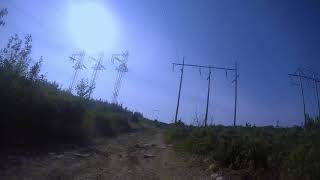
Fun trail with some rocks. Very up and down. Good section near Fire Trail entrance

This trail is unsanctioned.

Tags
DropsRock slabsRocky

Traditionally Indigenous Territory

Recent Activity on Trail

Past Week
  • 1 rides
  • 6 miles average
6 Months
  • 4 rides
  • 6 miles avg distance
All
  • 84 rides
  • Last: Nov 20, 2026
update trails status or condition

Powerline Trail Reports

statusdatedescription
Apr 28, 2025 @ 5:44pm
Apr 28, 2025
Apr 29, 2023 @ 10:51am
Apr 29, 2023
Nov 6, 2022 @ 5:19am
Nov 6, 2022
Powerline has become a lot more rocky than previous years in my experience and thus a bit more challenging. A couple pools of water here and...
Oct 5, 2021 @ 4:08pm
Oct 5, 2021
reporter
Sep 10, 2021 @ 9:02am
Sep 10, 2021
Work is being done on the hydro lines, heavy machinery has chewed up many parts of the trail.
more »
Status:
on Apr 28, 2025
Prevalent Mud
Avg: 3.59 (4 votes)
Your vote: 0

view (663)
close
      Directions to powerline-8739 trailhead (44.655490, -63.710660)

      Photos

      9 more »
      mtb
      268 |
      Jul 5, 2020 @ 1:56pm
      Jul 5, 2020
      mtb
      273 |
      Nov 16, 2019 @ 5:21am
      Nov 16, 2019
      mtb
      92 |
      Oct 4, 2022 @ 5:24pm
      Oct 4, 2022
      mtb
      99 |
      Oct 4, 2022 @ 5:24pm
      Oct 4, 2022

      Videos

      1 more »
      power line
      mtb
      634 | Sep 22, 2017 , Halifax
      3.0 ★★★★★
      4 Ratings
      5 ★ 25%
      4 ★ 25%
      3 ★
      2 ★ 25%
      1 ★ 25%

      2 Reviews & Comments

      gymclasshero gymclasshero
      This looks unreal. If I am traveling to Nova Scotia next Summer and already think McIntosh run is a must, is this spot better? Any reason to avoid in Summer months?

      We hope you've been enjoying Trailforks!

      Create a FREE account to view all trail reviews and much more.

      • #8739 - 3,514 views

      Frequently Asked Questions

      ▼ Where is Powerline located?
      Powerline is located in Whopper Dropper, Halifax, Nova Scotia, Canada. It is part of the Whopper Dropper trail network. The trailhead is located at coordinates 44.65549, -63.71066.
      ▼ How hard is Powerline?
      Powerline is rated as Green difficulty. The average grade is 0.624%.
      ▼ What is the elevation gain for Powerline?
      Powerline has 166 ft of elevation gain. The trail has 126 ft of elevation descent. The elevation ranges from 275 ft to 400 ft.
      ▼ Is Powerline a point to point trail?
      Powerline is not a point to point trail. The direction is Both Directions. The trail type is doubletrack.
      ▼ How long is Powerline?
      Powerline is 1.2 miles long. The trail type is doubletrack.
      ▼ Are dogs allowed on Powerline?
      Yes, dogs are allowed on Powerline. Please keep dogs on a leash where required and clean up after them.
      ▼ How do I access Powerline? Where is the closest parking trailhead?
      The closest parking and trailhead locations to Powerline are: View all parking locations in the area.
      ▼ How long does it take to ride Powerline?
      Based on recorded activities, it takes an average of 14 minutes to ride Powerline. The trail is 1.2 miles long. Actual times will vary based on fitness level, conditions, and pace. View recent activity logs for more details.
      ▼ How busy is Powerline?
      Powerline is a moderately popular trail. There have been 706 recorded activities on this trail. The trail has received 663 check-ins. View recent activity on this trail.

      Hit the Trail

      Open in App

      Get this trail on your phone instantly.

      open trail in app

      Download Trail

      Save to wishlist, Garmin & download.
      save the trail

      Find Related Routes

      Find routes and users activities that include this trail.
      find routes for this trail

      You must enter a description before submitting.

