
more stats
971 ft
Distance
-174 ft
Descent
00:03:34
Avg time
-174 ft
Altitude change
2,355 ft
Altitude min
2,529 ft
Altitude max
2,529 ft
Altitude start
2,356 ft
Altitude end
-17.8%
Grade
-45.5%
Grade max
-0.8%
Grade min
899 ft
Distance down
75 ft
Distance flat
00:03:34
Avg time

Pre-Reaper Details

  • Activities
    • Mountain Bike
    • E-Bike
    • Hike
    • Trail Running
  • Riding Area
    Cypress Mountain
    West Vancouver, British Columbia
  • Difficulty Rating
  • Local Popularity
    75 in Mountain Biking [+]
    • 55 in E-Biking
    • 5 in Trail Running
    • 30 in Hiking
  • Global Ranking
    #87328 in Mountain Biking [+]
    • #54632 in E-Biking
    • #355784 in Trail Running
    • #157161 in Hiking
  • Provincial Ranking
    #4,411 in Mountain Biking · British Columbia [+]
    • #3,702 in E-Biking
    • #14,042 in Trail Running
    • #10,068 in Hiking
  • Trail Type
    Singletrack
  • Bike Type
    DH
  • Direction
    Downhill Only
    Popular Direction Shown
  • Dogs Allowed
    Yes
  • eBike Allowed
  • TTFs on Trail
    Drop, Rock Face
  • Land Owner
    BPP

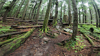
Short technical trail from Blind Skier to CBR. Used to access Reaper.

This trail is unsanctioned.

Tags
DropsRock slabs

Recent Activity on Trail

Past Week
  • 0 rides
  •  
6 Months
  • 22 rides
  • 10 miles avg distance
All
  • 169 rides
  • Last: Nov 2, 2026
c1c2c3c4
January
February
March
April
May
June
July
August
September
October
November
December
update trails status or condition

Pre-Reaper Trail Reports

statusdatedescription
Oct 26, 2026 @ 8:43pm (America/Vancouver)
Oct 26, 2026
Aug 30, 2026 @ 11:59am (America/Vancouver)
Aug 30, 2026
reporter New skinny line!
Sep 16, 2025 @ 5:34pm (America/Vancouver)
Sep 16, 2025
A little greasy in some spots. The exit is a little spicier than it used to be.
May 12, 2025 @ 6:02pm
May 12, 2025
Someone dragged debris onto the trail just above the exit. All small stuff easily cleared but it was a deliberate act.
Nov 10, 2024 @ 3:17pm
Nov 10, 2024
Cut out some fallen trees. Exit to road is now a rootball dropping into a river, extra spice compared to before but she goes.
more »
Status:
on Oct 26, 2026
Ideal
Avg: 3.81 (6 votes)
Your vote: 0

view (541)
close
      Directions to pre-reaper trailhead (49.363950, -123.195220)

      Photos

      50 more »
      mtb
      126 |
      Nov 10, 2020 @ 9:45pm
      Nov 10, 2020
      mtb
      149 |
      Sep 22, 2019 @ 10:13am
      Sep 22, 2019
      mtb
      283 |
      Jan 13, 2021 @ 12:40pm
      Jan 13, 2021
      mtb
      293 |
      Jan 13, 2021 @ 12:40pm
      Jan 13, 2021

      Videos

      6 more »
      youtuber Riding A Bunch More Trails For The First Time...
      mtb
      11:48 | 282 | Nov 30, 2021 , West Vancouver
      Pre-Reaper - Cypress, West Vancouver
      mtb
      2:23 | 508 | Nov 8, 2018 , West Vancouver
      Pre reaper Over the bars
      mtb
      0:06 | 173 | Oct 10, 2020 , West Vancouver
      Pre-Reaper
      mtb
      0:51 | 145 | Aug 19, 2016 , West Vancouver

      Trail Lists

      Routes with this trail

      more »
      76 miles • 10,896 ft • 55 • Race •
      Virtual Merritt Crown 120K
      3.5 ★★★★★
      6 Ratings
      5 ★ 17%
      4 ★ 17%
      3 ★ 67%
      2 ★
      1 ★

      1 Review & Comments

      mayorofcypress mayorofcypress
      Not sure who's been "working" on the upper portion of the trail, but maybe shoot me a pm and we can see if there's a more constructive way to add to the trail. Blind drops to flat, that encroach on existing features/rolls are not the best. Thanks

      We hope you've been enjoying Trailforks!

      Create a FREE account to view all trail reviews and much more.

      • #274 - 4,712 views

      Frequently Asked Questions

      ▼ Where is Pre-Reaper located?
      Pre-Reaper is located in Cypress Mountain, West Vancouver, British Columbia, Canada. It is part of the Cypress Mountain trail network. The trailhead is located at coordinates 49.36395, -123.19522.
      ▼ How hard is Pre-Reaper?
      Pre-Reaper is rated as Black Diamond difficulty. The average grade is 17.8%.
      ▼ What is the elevation gain for Pre-Reaper?
      The trail has 174 ft of elevation descent. The elevation ranges from 2,355 ft to 2,529 ft.
      ▼ Is Pre-Reaper a point to point trail?
      Yes, Pre-Reaper is a point to point trail. The direction is Downhill Only. The trail type is singletrack.
      ▼ How long is Pre-Reaper?
      Pre-Reaper is 971 ft long. The trail type is singletrack.
      ▼ Are dogs allowed on Pre-Reaper?
      Yes, dogs are allowed on Pre-Reaper. Please keep dogs on a leash where required and clean up after them.
      ▼ When is the best time of year to ride Pre-Reaper?
      Based on activity log data, the most popular months to ride Pre-Reaper are:
      • June (17 activities)
      • May (15 activities)
      • April (11 activities)
      Check the reports page for current trail conditions.
      ▼ How do I access Pre-Reaper? Where is the closest parking trailhead?
      The closest parking and trailhead locations to Pre-Reaper are: View all parking locations in the area.
      ▼ How long does it take to ride Pre-Reaper?
      Based on recorded activities, it takes an average of 4 minutes to ride Pre-Reaper. The trail is 971 ft long. Actual times will vary based on fitness level, conditions, and pace. View recent activity logs for more details.
      ▼ How busy is Pre-Reaper?
      Pre-Reaper is a very popular trail. There have been 560 recorded activities on this trail. The trail has received 541 check-ins. View recent activity on this trail.

      Hit the Trail

      Open in App

      Get this trail on your phone instantly.

      open trail in app

      Download Trail

      Save to wishlist, Garmin & download.
      save the trail

      Find Related Routes

      Find routes and users activities that include this trail.
      find routes for this trail

      You must enter a description before submitting.

