
more stats
4,199 ft
Distance
8 ft
Climb
-413 ft
Descent
00:09:31
Avg time
-406 ft
Altitude change
2,149 ft
Altitude min
2,555 ft
Altitude max
2,555 ft
Altitude start
2,149 ft
Altitude end
-9.7%
Grade
-35.2%
Grade max
11.9%
Grade min
135 ft
Distance climb
3,612 ft
Distance down
453 ft
Distance flat
00:09:31
Avg time

Blind Skier Details

  • Activities
    • Mountain Bike
    • E-Bike
    • Hike
    • Trail Running
  • Riding Area
    Cypress Mountain
    West Vancouver, British Columbia
  • Difficulty Rating
  • Voted Difficulty
    Blue (1 vote)
  • Local Popularity
    90 in Mountain Biking [+]
    • 85 in E-Biking
    • 55 in Trail Running
    • 65 in Hiking
  • Global Ranking
    #67889 in Mountain Biking [+]
    • #23115 in E-Biking
    • #137185 in Trail Running
    • #134069 in Hiking
  • Provincial Ranking
    #3,317 in Mountain Biking · British Columbia [+]
    • #1,517 in E-Biking
    • #7,899 in Trail Running
    • #7,581 in Hiking
  • Trail Type
    Singletrack
  • Bike Type
    DH
  • Dogs Allowed
    Yes
  • eBike Allowed
  • TTFs on Trail
    Rock Face
  • Land Owner
    BPP

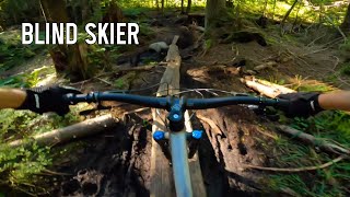
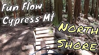
Starts flat going through the Old Growth Conservancy before getting steeper with natural and some older man-made TTFs.

This trail is unsanctioned.

Tags
Old-growth forestRock slabs
Status:
on Oct 26, 2026
Ideal
Avg: 3.68 (16 votes)
Your vote: 0

view (2,190)
close
      Directions to blind-skier trailhead (49.365910, -123.194210)

      Photos

      27 more »
      mtb
      195 |
      Apr 5, 2021 @ 3:51pm
      Apr 5, 2021
      mtb
      1,147 |
      Oct 28, 2018 @ 7:31pm
      Oct 28, 2018
      mtb
      1,054 |
      Oct 28, 2018 @ 7:29pm
      Oct 28, 2018
      mtb
      1,033 |
      Oct 28, 2018 @ 7:29pm
      Oct 28, 2018

      Videos

      8 more »
      youtuber Blind Skier - Cypress Mountain MTB
      mtb
      5:27 | 1124 | Jun 21, 2021 , West Vancouver
      youtuber First Time Riding Wutang and Upper Tall Cans |...
      mtb
      12:43 | 560 | May 14, 2021 , West Vancouver
      Cypress Mountain || Shout Outs || Blind Skier...
      mtb
      5:18 | 1120 | Jul 5, 2018 , West Vancouver
      Blind Skier 2009
      mtb
      1343 | Oct 5, 2011 , West Vancouver

      Trail Lists

      Routes with this trail

      ★ 3.8 • 37 miles • 7,397 ft • 25 • Point to Point •
      North Shore Tripple crown No unsanctioned trails
      31 miles • 6,667 ft • 32 •
      another ride with some fun pals
      32 miles • 7,371 ft • 20 •
      Brainstorming a big day out with some pals
      3.6 ★★★★★
      16 Ratings
      5 ★ 19%
      4 ★ 25%
      3 ★ 50%
      2 ★ 6%
      1 ★

      3 Reviews & Comments

      nofunstravaguy nofunstravaguy
      A bit flat and less fun than the lower mtn trails. But less rode-in. Feels like a loamer.
      cannae
      Easiest of the upper trails, basically a loamer with a couple small jumps along the way.
      bsb2001ca bsb2001ca
      This trail should be marked as 'no' to rainy weather. Trail damage may occur while trail is wet.

      We hope you've been enjoying Trailforks!

      Create a FREE account to view all trail reviews and much more.

      • #277 - 9,677 views

      Frequently Asked Questions

      ▼ Where is Blind Skier located?
      Blind Skier is located in Cypress Mountain, West Vancouver, British Columbia, Canada. It is part of the Cypress Mountain trail network. The trailhead is located at coordinates 49.36591, -123.19421.
      ▼ How hard is Blind Skier?
      Blind Skier is rated as Black Diamond difficulty. The average grade is 9.7%.
      ▼ What is the elevation gain for Blind Skier?
      Blind Skier has 8 ft of elevation gain. The trail has 413 ft of elevation descent. The elevation ranges from 2,149 ft to 2,555 ft.
      ▼ How long is Blind Skier?
      Blind Skier is 4,199 ft long. The trail type is singletrack.
      ▼ Are dogs allowed on Blind Skier?
      Yes, dogs are allowed on Blind Skier. Please keep dogs on a leash where required and clean up after them.
      ▼ How do I access Blind Skier? Where is the closest parking trailhead?
      The closest parking and trailhead locations to Blind Skier are: View all parking locations in the area.
      ▼ How long does it take to ride Blind Skier?
      Based on recorded activities, it takes an average of 10 minutes to ride Blind Skier. The trail is 4,199 ft long. Actual times will vary based on fitness level, conditions, and pace. View recent activity logs for more details.
      ▼ How busy is Blind Skier?
      Blind Skier is a very popular trail. There have been 2,305 recorded activities on this trail. The trail has received 2,190 check-ins. View recent activity on this trail.

      Hit the Trail

      Open in App

      Get this trail on your phone instantly.

      open trail in app

      Download Trail

      Save to wishlist, Garmin & download.
      save the trail

      Find Related Routes

      Find routes and users activities that include this trail.
      find routes for this trail

      You must enter a description before submitting.

