2,149 ft
Distance
-193 ft
Descent
00:02:29
Avg time

Pub Run Details

  • Activities
    • Mountain Bike
    • E-Bike
  • Riding Area
    Greno Woods
    Sheffield
  • Difficulty Rating
  • Trail Type
    Singletrack
  • Bike Type
    AM
  • Direction
    Downhill Primary
    Popular direction shown
  • Climb Difficulty
    Blue
  • Season
    All year
  • Dogs Allowed
    Yes
  • eBike Allowed
    Yes up to Class 1
  • TTFs on Trail
    Berm, Jump, Gap Jump, Rock Garden
  • Ride in Rain
    Yes
  • Global Ranking
    #7952 in Mountain Biking [+]
    • #3724 in E-Biking
  • Local Popularity
    85 in Mountain Biking [+]
    • 80 in E-Biking

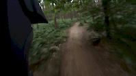
Nice flowing DH single track best suited to All Mountain bikes
with plenty of features including berms,tables and rock gardens and one small gap jump that can be rolled
good fun for beginners to advanced riders

Access Info

Park in Wharncliffe woods top car park on Woodhead road,cyle across the road in to Greno woods then follow the trail up to the top of the small hill and the start is directly in front of you and sign posted

Local Trail Association
More Stats for Pub Run mountain bike trail trail
  • Altitude change
    -194 ft
  • Altitude min
    751 ft
  • Altitude max
    945 ft
  • Altitude start
    945 ft
  • Altitude end
    751 ft
  • Grade
    -9%
  • Grade max
    -24.2%
  • Grade min
    1.8%
  • Distance down
    1,995 ft
  • Distance flat
    151 ft
  • Avg time
    00:02:29
  • Avg reverse time
    00:07:02
  • view trail stats
Status:
on Dec 16, 2024
Ideal
Avg: 4.18 (10 votes)
Your vote: 0

view (2,884)
close
3D
Trail Conditions
  • Unknown
  • Snow Groomed
  • Snow Packed
  • Snow Covered
  • Snow Cover Partial
  • Freeze/thaw Cycle
  • Icy
  • Prevalent Mud
  • Wet
  • Variable
  • Ideal
  • Dry
  • Very Dry
Trail Flow (Ridden Direction)
Trailforks scans users ridelogs to determine the most popular direction each trail is ridden. A good flowing trail network will have most trails flowing in a single direction according to their intension.
The colour categories are based on what percentage of riders are riding a trail in its intended direction.
  • > 96%
  • > 90%
  • > 80%
  • > 70%
  • > 50%
  • < 50%
  • bi-directional trail
  • no data
Trail Last Ridden
Trailforks scans ridelogs to determine the last time a trail was ridden.
  • < 2 days
  • < 1 week
  • < 2 weeks
  • < 1 month
  • < 6 months
  • > 6 months
Trail Ridden Direction
The intended direction a trail should be ridden.
  • Downhill Only
  • Downhill Primary
  • Both Directions
  • Uphill Primary
  • Uphill Only
  • One Direction
Contribute Details
Colors indicate trail is missing specified detail.
  • Description
  • Photos
  • Description & Photos
  • Videos
Trail Popularity ?
Trailforks scans ridelogs to determine which trails are ridden the most in the last 9 months. Trails are compared with nearby trails in the same city region with a possible 25 colour shades. Think of this as a heatmap, more rides = more kinetic energy = warmer colors.
  • most popular
  • popular
  • less popular
  • not popular
ATV/ORV/OHV Filter
Max Vehicle Width
inches
US Cell Coverage
Legend
cell carrier legend

Radar Time
x Activity Recordings
Trailforks users anonymized public ridelogs from the past 6 months.
  • mountain biking recent
  • mountain biking (>6 month)
  • hiking (1 year)
  • moto (1 year)
Activity Recordings
Trailforks users anonymized public skilogs from the past 12 months.
  • Downhill Ski
  • Backcountry Ski
  • Nordic Ski
  • Snowmobile
Winter Trails
Warning A routing network for winter maps does not exist. Selecting trails using the winter trails layer has been disabled.
x Missing Trails
Most Popular
Least Popular
Trails are colored based on popularity. The more popular a trail is, the more red. Less popular trails trend towards green.
Jump Magnitude Heatmap
Heatmap of where riders jump on trails. Zoom in to see individual jumps, click circles to view jump details.
Trails Deemphasized
Trails are shown in grey.
disable
Only show trails with NO bikes.
enable

Save the current map location and zoom level as your default home location whenever this page is loaded.

Save
      Directions to pub-run-62637 trailhead (53.451290, -1.509100)
      update trails status or condition

      Pub Run Trail Reports

      statusdatedescription
      Dec 16, 2024 @ 10:19am
      Dec 16, 2024
      Much of it is a rock garden. Still fun, but rough
      May 5, 2024 @ 1:11am
      May 5, 2024
      Oct 21, 2023 @ 4:24am
      Oct 21, 2023
      Apr 20, 2023 @ 8:48am
      Apr 20, 2023
      Minor erosion (trail braiding, small ruts developing, brake bumps)
      Apr 3, 2023 @ 4:41pm
      Apr 3, 2023
      view all reports »

      Recent Ridelog Activity on Trail

      Past Week
      • 0 rides
      •  
      6 Months
      • 14 rides
      • 12.6 km avg distance
      All
      • 97 rides
      • Last: Jul 11, 2025

      Photos

      more »
      234 |
      Sep 3, 2017 @ 11:17am
      Sep 3, 2017
      276 |
      Sep 3, 2017 @ 11:16am
      Sep 3, 2017
      201 |
      Jul 22, 2017 @ 10:04am
      Jul 22, 2017
      357 |
      Jul 6, 2013 @ 12:37pm
      Jul 6, 2013

      1 Review & Comments


      We hope you've been enjoying Trailforks!

      Create a FREE account to view trail comments and much more.

      Videos

      more »
      youtuber Pub Run MTB Segment | Greno Woods | Sheffield...
      0:45 | 344 | Jan 6, 2023 , Sheffield
      20th July 2020 - First visit to Wharncliffe Woods
      24:04 | 351 | Jul 27, 2020 , Sheffield
      Pub Run to Face plant, Grenoside Woods,...
      2:43 | 967 | Jul 25, 2016 , Sheffield
      • By SteelCityMTBer & contributors
      • #62637 - 6,186 views

      You must enter a description before submitting.