more stats
2.5 miles
Distance
3 ft
Climb
-2,603 ft
Descent
01:07:25
Avg time
-2,600 ft
Altitude change
3,686 ft
Altitude min
6,286 ft
Altitude max
6,286 ft
Altitude start
3,688 ft
Altitude end
-19.8%
Grade
-67.5%
Grade max
10.7%
Grade min
36 ft
Distance climb
2 miles
Distance down
01:07:25
Avg time

Punta Corona Details

  • Activities
    • Mountain Bike
    • E-Bike
    • Hike
    • Trail Running
  • Riding Area
  • Difficulty Rating
  • Local Popularity
    5 in Mountain Biking [+]
    • 5 in E-Biking
    • 85 in Trail Running
    • 5 in Hiking
  • Global Ranking
    #148590 in Mountain Biking [+]
    • #1924 in E-Biking
    • #86327 in Trail Running
    • #353766 in Hiking
  • National Ranking
    #13,539 in Mountain Biking · Spain [+]
    • #884 in E-Biking
    • #7,338 in Trail Running
    • #36,006 in Hiking
  • Hiking SAC Scale
    T3 Demanding Mountain Hiking
  • Trail Type
    Wilderness Trail
  • Bike Type
    AM
  • Direction
    Downhill Primary
    Popular Direction Shown
  • Climb Difficulty
    Black Diamond
  • Physical Rating
    Hard
  • Trail Visibility
    Sometimes hard to follow
  • Family Friendly
    Yes
  • Dogs Allowed
    Yes
  • eBike Allowed
    Yes up to Class 1
  • TTFs on Trail
    Rock Garden

Descenso largo que tiene 3 partes diferentes.
Arriba es terreno abierto por tasca y sin trazado concreto.
Medio: es trocha abandonada con piedras
Abajo: es ya camino viejo trialero.
Buena si estas al nivel. No demasiado mantenimiento.

Disclaimer

Primer tramo sin sendero marcado. Starting without crear path

Tags

Trail Supporters

Local Trail Association

Recent Activity on Trail

Past Week
  • 0 rides
  •  
6 Months
  • 0 rides
  •  
All
  • 3 rides
  • Last: Mar 14, 2021
update trails status or condition

Punta Corona Trail Reports

statusdatedescription
Oct 11, 2025 @ 11:03pm (Europe/Madrid)
Oct 11, 2025
Oct 4, 2025 @ 10:15pm (Europe/Madrid)
Oct 4, 2025
reporter
Limpieza. Desbroce y despedregue
Jul 29, 2023 @ 2:35am
Jul 29, 2023
Sep 25, 2022 @ 12:35am
Sep 25, 2022
Cuidado porque por dónde va el track se han abierto buenos surcos en la tierra. Son escalones de medio metro en algún caso.
more »
Status:
on Oct 11, 2025
Ideal
Avg: 3.99 (2 votes)
Your vote: 0

view (12)
close
      Directions to punta-corona trailhead (42.532120, -0.095580)

      Photos

      3 more »
      ebike
      92 |
      Sep 25, 2022 @ 9:17am
      Sep 25, 2022
      ebike
      86 |
      Sep 25, 2022 @ 9:17am
      Sep 25, 2022
      hike
      106 |
      Sep 25, 2022 @ 9:18am
      Sep 25, 2022

      Videos

      1 more »
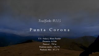
      Trailforks #115 - Punta Corona (P.N. Ordesa y...
      ebike
      11:29 | 43 | Feb 8, 2026 , Ainsa

      Routes with this trail

      ★ 4.0 • 16 miles • 4,510 ft • 3 • Loop •
      TIEMPO: 4 - 5 h BALIZADA: Sólo GPS CON BARRO: Poco recomendable Ruta recomendada para Trail Running...
      ★ 4.0 • 7 miles • 2,719 ft • 2 • Loop •
      DESCRIPCIÓN Ruta dura pero espectacular. Las vistas desde Punta Corona del Pirineo Central y del valle...
      ★ 3.0 • 13 miles • 4,475 ft • 2 • Loop •
      BALIZADA: GPS ZONA: Río Ara SALIDA: Fiscal LLEGADA: Fiscal Ruta recomendada para Trail Running...
      4.0 ★★★★★
      2 Ratings
      5 ★
      4 ★ 100%
      3 ★
      2 ★
      1 ★

      1 Review & Comments


      We hope you've been enjoying Trailforks!

      Create a FREE account to view all trail reviews and much more.

      • By KalamarrrrrdoTF Pro TFSPAIN & contributors
      • #440238 - 611 views

      Frequently Asked Questions

      ▼ Where is Punta Corona located?
      Punta Corona is located in Zona Zero Rio Ara, Ainsa, Spain. It is part of the Zona Zero Rio Ara trail network. The trailhead is located at coordinates 42.53212, -0.09558.
      ▼ How hard is Punta Corona?
      Punta Corona is rated as Black difficulty. The physical rating is Hard. The average grade is 19.8%. The climb difficulty is rated Black Diamond.
      ▼ What is the elevation gain for Punta Corona?
      Punta Corona has 3 ft of elevation gain. The trail has 2,603 ft of elevation descent. The elevation ranges from 3,686 ft to 6,286 ft.
      ▼ Is Punta Corona a point to point trail?
      Punta Corona is not a point to point trail. The direction is Downhill Primary. The trail type is wilderness trail.
      ▼ How long is Punta Corona?
      Punta Corona is 2.5 miles long. The trail type is wilderness trail.
      ▼ Are dogs allowed on Punta Corona?
      Yes, dogs are allowed on Punta Corona. Please keep dogs on a leash where required and clean up after them.
      ▼ How do I access Punta Corona? Where is the closest parking trailhead?
      The closest parking and trailhead locations to Punta Corona are: View all parking locations in the area.
      ▼ How long does it take to ride Punta Corona?
      The estimated time to ride Punta Corona is approximately 1 hour 7 minutes. The trail is 2.5 miles long. Actual times will vary based on fitness level, conditions, and pace.
      ▼ How busy is Punta Corona?
      Punta Corona is a less popular trail with lighter traffic. There have been 12 recorded activities on this trail. The trail has received 12 check-ins. View recent activity on this trail.

      Hit the Trail

      Open in App

      Get this trail on your phone instantly.

      open trail in app

      Download Trail

      Save to wishlist, Garmin & download.
      save the trail

      Find Related Routes

      Find routes and users activities that include this trail.
      find routes for this trail

      You must enter a description before submitting.