



Open in App
Get this trail on your phone instantly.

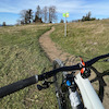
The Pyhra Trail near St. Pölten on the popular excursion mountain called Rudolfshöhe leads through a varied mixed forest. The mostly natural trail is of medium difficulty, larger roots and stones are to be expected in places. The trail runs over a length of 3.3 km with a loss of almost 250 meters from the Draxelhofer hill down to the aqueduct near Schauching. The maintainer of the trail is a non-profit local trail association called "Mountainbike Initiative St. Pölten". Read more under: www.mtbstp.at

| c1 | c2 | c3 | c4 |
|---|---|---|---|
January | February | March | April |
May | June | July | August |
September | October | November | December |

Service Road Atlas is a free to use, community-driven service for viewing and creating reports on the numerous back-country service roads around B.C. and Alberta.
Save the current map location and zoom level as your default home location whenever this page is loaded.
Save -Stephi von MTB.STP
We hope you've been enjoying Trailforks!
Create a FREE account to view all trail reviews and much more.
You must enter a description before submitting.

