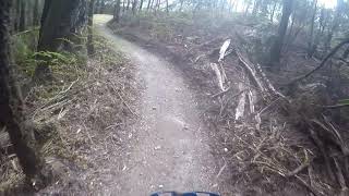
more stats
6.9 miles
Distance
951 ft
Climb
-1,120 ft
Descent
00:51:45
Avg time
-170 ft
Altitude change
85 ft
Altitude min
421 ft
Altitude max
272 ft
Altitude start
102 ft
Altitude end
-0.5%
Grade
-26%
Grade max
39.5%
Grade min
2 miles
Distance climb
4 miles
Distance down
4,839 ft
Distance flat
00:51:45
Avg time

Railton Express Details

  • Activities
    • Mountain Bike
    • E-Bike
    • Gravel Bike
    • Adaptive Bike
    • Hike
    • Trail Running
  • Riding Area
    Wild Mersey
    Latrobe
  • Difficulty Rating
  • Voted Difficulty
    Blue (3 votes)
  • Local Popularity
    55 in Mountain Biking [+]
    • 65 in E-Biking
    • 90 in Trail Running
    • 85 in Hiking
    • 5 in Adaptive Biking
    • 5 in Gravel Biking
  • Global Ranking
    #95160 in Mountain Biking [+]
    • #48192 in E-Biking
    • #102384 in Trail Running
    • #114534 in Hiking
    • #966 in Adaptive Biking
    • #14993 in Gravel Biking
  • National Ranking
    #4,499 in Mountain Biking · Australia [+]
    • #3,420 in E-Biking
    • #3,417 in Trail Running
    • #3,786 in Hiking
    • #56 in Adaptive Biking
    • #576 in Gravel Biking
  • Trail Type
    Singletrack
  • Bike Type
    AM, XC, Adaptive MTB, CX, Gravel
  • Direction
    Both Directions
  • Climb Difficulty
    Blue
  • Physical Rating
    Moderate
  • Dogs Allowed
    Yes
  • eBike Allowed
    Yes up to Class 1
  • TTFs on Trail
    Berm, Bridge
  • Ride in Rain
    Yes
  • Year Opened
    2019
  • Land Owner
    Kentish Council

Railton Express takes you either from the Warrawee Trails to the town of Railton or from Railton to Warrawee.
The trail follows the Mersey river in places and has a challenging 22 switchback climb. A great trail to extend your ride distance.

Access Info

Can be access at the end of Shale road within the Warrawee Reserve or on Native Rock Road just out of Railton

Adaptive Bike Info
aMTB Blue Rating: Intermediate features and steeper terrain.
Tags
BermsBridges

Trail Supporters

Local Trail Association

Traditionally Indigenous Territory

Recent Activity on Trail

Past Week
  • 0 rides
  •  
6 Months
  • 6 rides
  • 21 miles avg distance
All
  • 210 rides
  • Last: Oct 29, 2026
update trails status or condition

Railton Express Trail Reports

statusdatedescription
Aug 30, 2026 @ 8:47am (Australia/Hobart)
Aug 29, 2026
Riding great
Jul 30, 2026 @ 5:37pm (Australia/Hobart)
Jul 30, 2026
It’s dried out nicely
Jul 5, 2026 @ 9:23am (Australia/Hobart)
Jul 4, 2026
Wet in some places but riding fine from the bridge to the log lounge at the Latrobe end.
May 16, 2026 @ 8:56am (Australia/Hobart)
May 15, 2026
Riding well. It’s had a few realignments that are welcome improvements.
Aug 23, 2025 @ 9:37am
Aug 23, 2025
Riding great
more »
Status:
on Aug 30, 2026
Ideal
Avg: 4.06 (8 votes)
Your vote: 0

view (1,066)
close
      Directions to railton-express trailhead (-41.334300, 146.435250)

      Photos

      27 more »
      mtb
      130 |
      May 13, 2024 @ 6:25pm
      May 13, 2024
      mtb
      113 |
      Apr 16, 2024 @ 3:35pm
      Apr 16, 2024
      mtb
      228 |
      Jul 21, 2020 @ 10:04pm
      Jul 21, 2020
      mtb
      173 |
      Jul 18, 2020 @ 7:08pm
      Jul 18, 2020

      Videos

      2 more »
      Railton Express Northbound
      mtb
      43:35 | 1184 | Oct 25, 2019 , Latrobe
      Railton Express Southbound
      mtb
      47:23 | 714 | Oct 20, 2019 , Latrobe

      Routes with this trail

      ★ 4.0 • 17 miles • 2,442 ft • 3 • Out & Back •
      A good reasonable distance ride that goes from either Warrawee Reserve to Sheffield or vise versa. It...
      4.2 ★★★★★
      8 Ratings
      5 ★ 38%
      4 ★ 50%
      3 ★
      2 ★ 13%
      1 ★

      4 Reviews & Comments

      Downhilldavey
      Tree down. Half way through the pine plantation
      21/9/25
      VivF
      Tree down on second switchback set above river.

      We hope you've been enjoying Trailforks!

      Create a FREE account to view all trail reviews and much more.

      • By streddazTF Pro CCMBC & contributors
      • #197774 - 9,937 views

      Frequently Asked Questions

      ▼ Where is Railton Express located?
      Railton Express is located in Wild Mersey, Latrobe, Australia. It is part of the Wild Mersey trail network. The trailhead is located at coordinates -41.3343, 146.43525.
      ▼ How hard is Railton Express?
      Railton Express is rated as Blue difficulty. The physical rating is Moderate. The average grade is 0.5%. The climb difficulty is rated Blue.
      ▼ What is the elevation gain for Railton Express?
      Railton Express has 951 ft of elevation gain. The trail has 1,120 ft of elevation descent. The elevation ranges from 85 ft to 421 ft.
      ▼ Is Railton Express a point to point trail?
      Railton Express is not a point to point trail. The direction is Both Directions. The trail type is singletrack.
      ▼ How long is Railton Express?
      Railton Express is 6.9 miles long. The trail type is singletrack.
      ▼ Are dogs allowed on Railton Express?
      Yes, dogs are allowed on Railton Express. Please keep dogs on a leash where required and clean up after them.
      ▼ How do I access Railton Express? Where is the closest parking trailhead?
      The closest parking and trailhead locations to Railton Express are: View all parking locations in the area.
      ▼ How long does it take to ride Railton Express?
      Based on recorded activities, it takes an average of 52 minutes to ride Railton Express. The trail is 6.9 miles long. Actual times will vary based on fitness level, conditions, and pace. View recent activity logs for more details.
      ▼ How busy is Railton Express?
      Railton Express is a moderately popular trail. There have been 937 recorded activities on this trail. The trail has received 1,066 check-ins. View recent activity on this trail.

      Hit the Trail

      Open in App

      Get this trail on your phone instantly.

      open trail in app

      Download Trail

      Save to wishlist, Garmin & download.
      save the trail

      Find Related Routes

      Find routes and users activities that include this trail.
      find routes for this trail

      You must enter a description before submitting.