more stats
1,058 ft
Distance
4 ft
Climb
-7 ft
Descent
00:01:46
Avg time
-2 ft
Altitude change
229 ft
Altitude min
236 ft
Altitude max
236 ft
Altitude start
234 ft
Altitude end
-0.217%
Grade
-2.203%
Grade max
2.872%
Grade min
203 ft
Distance climb
224 ft
Distance down
33 ft
Distance flat
00:01:46
Avg time

Ranch House Crossing Details

  • Activities
    • Mountain Bike
    • E-Bike
    • Gravel Bike
    • Adaptive Bike
    • Hike
    • Trail Running
  • Riding Area
    Los Peñasquitos Canyon
    San Diego, California
  • Difficulty Rating
  • Local Popularity
    85 in Mountain Biking heatmap [+]
    • 70 in E-Biking
    • 100 in Trail Running
    • 100 in Hiking
    • 5 in Adaptive Biking
    • 95 in Gravel Biking
  • Global Ranking
    #91387 in Mountain Biking [+]
    • #39950 in E-Biking
    • #77097 in Trail Running
    • #81277 in Hiking
    • #4418 in Adaptive Biking
    • #1346 in Gravel Biking
  • State Ranking
    #3,089 in Mountain Biking · California [+]
    • #883 in E-Biking
    • #3,752 in Trail Running
    • #4,614 in Hiking
    • #278 in Adaptive Biking
    • #119 in Gravel Biking
  • Trail Type
    Doubletrack
  • Bike Type
    Adaptive MTB, Gravel
  • Direction
    Both Directions
  • Dogs Allowed
    Yes
  • eBike Allowed
    Yes up to Class 1
  • TTFs on Trail
    Bridge, Rock Garden
  • Land Owner
    City of San Diego

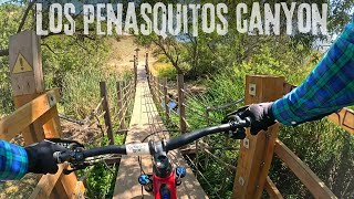
Short car width trail from parking lot to the South Sea to Sea Trail. Trail splits so you can either go through the stream like the horses do or pass through a rough rock patch then cross a small elevated foot bridge. The entire area floods out for a few days after a good rain.

Adaptive Bike Info
aMTB Blue Rating: Intermediate features and steeper terrain.

Two rock steps on north end of bridge. Recommended south to north only.

Tags
BridgesRock gardens

Local Trail Association

Traditionally Indigenous Territory

Recent Activity on Trail

Past Week
  • 1 rides
  • 15 miles average
6 Months
  • 106 rides
  • 14 miles avg distance
All
  • 907 rides
  • Last: Nov 18, 2026
update trails status or condition

Ranch House Crossing Trail Reports

Status:
on Jan 27, 2026
Ideal
Avg: 3.49 (2 votes)
Your vote: 0

view (5,063)
close
      Directions to ranch-house-crossing trailhead (32.937468, -117.135573)

      Photos

      2 more »
      mtb
      93 |
      Feb 18, 2022 @ 3:05pm
      Feb 18, 2022
      mtb
      186 |
      Mar 11, 2020 @ 3:43pm
      Mar 11, 2020

      Videos

      2 more »
      San Diego beginner and advanced MTB trail...
      mtb
      11:23 | 223 | Jul 12, 2024 , San Diego
      HIGHLIGHTS - Ranch House Crossing - Adaptive...
      mtb
      0:18 | 559 | Mar 12, 2020 , San Diego

      Routes with this trail

      more »
      20 miles • 1,477 ft • 14 •
      This is my personal route that I ride regularly. I'm adaptive rider, but anyone can do this route. Other...
      18 miles • 774 ft • 13 • Loop •
      This route will begin at the Penasquitos Ranch House staging area MAP LINK This route is for solid...
      6 miles • 82 ft • 3 • Loop •
      Official Route of the Ride On Mountain Biking Challenge presented by the County of San Diego The route...
      2.0 ★★★★★
      2 Ratings
      5 ★
      4 ★
      3 ★ 50%
      2 ★
      1 ★ 50%

      Reviews / Comments

      No reviews yet, be the first to write a review or ask a question.
      Use trail reports to comment on trail conditions.


      We hope you've been enjoying Trailforks!

      Create a FREE account to view all trail reviews and much more.

      • By The-dirt-farmerTF Pro & contributors
      • #49178 - 2,062 views

      Frequently Asked Questions

      ▼ Where is Ranch House Crossing located?
      Ranch House Crossing is located in Los Peñasquitos Canyon, San Diego, California, United States. It is part of the Los Peñasquitos Canyon trail network. The trailhead is located at coordinates 32.93747, -117.13557.
      ▼ How hard is Ranch House Crossing?
      Ranch House Crossing is rated as Green difficulty. The average grade is 0.217%.
      ▼ What is the elevation gain for Ranch House Crossing?
      Ranch House Crossing has 4 ft of elevation gain. The trail has 7 ft of elevation descent. The elevation ranges from 229 ft to 236 ft.
      ▼ Is Ranch House Crossing a point to point trail?
      Ranch House Crossing is not a point to point trail. The direction is Both Directions. The trail type is doubletrack.
      ▼ How long is Ranch House Crossing?
      Ranch House Crossing is 1,058 ft long. The trail type is doubletrack.
      ▼ Are dogs allowed on Ranch House Crossing?
      Yes, dogs are allowed on Ranch House Crossing. Please keep dogs on a leash where required and clean up after them.
      ▼ How do I access Ranch House Crossing? Where is the closest parking trailhead?
      The closest parking and trailhead locations to Ranch House Crossing are: View all parking locations in the area.
      ▼ How long does it take to ride Ranch House Crossing?
      Based on recorded activities, it takes an average of 2 minutes to ride Ranch House Crossing. The trail is 1,058 ft long. Actual times will vary based on fitness level, conditions, and pace. View recent activity logs for more details.
      ▼ How busy is Ranch House Crossing?
      Ranch House Crossing is a very popular trail. There have been 4,942 recorded activities on this trail. The trail has received 5,063 check-ins. View recent activity on this trail.

      Hit the Trail

      Open in App

      Get this trail on your phone instantly.

      open trail in app

      Download Trail

      Save to wishlist, Garmin & download.
      save the trail

      Find Related Routes

      Find routes and users activities that include this trail.
      find routes for this trail

      You must enter a description before submitting.