more stats
4.6 miles
Distance
421 ft
Climb
-425 ft
Descent
00:39:24
Avg time
-2 ft
Altitude change
732 ft
Altitude min
832 ft
Altitude max
830 ft
Altitude start
827 ft
Altitude end
-0%
Grade
-25.5%
Grade max
17.4%
Grade min
2 miles
Distance climb
2 miles
Distance down
1 mile
Distance flat
00:39:24
Avg time

Ray's Trail Details

  • Activities
    • Mountain Bike
    • E-Bike
    • Gravel Bike
  • Riding Area
    Arklow
    Collie
  • Difficulty Rating
  • Local Popularity
    60 in Mountain Biking heatmap [+]
    • 55 in E-Biking
    • 60 in Gravel Biking
  • Global Ranking
    #104660 in Mountain Biking [+]
    • #130037 in E-Biking
    • #46436 in Gravel Biking
  • National Ranking
    #4,898 in Mountain Biking · Australia [+]
    • #6,016 in E-Biking
    • #2,053 in Gravel Biking
  • Trail Exposure
    Normal
  • Trail Type
    Singletrack
  • Bike Type
    AM, XC, Gravel
  • Direction
    One Direction[+]
    Popular Direction Shown
    • One Direction for Gravel Biking
  • Climb Difficulty
    Blue
  • Physical Rating
    Easy
  • Trail Visibility
    Always easy to follow
  • eBike Allowed
    Yes up to Class 1
  • TTFs on Trail
    Log Ride, Rock Garden, Skinny
  • Land Owner

Located north of Collie in the Arklow Trail Network, Rays Trail is an 'old school' narrow, technical track with lots of twists and turns.

The trail runs in a clockwise direction. The first few kilometres are mainly flat (and twisty) before some fun bermed downhill. What goes down must come up, and the only major climb on the trail follows.

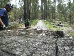
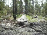
On the final section of the trail there are several large log rides.

Many other trails in the Arklow network can be accessed form the Rays Trail Trailhead

Access Info

Find the Trailhead north of Collie on Harris River Road just past the Harris River Estate Winery.

Tags

Local Trail Association

Traditionally Indigenous Territory

Recent Activity on Trail

Past Week
  • 0 rides
  •  
6 Months
  • 6 rides
  • 18.9 km avg distance
All
  • 168 rides
  • Last: Nov 5, 2026
c1c2c3c4
January
February
March
April
May
June
July
August
September
October
November
December
update trails status or condition

Ray's Trail Trail Reports

statusdatedescription
Dec 20, 2025 @ 3:53pm (Australia/Perth)
Dec 19, 2025
there's been a few windy weeks and the trail is littered with an assessment of branches, trees and leaf litter.
Jun 25, 2025 @ 7:45pm
Jun 25, 2025
Big trail clean up, prune and clear from start to about 500m from finish of trail, plus linking trails to HRE Winery and Collie Trails Retreat. ...
Apr 10, 2024 @ 9:15pm
Apr 10, 2024
Dec 25, 2023 @ 3:42pm
Dec 25, 2023
Pretty ordinary overgrown in parts
Jun 1, 2021 @ 6:40pm
Jun 1, 2021
Cleared some branches and debris on track today - condition improving :-)
more »
Status:
on Dec 20, 2025
Very Dry
Avg: 3.78 (8 votes)
Your vote: 0

view (777)
close
      Directions to ray-s-trail-19542 trailhead (-33.303830, 116.141070)

      Photos

      11 more »
      mtb
      78 |
      Oct 5, 2025 @ 4:41am
      Oct 5, 2025
      mtb
      68 |
      Oct 5, 2025 @ 4:42am
      Oct 5, 2025
      mtb
      76 |
      Oct 5, 2025 @ 4:42am
      Oct 5, 2025
      mtb
      68 |
      Oct 5, 2025 @ 4:42am
      Oct 5, 2025

      Videos

      4 more »
      Bwoty sinppets
      mtb
      5:29 | 539 | Jan 19, 2011 , Collie
      mrwobbles log ride
      mtb
      0:07 | 362 | Jan 19, 2011 , Collie
      rays trail colli
      mtb
      0:51 | 282 | Jan 19, 2011 , Collie
      rays trail switchbacks
      mtb
      0:51 | 335 | Nov 22, 2010 , Collie

      Routes with this trail

      more »
      44 miles • 2,084 ft • 7 • Loop • Race •
      50km Course for the Synergy Collie River MTB Marathon event on the 13th July 2024. It'll be a great day -...
      30 miles • 1,741 ft • 5 • Loop • Race •
      50km Course for the Synergy Collie River MTB Marathon event on the 13th July 2024. It'll be a great day -...
      25 miles • 1,454 ft • 6 • Loop • Race •
      50km Course for the Synergy Collie River MTB Marathon event on the 13th July 2024. It'll be a great day -...
      3.7 ★★★★★
      8 Ratings
      5 ★ 38%
      4 ★
      3 ★ 50%
      2 ★ 13%
      1 ★

      3 Reviews & Comments

      Greenmachine6
      Removed log across track today as was a bit hazardous
      TyronRobinson1 TyronRobinson1
      Good old school single-track that's reminiscent of so many local trails, twisty and tight with a good balance of up and down, quite a few suprise rocks after corners, pop over logs and handlebar clipping trees to keep your eyes peeled for.
      jack-cross
      Rode this earlier this year and would not recommend at all. Adding more turns doesn't make the ride more interesting.

      We hope you've been enjoying Trailforks!

      Create a FREE account to view all trail reviews and much more.

      • By Jake-HannahTF Pro MPTA & contributors
      • #19542 - 3,792 views

      Frequently Asked Questions

      ▼ Where is Ray's Trail located?
      Ray's Trail is located in Arklow, Collie, Australia. It is part of the Arklow trail network. The trailhead is located at coordinates -33.30383, 116.14107.
      ▼ How hard is Ray's Trail?
      Ray's Trail is rated as Blue difficulty. The physical rating is Easy. The climb difficulty is rated Blue.
      ▼ What is the elevation gain for Ray's Trail?
      Ray's Trail has 421 ft of elevation gain. The trail has 425 ft of elevation descent. The elevation ranges from 732 ft to 832 ft.
      ▼ Is Ray's Trail a point to point trail?
      Yes, Ray's Trail is a point to point trail. The direction is One Direction. The trail type is singletrack.
      ▼ How long is Ray's Trail?
      Ray's Trail is 4.6 miles long. The trail type is singletrack.
      ▼ Are dogs allowed on Ray's Trail?
      There is no information about dogs being allowed on Ray's Trail. Check with local trail managers or the trail page for the latest access rules.
      ▼ How do I access Ray's Trail? Where is the closest parking trailhead?
      The closest parking and trailhead locations to Ray's Trail are: View all parking locations in the area.
      ▼ How long does it take to ride Ray's Trail?
      Based on recorded activities, it takes an average of 39 minutes to ride Ray's Trail. The trail is 4.6 miles long. Actual times will vary based on fitness level, conditions, and pace. View recent activity logs for more details.
      ▼ How busy is Ray's Trail?
      Ray's Trail is a moderately popular trail. There have been 741 recorded activities on this trail. The trail has received 777 check-ins. View recent activity on this trail.

      Hit the Trail

      Open in App

      Get this trail on your phone instantly.

      open trail in app

      Download Trail

      Save to wishlist, Garmin & download.
      save the trail

      Find Related Routes

      Find routes and users activities that include this trail.
      find routes for this trail

      You must enter a description before submitting.