
more stats
1,076 ft
Distance
-64 ft
Descent
00:01:22
Avg time
-64 ft
Altitude change
3,008 ft
Altitude min
3,072 ft
Altitude max
3,072 ft
Altitude start
3,009 ft
Altitude end
-5.9%
Grade
-17.4%
Grade max
-1.9%
Grade min
1,076 ft
Distance down
00:01:22
Avg time

Remedios Details

  • Activities
    • Mountain Bike
    • E-Bike
    • Hike
    • Trail Running
  • Riding Area
  • AKA
    Chiloeches
  • Difficulty Rating
  • Local Popularity
    95 in Mountain Biking heatmap [+]
    • 90 in E-Biking
    • 100 in Trail Running
    • 5 in Hiking
  • Global Ranking
    #86929 in Mountain Biking [+]
    • #84175 in E-Biking
    • #93573 in Trail Running
    • #351895 in Hiking
  • National Ranking
    #6,105 in Mountain Biking · Spain [+]
    • #16,112 in E-Biking
    • #7,999 in Trail Running
    • #35,674 in Hiking
  • Hiking SAC Scale
    T2 Mountain Hiking
  • Trail Type
    Singletrack
  • Bike Type
    AM, XC
  • Direction
    Both Directions
  • Climb Difficulty
    Green
  • Physical Rating
    Easy
  • Trail Visibility
    Always easy to follow
  • Season
    En cualquier momento de el año
  • Family Friendly
    Yes
  • Dogs Allowed
    Yes
  • eBike Allowed
  • TTFs on Trail
    Gap Jump, Pump Track, Wallride, Other

Senda muy rapida con un peralte de madera que despues tiene un salto doble en medio de la senda y al final una zona de dubies muy rapida

Disclaimer

Al hacer el doble hay que girar hacia la izquierda para seguir la senda

Tags

Recent Activity on Trail

Past Week
  • 0 rides
  •  
6 Months
  • 20 rides
  • 14 miles avg distance
All
  • 65 rides
  • Last: Nov 1, 2026
c1c2c3c4
January
February
March
April
May
June
July
August
September
October
November
December
update trails status or condition

Remedios Trail Reports

statusdatedescription
Aug 6, 2026 @ 10:19pm (Europe/Madrid)
Aug 6, 2026
Pista muy disfrutona, con terreno seco se puede dejar correr la bici sin ningún problema Cuidado con los senderistas en sentido contrario
May 25, 2026 @ 5:18pm (Europe/Madrid)
May 25, 2026
reporter
Feb 1, 2025 @ 10:07am
Feb 1, 2025
reporter
Mar 25, 2024 @ 11:55pm
Mar 25, 2024
reporter
Dec 31, 2023 @ 1:50am
Dec 31, 2023
reporter
more »
Status:
on Aug 6, 2026
Dry
Avg: 3.98 (1 votes)
Your vote: 0

view (558)
close
      Directions to remedios trailhead (40.582540, -3.157170)

      Photos

      No photos have been added for Remedios yet, add a photo.

      Videos

      1 more »
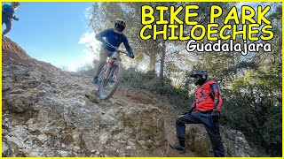
      youtuber Bike Park Chiloeches ​ Guadalajara | Living...
      mtb
      9:48 | 248 | Jan 23, 2025 , My City

      Trail Lists

      Routes with this trail

      more »
      28 miles • 5,172 ft • 53 •
      Una ruta para conocer Chilo a fondo haciendo lo mejor de la zona
      4.0 ★★★★★
      1 Ratings
      5 ★
      4 ★ 100%
      3 ★
      2 ★
      1 ★

      Reviews / Comments

      No reviews yet, be the first to write a review or ask a question.
      Use trail reports to comment on trail conditions.


      We hope you've been enjoying Trailforks!

      Create a FREE account to view all trail reviews and much more.

      • By JorgeHM4 & contributors
      • #230776 - 647 views

      Frequently Asked Questions

      ▼ Where is Remedios located?
      Remedios is located in Chiloeches, Spain. It is part of the Chiloeches trail network. The trailhead is located at coordinates 40.58254, -3.15717.
      ▼ How hard is Remedios?
      Remedios is rated as Green difficulty. The physical rating is Easy. The average grade is 5.9%. The climb difficulty is rated Green.
      ▼ What is the elevation gain for Remedios?
      The trail has 64 ft of elevation descent. The elevation ranges from 3,008 ft to 3,072 ft.
      ▼ Is Remedios a point to point trail?
      Remedios is not a point to point trail. The direction is Both Directions. The trail type is singletrack.
      ▼ How long is Remedios?
      Remedios is 1,076 ft long. The trail type is singletrack.
      ▼ Are dogs allowed on Remedios?
      Yes, dogs are allowed on Remedios. Please keep dogs on a leash where required and clean up after them.
      ▼ When is the best time of year to ride Remedios?
      Remedios is best visited during: En cualquier momento de el año.
      ▼ How do I access Remedios? Where is the closest parking trailhead?
      The closest parking and trailhead locations to Remedios are: View all parking locations in the area.
      ▼ How long does it take to ride Remedios?
      Based on recorded activities, it takes an average of 1 minute to ride Remedios. The trail is 1,076 ft long. Actual times will vary based on fitness level, conditions, and pace. View recent activity logs for more details.
      ▼ How busy is Remedios?
      Remedios is a very popular trail. There have been 404 recorded activities on this trail. The trail has received 558 check-ins. View recent activity on this trail.

      Hit the Trail

      Open in App

      Get this trail on your phone instantly.

      open trail in app

      Download Trail

      Save to wishlist, Garmin & download.
      save the trail

      Find Related Routes

      Find routes and users activities that include this trail.
      find routes for this trail

      You must enter a description before submitting.

