
more stats
2.0 miles
Distance
48 ft
Climb
-2,483 ft
Descent
00:13:33
Avg time
-2,435 ft
Altitude change
2,070 ft
Altitude min
4,505 ft
Altitude max
4,505 ft
Altitude start
2,070 ft
Altitude end
-22.7%
Grade
-136.4%
Grade max
27.1%
Grade min
522 ft
Distance climb
2 miles
Distance down
00:13:33
Avg time

Rientro Details

  • Activities
    • Mountain Bike
    • E-Bike
    • Adaptive Bike
  • Riding Area
  • Ref Number
    #10
  • Difficulty Rating
  • Voted Difficulty
    Red (2 votes)
  • Global Ranking
    #108652 in Mountain Biking [+]
    • #120605 in E-Biking
    • #813 in Adaptive Biking
  • National Ranking
    #8,472 in Mountain Biking · Italy [+]
    • #12,089 in E-Biking
    • #20 in Adaptive Biking
  • Trail Type
    Singletrack
  • Bike Type
    DH, AM, Adaptive MTB
  • Direction
    One Direction
    Popular Direction Shown
  • Physical Rating
    Hard
  • Trail Visibility
    Always easy to follow
  • Season
    mar-oct
  • eBike Allowed
    Yes up to Class 1
  • TTFs on Trail
    Berm, Bridge, Drop, Jump, Rock Face

IT: pista da freeride divertente e varia, con diverse paraboliche, salti e drop. Dalla stagione 2022 é aperta solamente l' ultima parte da Les Fleurs.

EN: fun and varied freeride track, with many berms, jumps and drop.
Since 2022 only the last part from Les Fleurs is open.

Access Info

IT: Dalla strada asfaltata, o scendendo alla prima fermata della telecabina.

EN: From the paved road or getting off the gondola at the first stop.

Tags
BermsBridgesDropsJumpsRock slabs

Local Trail Association

Recent Activity on Trail

Past Week
  • 0 rides
  •  
6 Months
  • 114 rides
  • 33 miles avg distance
All
  • 282 rides
  • Last: Sep 19, 2026
c1c2c3c4
January
February
March
April
May
June
July
August
September
October
November
December
update trails status or condition

Rientro Trail Reports

statusdatedescription
Aug 20, 2026 @ 6:23pm (Europe/Rome)
Aug 20, 2026
vale la pena provarla
Jun 27, 2026 @ 3:50pm (Europe/Rome)
Jun 27, 2026
La definizione MOLTO SECCO non rende bene l’idea. A tratti sembra di stare sulle dune del Sahara... speriamo che piova...
Jun 27, 2026 @ 1:46pm (Europe/Rome)
Jun 27, 2026
bellissimo, ma davvero un sacco di polvere! c'è giù la sabbia...
Aug 24, 2025 @ 11:19am
Aug 24, 2025
There was big tree in the middle of the trail. Very dry and bad shape, need a lot of work!
Aug 7, 2025 @ 11:05am
Aug 7, 2025
more »
Status:
on Aug 20, 2026
Dry
Avg: 4.37 (21 votes)
Your vote: 0

view (345)
close
      Directions to rientro-37081 trailhead (45.700930, 7.317840)

      Photos

      89 more »
      mtb
      62 |
      Aug 17, 2026 @ 10:39pm
      Aug 17, 2026
      mtb
      196 |
      Jul 11, 2016 @ 2:38pm
      Jul 11, 2016
      mtb
      175 |
      Jul 4, 2018 @ 12:47am
      Jul 4, 2018
      mtb
      137 |
      Feb 25, 2018 @ 3:41am
      Feb 25, 2018

      Videos

      17 more »
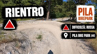
      Rientro  - MTB Pila Bikepark (AO) - DALLA...
      mtb
      16:42 | 1 | Oct 17, 2026 , Aosta
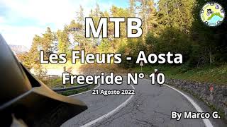
      MTB Les Fleurs -Aosta Freeride N° 10
      mtb
      4:52 | 560 | Aug 30, 2022 , Aosta
      Pila Aosta Mtb Running In The Dust 2021
      mtb
      14:57 | 253 | Nov 3, 2021 , Aosta
      youtuber Pila to Aosta Raw
      mtb
      14:14 | 298 | Aug 31, 2021 , Aosta

      Articles

      POV Video: Wyn Masters Rips 10 Minutes of DH Track from Pila to Aosta
      Sep 9, 2020 from pinkbike.com
      A fun ride home at the end of the day.
      4.5 ★★★★★
      21 Ratings
      5 ★ 62%
      4 ★ 29%
      3 ★ 5%
      2 ★ 5%
      1 ★

      7 Reviews & Comments

      stevek36
      I loved this trail as it interesting and a lot less corrugated than the bike park. My wife is a grade 3 intermediate and she found sections of this too hard. Its a grade 5 (single black) on an international rating in my opinion. If thats what you like it is a great ride.
      herotrail
      What a fabulous trail! It's the official trail down to Aosta, perfectly signposted with yellow Les Fleurs to Aosta signs. I relished every metre of it.
      wilkomtb wilkomtb
      Don't listen to the negative reviews, this trails is all time awesome!! Go ride it, support the local community, these guys are busting their balls to bring us tourists these amazing trails.
      BIG thumbsup from me.

      We hope you've been enjoying Trailforks!

      Create a FREE account to view all trail reviews and much more.

      • By cheorchTF Pro & contributors
      • #37081 - 20,092 views

      Frequently Asked Questions

      ▼ Where is Rientro located?
      Rientro is located in Aosta, Italy. It is part of the Aosta trail network. The trailhead is located at coordinates 45.70093, 7.31784.
      ▼ How hard is Rientro?
      Rientro is rated as Red difficulty. The physical rating is Hard. The average grade is 22.7%.
      ▼ What is the elevation gain for Rientro?
      Rientro has 48 ft of elevation gain. The trail has 2,483 ft of elevation descent. The elevation ranges from 2,070 ft to 4,505 ft.
      ▼ Is Rientro a point to point trail?
      Yes, Rientro is a point to point trail. The direction is One Direction. The trail type is singletrack.
      ▼ How long is Rientro?
      Rientro is 2.0 miles long. The trail type is singletrack.
      ▼ Are dogs allowed on Rientro?
      There is no information about dogs being allowed on Rientro. Check with local trail managers or the trail page for the latest access rules.
      ▼ When is the best time of year to ride Rientro?
      Rientro is best visited during: mar-oct.
      ▼ How do I access Rientro? Where is the closest parking trailhead?
      The closest parking and trailhead locations to Rientro are: View all parking locations in the area.
      ▼ How long does it take to ride Rientro?
      Based on recorded activities, it takes an average of 14 minutes to ride Rientro. The trail is 2.0 miles long. Actual times will vary based on fitness level, conditions, and pace. View recent activity logs for more details.
      ▼ How busy is Rientro?
      Rientro is a less popular trail with lighter traffic. There have been 1,721 recorded activities on this trail. The trail has received 345 check-ins. View recent activity on this trail.

      Hit the Trail

      Open in App

      Get this trail on your phone instantly.

      open trail in app

      Download Trail

      Save to wishlist, Garmin & download.
      save the trail

      Find Related Routes

      Find routes and users activities that include this trail.
      find routes for this trail

      You must enter a description before submitting.

