close
-
Layers w
- Weather Layers
- Pro
- Pro
- Pro
- Pro
- Pro
- Pro
- More Layers
- Pro
- Pro
- Pro
- Pro
-
Upgrade to

3D
Trail Conditions
- Unknown
- Snow Groomed
- Snow Packed
- Snow Covered
- Snow Cover Partial
- Freeze/thaw Cycle
- Icy
- Prevalent Mud
- Wet
- Variable
- Ideal
- Dry
- Very Dry
Trail Flow (Ridden Direction)
Trailforks scans users ridelogs to determine the most popular direction each trail is ridden. A good flowing trail network will have most trails flowing in a single direction according to their intension.
The colour categories are based on what percentage of riders are riding a trail in its intended direction.
The colour categories are based on what percentage of riders are riding a trail in its intended direction.
- > 96%
- > 90%
- > 80%
- > 70%
- > 50%
- < 50%
- bi-directional trail
- no data
Trail Last Ridden
Trailforks scans ridelogs to determine the last time a trail was ridden.
- < 2 days
- < 1 week
- < 2 weeks
- < 1 month
- < 6 months
- > 6 months
Trail Ridden Direction
The intended direction a trail should be ridden.
- Downhill Only
- Downhill Primary
- Both Directions
- Uphill Primary
- Uphill Only
- One Direction
Contribute Details
Colors indicate trail is missing specified detail.
- Description
- Photos
- Description & Photos
- Videos
Trail Popularity ?
Trailforks scans ridelogs to determine which trails are ridden the most in the last 9 months.
Trails are compared with nearby trails in the same city region with a possible 25 colour shades.
Think of this as a heatmap, more rides = more kinetic energy = warmer colors.
- most popular
- popular
- less popular
- not popular
ATV/ORV/OHV Filter
Max Vehicle Width
inches
US Cell Coverage
Legend

Radar Time
Activity Recordings
Trailforks uses anonymized public activity data.
?
Activity Recordings
Trailforks uses anonymized public activity data.
?
Personal Heatmap
▶
Activity Types
all
/
none
▶
Options
2
Date range
month
–
Winter Trails
Warning
A routing network for winter maps does not exist. Selecting trails using the winter trails layer has been disabled.
Missing Trails
Most Popular
Least Popular
Trails are colored based on popularity. The more popular a trail is, the more red. Less popular trails trend towards green.
Jump Magnitude Heatmap
Heatmap of where riders jump on trails. Zoom in to see individual jumps, click circles to view jump details.
BC Backroad Status
![map legend]()
Service Road Atlas is a free to use, community-driven service for viewing and creating reports on the numerous back-country service roads around B.C. and Alberta.

Slope Aspect
Direction the slope faces
Trails Deemphasized
Trails are shown in grey.
Only show trails with no bike usage.
Suggested Layers
Based on selected activity type
Save the current map location and zoom level as your default home location whenever this page is loaded.
SaveThe area includes many natural trails that you can easily reach by bike from Aosta in less than two hours. The trails' conditions can vary depending on the weather, as they are natural and they don't belong to any bikepark.
This region uses the Uk/Euro style trail grading system.
Activities Click to view
- Mountain Bike
83 trails
- E-Bike
74 trails
- Gravel Bike
1 trails
- Adaptive Bike
0 trails
- Winter Fat Bike
1 trails
- Hike
80 trails
- Trail Running
79 trails
Region Details
- 14
- 3
- 45
- 1
- 1
Region Status
Open as of 4 hoursLocal Trail Association
Stats
- Avg Trail Rating
- Trails (view details)
- 85
- Trails Mountain Bike
- 83
- Trails E-Bike
- 74
- Trails Gravel Bike
- 1
- Trails Winter Fat Bike
- 1
- Trails Horse
- 1
- Trails Hike
- 80
- Trails Trail Running
- 79
- Trails Dirtbike/Moto
- 1
- Trails Backcountry Ski
- 3
- Total Distance
- 104 miles
- Total Descent
- 77,689 ft
- Total Vertical
- 7,157 ft
- Highest Trailhead
- 9,099 ft
- Reports
- 609
- Photos
- 354
- Ridden Counter
- 10,378
Articles
POV Video: Wyn Masters Rips 10 Minutes of DH Track from Pila to Aosta
Sep 9, 2020 from pinkbike.com
A fun ride home at the end of the day.
Popular Aosta Mountain Biking Trails
• 5 ★ 4.5 • 2 miles • 48 ft • 867 •
IT: pista da freeride divertente e varia, con diverse paraboliche, salti e drop. Dalla stagione 2022 é aperta solamente l' ultima parte da . EN: fun and varied freeride track, with many berms, jumps and drop. Since 2022 only the last...
• 50 ★ 4.4 • 4,632 ft • 14 ft • 277 •
Steep and fast but mostly not very technical.
• 95 ★ 4.5 • 4 miles • 368 ft • 249 •
IT: sentiero naturale alpino, abbastanza frequentato. Il terreno varia dal sentiero in mezzo ai prati, a tratti rocciosi, per terminare con un lungo singletrack nel bosco. In alcuni punti è ripido e esposto. Alla fine del sentiero si...
• 100 ★ 4.0 • 2,753 ft • 0 ft • 198 •
Popular blue difficulty singletrack. This mountain bike primary trail can be used downhill primary and has a easy overall physical rating. It features berm, drop and jump. On average it takes 3 minutes to complete this trail.
• 95 ★ 4.2 • 2 miles • 14 ft • 196 •
IT: sentiero naturale di media difficoltà, con molti tornanti stretti. Il terreno è abbastanza secco e flow, specialmente nell'ultima parte. Attenzione ai possibili escursionisti che salgono a piedi. EN: natural trail, medium...
• 100 ★ 5.0 • 2 miles • 28 ft • 180 •
IT: sentiero naturale con terreno secco e scivoloso. La prima parte è veloce e presenta curve larghe, la parte centrale è più pianeggiante e ha molti tornanti stretti e l'ultima è molto veloce e dritta. In alcune parti il terreno è...
• 65 ★ 4.6 • 2 miles • 429 ft • 147 •
IT: sentiero naturale. La prima parte è principalmente nel bosco, ed è abbastanza pianeggiante e flow. In seguito diventa più ripido e roccioso. Il terreno è morbido e ricco di grip. EN: natural trail. The first part is mainly in...
• 95 ★ 4.0 • 3,407 ft • 116 ft • 135 •
IT: sentiero naturale, con terreno secco e cedevole. Il fondo è ricoperto da molti sassi che lo rendono scivoloso e poco adatto in condizioni di pioggia. Il sentiero è stato anche usato come prova speciale del Blast Enduro Aosta...
Aosta Mountain Bike Routes
★ 5.0 • 29 miles • 8,386 ft • 8 • Loop •
A true extreme freeride tour in Pila, from Aosta to the top of Couis 1 Amazing panorama: you can spot Gran...
• 4 miles • 1,977 ft • 1 •
• 10 miles • 3,681 ft • 3 •
• 10 miles • 2,803 ft • 2 •
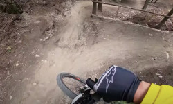
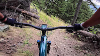
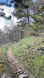
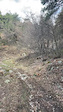
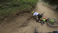
Photos of Aosta Mountain Bike
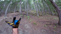
Videos of Aosta Mountain Bike
0:00 |
3 |
Sep 18, 2025

trail: Becca France
0:11 |
33 |
Jul 3, 2024

trail: Becca France
0:08 |
13 |
Jul 3, 2024

trail: Rientro
0:13 |
38 |
Apr 5, 2023
trail: 105
0:12 |
144 |
Apr 5, 2023
trail: Blavy
0:15 |
67 |
Apr 5, 2023
trail: Rientro
3:08 |
117 |
Jun 29, 2022
trail: Rientro
3:38 |
114 |
Jun 30, 2020
Current Trail Warnings
| status | trail | date | condition | user | info |
|---|---|---|---|---|---|
| 21b | Jul 7, 2026 @ 3:23pm (Europe/Rome) 2 days | Dry | ac95 | Tanti alberi a terra, niente da fare |
Recent Trail Reports
| status | trail | date | condition | info | user |
|---|---|---|---|---|---|
| Tsa de Metz | Jul 9, 2026 @ 9:21am (Europe/Rome) 4 hours | Dry | micheloren | ||
| Fenêtre de Ferret South-East | Jun 26, 2026 @ 9:31am (Europe/Zurich) Jun 26, 2026 | Variable | LionelBloch | ||
| Rientro | Jun 27, 2026 @ 3:50pm (Europe/Rome) Jun 27, 2026 | Very Dry | Stefanof2Io9R | ||
| TS Chamole | Jun 23, 2026 @ 11:50am (Europe/Rome) Jun 23, 2026 | Very Dry | yomgui-38 | ||
| Climb to Rifugio Mont Fallère | Jun 22, 2026 @ 9:37am (Europe/Zurich) Jun 22, 2026 | Ideal | Pezzottocicloteam | ||
| Pointier #1B | May 19, 2026 @ 12:59pm (Europe/Rome) May 19, 2026 | Dry | mattiapic | ||
| Roisan #1B | May 19, 2026 @ 12:58pm (Europe/Rome) May 19, 2026 | Dry | mattiapic | ||
| Parleaz #26B | May 14, 2026 @ 9:53pm (Europe/Rome) May 14, 2026 | Ideal | abmcr | ||
| Blavy | May 13, 2026 @ 11:43am (Europe/Zurich) May 13, 2026 | Ideal | mattiapic | ||
| Parleaz #26A | May 2, 2026 @ 9:48am (Europe/Rome) May 2, 2026 | Dry | EnricoGenerali |
Activity Feed
| username | action | type | title | date |
|---|---|---|---|---|
| micheloren | add | report | activity #98767747 | Jul 9, 2026 @ 12:21am 4 hours |
| StephanexmJhRm | vote | trail | activity #98693551 | Jul 7, 2026 @ 11:29pm 1 day |
| StephanexmJhRm | ridden | trail | activity #98693542 | Jul 7, 2026 @ 11:29pm 1 day |
| StephanexmJhRm | wishlist | trail | activity #98693488 | Jul 7, 2026 @ 11:28pm 1 day |
| ac95 | add | report | activity #98636227 | Jul 7, 2026 @ 6:23am 2 days |
Recent Comments
| username | type | title | comment | date |
|---|---|---|---|---|
| trail | Sempre bloccata da alberi caduti.Non e... | Oct 18, 2025 @ 7:15am Oct 18, 2025 | ||
| trail | Ottime condizioni Quasi in fondo c'è un... | Sep 30, 2025 @ 8:18am Sep 30, 2025 | ||
| trail | Condizioni perfette | Sep 30, 2025 @ 8:16am Sep 30, 2025 | ||
| trail | Relatively easy zone to climb on a fire Road... | Sep 14, 2025 @ 10:02am Sep 14, 2025 | ||
| trail | Section below Blavy starts well but soon turns... | Sep 9, 2025 @ 11:27pm Sep 9, 2025 |
Local Badges
-

10 Blue Trails28 awarded -

10 Black Trails9 awarded -

Epic Ride Climb 2k305 awarded -

Climbing 10k Badge42 awarded -

Climbing 100k Badge4 awarded -

Epic Ride Descent 2k519 awarded
Bike & Skill Parks
| name | type | city | rating |
|---|---|---|---|
| Aosta/Saint-Christophe skillpark | skill park | Aosta | |
| Aosta BMX track | skill park | Aosta |
Activity Type Stats
| activitytype | trails | distance | descent | descent distance | total vertical | rating | global rank | state rank | photos | reports | routes | ridelogs |
|---|---|---|---|---|---|---|---|---|---|---|---|---|
| Mountain Bike | 83 | 98 miles | 76,453 ft | 71 miles | 7,083 ft | #1,024 | #19 | 343 | 608 | 3 | 5,379 | |
| E-Bike | 74 | 81 miles | 63,780 ft | 57 miles | 5,850 ft | #269 | #22 | 11 | 550 | 1 | 1,237 | |
| Gravel Bike | 1 | #168 | #101 | 8 | 19 | |||||||
| Winter Fat Bike | 1 | #107 | #220 | 2 | 1 | |||||||
| Horse | 1 | 2,825 ft | 400 ft | 2,825 ft | 400 ft | 80 | ||||||
| Hike | 80 | 93 miles | 71,345 ft | 67 miles | 7,083 ft | #1,216 | #36 | 596 | 271 | |||
| Trail Running | 79 | 93 miles | 70,636 ft | 66 miles | 7,083 ft | #895 | #25 | 598 | 208 | |||
| Dirtbike/Moto | 1 | 2,825 ft | 400 ft | 2,825 ft | 400 ft | 79 | ||||||
| Backcountry Ski | 3 | 5 miles | 551 ft | 1 mile | 3,681 ft | 127 |
Frequently Asked Questions About Aosta
▼
What are the highest rated mountain biking trails in Aosta?
The highest rated mountain biking trails in Aosta are:
- Becca France (4.4/5)
- Parleaz #26B (4.4/5)
- Roisan #1A (4.4/5)
- Leysser (4.4/5)
- 21b (4.3/5)
▼
What is the best time of the year to ride in Aosta?
Based on ride log data, the most popular months to ride in Aosta are:
- July (68 activities)
- August (62 activities)
- May (48 activities)
▼
Where can I park to ride in Aosta?
There are 11 parking locations listed in Aosta. The most popular parking spots are: View all parking and trailhead locations on the map to plan your visit.
▼
What is the longest trail in Aosta?
The longest trail in Aosta is Alta Via 2 at 10.2 km. View all trails sorted by distance.
Activities
Trails
Points of Interest
- By samthornton1990 & contributors
- Admins: AVTC
- #6234 - 26,947 views
- aosta activity log | embed map of Aosta mountain bike trails | aosta mountain biking points of interest
Downloading of trail gps tracks in kml & gpx formats is enabled for Aosta.
You must login to download files.