


more stats
1,804 ft
Distance
10 ft
Climb
-52 ft
Descent
00:04:56
Avg time
-41 ft
Altitude change
906 ft
Altitude min
958 ft
Altitude max
949 ft
Altitude start
909 ft
Altitude end
-2.3%
Grade
-20.7%
Grade max
8.8%
Grade min
348 ft
Distance climb
725 ft
Distance down
495 ft
Distance flat
00:04:56
Avg time

RimRunner Details

  • Activities
    • Mountain Bike
    • E-Bike
    • Hike
    • Trail Running
  • Riding Area
    Ridge Runner
    Nanaimo, British Columbia
  • Difficulty Rating
  • Local Popularity
    65 in Mountain Biking [+]
    • 60 in E-Biking
    • 40 in Trail Running
    • 25 in Hiking
  • Global Ranking
    #66497 in Mountain Biking [+]
    • #45876 in E-Biking
    • #154713 in Trail Running
    • #158399 in Hiking
  • Provincial Ranking
    #3,265 in Mountain Biking · British Columbia [+]
    • #3,156 in E-Biking
    • #9,442 in Trail Running
    • #10,218 in Hiking
  • Trail Type
    Singletrack
  • Bike Type
    XC
  • Climb Difficulty
    Blue
  • Physical Rating
    Moderate
  • Season
    All Year unless there is snow.
  • Dogs Allowed
    Yes
  • eBike Allowed
    Yes up to Class 1
  • Ride in Rain
    Yes
  • Year Opened
    2016

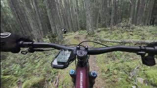
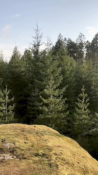
Phase 1 now complete, Best present start is East end where "Quarry Connector" and "Raven" meet on short logging road spur. It follows the Rim of rock West above the Quarry. Lots of Slick rock sections and some technical sections. I will wait to see if Blue / Intermediate, is the correct level for this trail. "Please keep in Mind the trail follows the edge of the cliff all the way around and has some EXPOSURE" It joins up with "NightHawk" ( Which crosses "Quadrophenia")

This trail is unsanctioned.

Tags
Exposure

Traditionally Indigenous Territory

Recent Activity on Trail

Past Week
  • 4 rides
  • 11 miles average
6 Months
  • 62 rides
  • 10 miles avg distance
All
  • 528 rides
  • Last: Oct 22, 2026
c1c2c3c4
January
February
March
April
May
June
July
August
September
October
November
December
Status:
on Apr 22, 2026
Ideal
Avg: 4.32 (6 votes)
Your vote: 0

view (1,837)
close
      Directions to rimrunner-64749 trailhead (49.099720, -123.991280)

      Photos

      13 more »
      mtb
      202 |
      Feb 16, 2020 @ 2:47pm
      Feb 16, 2020
      mtb
      77 |
      Oct 14, 2019 @ 7:32pm
      Oct 14, 2019
      mtb
      77 |
      Oct 19, 2023 @ 2:31pm
      Oct 19, 2023
      mtb
      73 |
      Sep 12, 2022 @ 7:35pm
      Sep 12, 2022

      Videos

      3 more »
      Rim Runner & Quadrophenia - Ridge Runner,...
      mtb
      10:18 | 5 | Oct 14, 2026 , Nanaimo
      Rim Runner & Quadrraphenia - Ridge Runner,...
      mtb
      12:35 | 21 | Apr 25, 2026 , Nanaimo
      Looking out towards Wolf Mountain & Mt. Benson
      mtb
      0:20 | 62 | Apr 24, 2020 , Nanaimo

      Routes with this trail

      ★ 5.0 • 10 miles • 964 ft • 43 • Loop •
      Best to do this loop in a clockwise direction - although it is a lot of UP. 16 kms. Probably take 2.5 - 3...
      ★ 2.0 • 9 miles • 924 ft • 46 • Loop •
      A tougher route, lots of rock. Can be ridden both directions but better to do it counter-clockwise. Lots...
      16 miles • 1,737 ft • 68 • Loop •
      4.7 ★★★★★
      6 Ratings
      5 ★ 67%
      4 ★ 33%
      3 ★
      2 ★
      1 ★

      3 Reviews & Comments

      kphjelholt kphjelholt
      lol I ride this backwards on a single speed. It’s not a black.
      Hunter3ju0cG
      This is quite technical in places, u would call it a Black.
      kraf kraf
      Slow speed twisty as an uphill, up and over slow speed balancy rock moves, will make you work for it.

      We hope you've been enjoying Trailforks!

      Create a FREE account to view all trail reviews and much more.

      • #64749 - 1,846 views

      Frequently Asked Questions

      ▼ Where is RimRunner located?
      RimRunner is located in Ridge Runner, Nanaimo, British Columbia, Canada. It is part of the Ridge Runner trail network. The trailhead is located at coordinates 49.09972, -123.99128.
      ▼ How hard is RimRunner?
      RimRunner is rated as Blue difficulty. The physical rating is Moderate. The average grade is 2.3%. The climb difficulty is rated Blue.
      ▼ What is the elevation gain for RimRunner?
      RimRunner has 10 ft of elevation gain. The trail has 52 ft of elevation descent. The elevation ranges from 906 ft to 958 ft.
      ▼ How long is RimRunner?
      RimRunner is 1,804 ft long. The trail type is singletrack.
      ▼ Are dogs allowed on RimRunner?
      Yes, dogs are allowed on RimRunner. Please keep dogs on a leash where required and clean up after them.
      ▼ When is the best time of year to ride RimRunner?
      RimRunner is best visited during: All Year unless there is snow..
      ▼ How do I access RimRunner? Where is the closest parking trailhead?
      The closest parking and trailhead locations to RimRunner are: View all parking locations in the area.
      ▼ How long does it take to ride RimRunner?
      Based on recorded activities, it takes an average of 5 minutes to ride RimRunner. The trail is 1,804 ft long. Actual times will vary based on fitness level, conditions, and pace. View recent activity logs for more details.
      ▼ How busy is RimRunner?
      RimRunner is a moderately popular trail. There have been 1,851 recorded activities on this trail. The trail has received 1,837 check-ins. View recent activity on this trail.

      Hit the Trail

      Open in App

      Get this trail on your phone instantly.

      open trail in app

      Download Trail

      Save to wishlist, Garmin & download.
      save the trail

      Find Related Routes

      Find routes and users activities that include this trail.
      find routes for this trail

      You must enter a description before submitting.

