
close
3D
Trail Conditions
- Unknown
- Snow Groomed
- Snow Packed
- Snow Covered
- Snow Cover Partial
- Freeze/thaw Cycle
- Icy
- Prevalent Mud
- Wet
- Variable
- Ideal
- Dry
- Very Dry
Trail Flow (Ridden Direction)
Trailforks scans users activity logs to determine the most popular direction each trail is ridden. A good flowing trail network will have most trails flowing in a single direction according to their intension.
The colour categories are based on what percentage of users are riding a trail in its intended direction.
The colour categories are based on what percentage of users are riding a trail in its intended direction.
- > 96%
- > 90%
- > 80%
- > 70%
- > 50%
- < 50%
- bi-directional trail
- no data
Trail Last Used
Trailforks scans activity logs to determine the last time a trail was ridden.
- < 2 days
- < 1 week
- < 2 weeks
- < 1 month
- < 6 months
- > 6 months
Trail Ridden Direction
The intended direction a trail should be ridden.
- Downhill Only
- Downhill Primary
- Both Directions
- Uphill Primary
- Uphill Only
- One Direction
Contribute Details
Colors indicate trail is missing specified detail.
- Description
- Photos
- Description & Photos
- Videos
Trail Popularity ?
Trailforks scans activity logs to determine which trails are ridden the most in the last 9 months.
Trails are compared with nearby trails in the same city region with a possible 25 colour shades.
Think of this as a heatmap, more activities = more kinetic energy = warmer colors.
- most popular
- popular
- less popular
- not popular
ATV/ORV/OHV Filter
Max Vehicle Width
inches
US Cell Coverage
Legend

Radar Time
Activity Recordings
Trailforks uses anonymized public activity data.
?
Activity Recordings
Trailforks uses anonymized public activity data.
?
Winter Trails
Warning
A routing network for winter maps does not exist. Selecting trails using the winter trails layer has been disabled.
Missing Trails
Most Popular
Least Popular
Trails are colored based on popularity. The more popular a trail is, the more red. Less popular trails trend towards green.
Jump Magnitude Heatmap
Heatmap of where users jump on trails. Zoom in to see individual jumps, click circles to view jump details.
BC Backroad Status
![map legend]()
Service Road Atlas is a free to use, community-driven service for viewing and creating reports on the numerous back-country service roads around B.C. and Alberta.

Slope Aspect
Direction the slope faces
Trails Deemphasized
Trails are shown in grey.
Only show trails with no bike usage.
Suggested Layers
Based on selected activity type
Save the current map location and zoom level as your default home location whenever this page is loaded.
SaveNanaimo trails and routes are listed on Trailforks with interactive trail maps, difficulty ratings, photos, and user-reported trail conditions. The Trailforks community has mapped hundreds of trails and shared thousands of photos in this region. Supported activity types include Mountain Biking, Hiking, Trail Running, E-Biking, Gravel Biking, Dirtbiking, Adaptive Biking, ATVing/Offroading, Horseback, Observed Trials, Winter Fat Biking and Snowshoeing. Trails here are often flowy, faint trail and tight and twisty. Scenery includes views, lakes and ridgelines. Common trail features include bridges, jumps and rock slabs. Many trails are family friendly. Amenities include restrooms. Popular destinations include Doumont, Ridge Runner and The Abyss / Extension Ridge.
This is an auto-generated description of Nanaimo.
Login or register to submit a custom description.
Trail info last updated
Activities Click to view
- Mountain Bike
631 trails
- E-Bike
472 trails
- Gravel Bike
152 trails
- Adaptive Bike
81 trails
- Winter Fat Bike
13 trails
- Horse
60 trails
- Hike
630 trails
- Trail Running
630 trails
- Dirtbike/Moto
127 trails
- Observed Trials
19 trails
- ATV/ORV/OHV
73 trails
- Snowshoe
12 trails
Region Details
- 118
- 5
- 67
- 338
- 87
- 15
- 1
Region Status
Open as of 2 hours
Stats
- Avg Trail Rating
- Trails (view details)
- 723
- Trails Mountain Bike
- 631
- Trails E-Bike
- 472
- Trails Gravel Bike
- 152
- Trails Adaptive Bike
- 81
- Trails Winter Fat Bike
- 13
- Trails Horse
- 60
- Trails Hike
- 630
- Trails Trail Running
- 630
- Trails Dirtbike/Moto
- 127
- Trails Observed Trials
- 19
- Trails ATV/ORV/OHV
- 73
- Trails Snowshoe
- 12
- Total Distance
- 391 miles
- Total Descent
- 69,863 ft
- Total Vertical
- 4,771 ft
- Highest Trailhead
- 4,793 ft
- Reports
- 23,826
- Photos
- 3,608
- Completed Counter
- 319,805
Articles

Stephane's Randoms From The 2026 Reece Wallace Invitational
Jul 21, 2026 from pinkbike.com
Planes, donairs, dogs, Dylan Tremblay performance art, and good times at Canada's annual freeride pilgrimage.
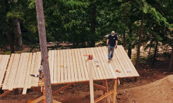
Video: Reece Wallace Mills Lumber to Build a New Freeride Feature From Scratch
Jun 1, 2026 from pinkbike.com
After an island storm knocked down raw fir on his property, Reece Wallace fired up the sawmill to build a massive new feature for the RW Invitational.
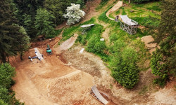
RW Invitational Returns: 100% of Ticket Proceeds Go Directly to the Athletes
May 14, 2026 from pinkbike.com
Reece Wallace brings the freeride community back to his Nanaimo backyard for a high-stakes Whip-Off and Best Trick showdown this July.
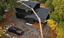
Video: Reece Wallace E-Bikes Up & Off His House
Nov 27, 2025 from pinkbike.com
Those darn e-bikers out there causing a ruckus again...
Sub Regions
-
Diver Lake
- 5
- 1
-
Doumont
- 5
- 96
- 21
- 6
- 1
-
Hemer Provincial Park
- 5
-
Linley Valley
- 5
- 27
- 4
-
Newcastle Island Marine Provincal Park
- 8
-
North Benson / Jameson
- 1
- 5
- 1
-
Ridge Runner
- 10
- 78
- 6
-
South Benson / Wolf Mountain
- 1
- 16
- 28
- 8
-
South Wellington
- 10
- 25
- 11
-
The Abyss / Extension Ridge
- 6
- 55
- 4
-
The Bay
-
Water District Lands
- 4
- 13
-
Westwood
- 4
- 22
- 12
- 1
Popular Nanaimo Mountain Biking Trails
• 95 ★ 4.5 • 2,890 ft • 0 ft • 2,747 •
Strap in kids cuz... There's the right way, the wrong way, AND the Max Power way!!! Isn't that the wrong way? Yes! But FASTER!
• 95 ★ 4.6 • 4,764 ft • 0 ft • 2,744 •
Ned approved, this trail will have you exclaiming, "Feels like I'm wearing nothing at all!"
• 100 ★ 4.0 • 2,779 ft • 10 ft • 2,720 •
Fine China, also known as the pump track or flow trail, is the first provincially approved trail built by the NMBC. The trail is on a piece of Crown land in the Doumont trail network. Approval and construction of the trail would not...
• 100 ★ 4.4 • 1,017 ft • 0 ft • 2,651 •
This is the most blatant case of false advertising since my suit against the movie The Neverending Story.
• 100 ★ 3.7 • 1,342 ft • 151 ft • 2,404 •
Moderate singletrack climbing trail to get the uphill traffic off of Gatekeeper.
• 100 ★ 4.0 • 3,724 ft • 3 ft • 2,323 •
Machine built downhill pumptrack. This trail is a must ride! Built in 2017-8 for the Nanaimo Mountain Bike Club with funding from the Nanaimo Hospitality Association and Tourism Nanaimo along with Generous donations from FMI, Sharecost...
• 100 ★ 3.9 • 5,020 ft • 361 ft • 2,009 •
Unleash the power of apples!!! GYM?! What's a GYM?! The first section of the South Benson Climber. Connect this trail with UpandAtom and E&M Express to get to 142 Main and beyond.
Nanaimo Mountain Bike Routes
Ridge Runner Tour Featured
16 miles • 1,737 ft • 68 • Loop •
★ 3.7 • 23 miles • 3,114 ft • 17 •
BCBR 2025 Stage 4 Nanaimo. An XC heavy, steady load day in the amazing and varied landscapes of Nanaimo
★ 4.5 • 5 miles • 969 ft • 8 • Loop •
Nice little quick loop around Westwood Lake - easy climbs for beginners or hardtails.
★ 4.0 • 23 miles • 2,916 ft • 19 •
Stage 6 BCBR: A mix of riding styles; distinct terrain, Big Bang Cidery to finish!
★ 5.0 • 22 miles • 3,391 ft • 16 •
Four distinct zones, very pedalable with a few very hard climbs. Some ripper downs. Well built, modern...
Photos of Nanaimo Mountain Bike
Videos of Nanaimo Mountain Bike


Current Trail Warnings
| status | trail | date | condition | user | info |
|---|---|---|---|---|---|
| Custard Cream | Nov 13, 2026 @ 1:59pm (America/Vancouver) 2 hours | Variable | trailanderror | Closed for falling. Access on 142-286 is... | |
| What's up dog? | Nov 13, 2026 @ 1:59pm (America/Vancouver) 2 hours | Variable | trailanderror | Closed for falling. Access on 142-286 is... | |
| Wagon Wheel | Nov 13, 2026 @ 1:59pm (America/Vancouver) 2 hours | Variable | trailanderror | Closed for falling. Access on 142-286 is... |
Recent Trail Reports
| status | trail | date | condition | info | user |
|---|---|---|---|---|---|
| E&M Express | Nov 11, 2026 @ 4:10pm (America/Vancouver) 2 days | Wet | luckylegz | ||
| Hutz | Nov 11, 2026 @ 4:10pm (America/Vancouver) 2 days | Wet | luckylegz | ||
| distilled | Nov 11, 2026 @ 9:02pm (America/Vancouver) 2 days | Variable | greg-mowat NMBC | ||
| Double Crown | Nov 11, 2026 @ 3:07pm (America/Vancouver) 2 days | Unknown | geoffocup | ||
| Swampy Connector | Nov 11, 2026 @ 10:41am (America/Vancouver) 2 days | Unknown | Squirrelonthewind | ||
| Serenity | Nov 11, 2026 @ 10:41am (America/Vancouver) 2 days | Variable | Squirrelonthewind | ||
| Fracture Line | Nov 9, 2026 @ 12:06pm (America/Vancouver) Nov 9, 2026 | Ideal | nerkanerka | ||
| Hoochie Koochie | Nov 9, 2026 @ 10:52am (America/Vancouver) Nov 9, 2026 | Unknown | Edwinthebaker | ||
| Blitzkreek | Nov 8, 2026 @ 10:52am (America/Vancouver) Nov 8, 2026 | Wet | Justinperkins | ||
| UpandAtom | Nov 8, 2026 @ 10:52am (America/Vancouver) Nov 8, 2026 | Wet | Justinperkins |
Activity Feed
| username | action | type | title | date |
|---|---|---|---|---|
| trailanderror | add | report | activity #107721604 and 2 more | Nov 13, 2026 @ 1:01pm 2 hours |
| Jbrassard98 | add | trail | activity #107711515 | Nov 13, 2026 @ 9:18am 6 hours |
| ibax | wishlist | region | activity #107692145 | Nov 12, 2026 @ 10:09pm 17 hours |
| illiakailli | wishlist | trail | activity #107690522 and 1 more | Nov 12, 2026 @ 8:36pm 19 hours |
| Brookefoli | wishlist | trail | activity #107677699 | Nov 12, 2026 @ 2:55pm 1 day |
Recent Comments
| username | type | title | comment | date |
|---|---|---|---|---|
| trail | Tree down just after the A frame. Too big for... | Nov 2, 2026 @ 6:58pm Nov 2, 2026 | ||
| report | Someone has cut out these trees. 👌👍 | Oct 30, 2026 @ 9:45pm Oct 30, 2026 | ||
| trail | Chainsaw Ridges signature features are the... | Oct 24, 2026 @ 11:26am Oct 24, 2026 | ||
| trail | Super fun trail, well done builders! | Oct 21, 2026 @ 8:26pm Oct 21, 2026 | ||
| trail | Hike a bike near the end. Tough but worth it.... | Oct 20, 2026 @ 11:30pm Oct 20, 2026 |
Local Badges
-

Completionist18 awarded -

Top 10 Trails66 awarded -
Completionist0 awarded -
Completionist6 awarded -
Completionist0 awarded -

10 Expert Trails142 awarded
Bike & Skill Parks
| name | type | city | rating |
|---|---|---|---|
| Stevie Smith Memorial Park | skill park | Nanaimo | |
| Nanaimo BMX | skill park | Nanaimo | |
| Wastelands Motocross Park (NMA) | skill park | Nanaimo |



Activity Type Stats
| activitytype | trails | distance | descent | descent distance | total vertical | rating | global rank | state rank | photos | reports | routes | activity logs |
|---|---|---|---|---|---|---|---|---|---|---|---|---|
| Mountain Bike | 631 | 342 miles | 58,671 ft | 141 miles | 3,307 ft | #22 | #5 | 3,345 | 23,779 | 106 | 178,551 | |
| E-Bike | 472 | 253 miles | 46,178 ft | 107 miles | 3,251 ft | #65 | #14 | 43 | 21,029 | 19 | 13,131 | |
| Gravel Bike | 152 | 158 miles | 12,654 ft | 52 miles | 3,261 ft | #138 | #12 | 1,463 | 2 | 745 | ||
| Adaptive Bike | 81 | 87 miles | 6,096 ft | 27 miles | 2,257 ft | #74 | #7 | 1,316 | 8 | |||
| Winter Fat Bike | 13 | 13 miles | 558 ft | 3 miles | 840 ft | #210 | #17 | 491 | 8 | |||
| Horse | 60 | 24 miles | 2,497 ft | 10 miles | 1,329 ft | #136 | #10 | 4,839 | 51 | |||
| Hike | 630 | 344 miles | 53,317 ft | 136 miles | 4,770 ft | #79 | #6 | 160 | 23,242 | 6 | 17,282 | |
| Trail Running | 630 | 344 miles | 53,333 ft | 137 miles | 4,770 ft | #65 | #4 | 21 | 23,226 | 9 | 27,636 | |
| Dirtbike/Moto | 127 | 81 miles | 8,356 ft | 28 miles | 3,241 ft | #27 | #9 | 27 | 4,899 | 1 | 903 | |
| Observed Trials | 19 | 17 miles | 1,037 ft | 4 miles | 2,904 ft | #18 | #7 | 26 | 94 | |||
| ATV/ORV/OHV | 73 | 63 miles | 6,375 ft | 22 miles | 3,238 ft | #17 | #3 | 6 | 4,869 | 1 | 175 | |
| Snowshoe | 12 | 6 miles | 276 ft | 3 miles | 89 ft | #193 | #20 | 29 |
Frequently Asked Questions
▼
What are the best places to ride in Nanaimo?
Nanaimo has 16 areas to explore for mountain biking. The top rated areas are:
▼
What are the highest rated mountain biking trails in Nanaimo?
The highest rated mountain biking trails in Nanaimo are:
- Sexy Flanders (4.5/5)
- Meat Draw (4.5/5)
- Mattmo (4.5/5)
- Sempiternal (4.5/5)
- Meat Draw (Upper) (4.5/5)
▼
What is the best time of the year to ride in Nanaimo?
Based on activity log data, the most popular months to ride in Nanaimo are:
- May (2,633 activities)
- July (2,607 activities)
- June (2,451 activities)
▼
Where can I park to ride in Nanaimo?
There are 26 parking locations listed in Nanaimo. The most popular parking spots are:
- Westwood alternate parking lot
- New Benson Creek Falls Parking Lot
- Main Westwood Lake parking lot
- Parking
- Parking Along Road
▼
What is the longest trail in Nanaimo?
The longest trail in Nanaimo is E&N Trail at 7.4 km. View all trails sorted by distance.
▼
What are the best & highest rated hiking trails in Nanaimo?
The best hiking trails in Nanaimo are: View all hiking trails sorted by popularity score.
▼
What are the best & highest rated trail running trails in Nanaimo?
The best trail running trails in Nanaimo are: View all trail running trails sorted by popularity score.
▼
What are the best & highest rated dirtbiking trails in Nanaimo?
The best dirtbiking trails in Nanaimo are: View all dirtbiking trails sorted by popularity score.
▼
How many trails are in Nanaimo?
Nanaimo has a total of 723 trails. Of those, 631 are designated for mountain biking. Browse top mountain biking trails in Nanaimo to find detailed information including difficulty ratings, distances, and trail conditions.
▼
Which trail has the most elevation gain in Nanaimo?
The trail with the most elevation gain in Nanaimo is The Abyss with 172 m of elevation gain. View all trails sorted by elevation gain.
▼
Which trail has the most elevation descent in Nanaimo?
The trail with the most elevation descent in Nanaimo is Meat Draw with 322 m of elevation descent. View all trails sorted by elevation descent.
▼
What activities are most popular in Nanaimo?
Nanaimo supports the following activities: Mountain Biking, E-Biking, Gravel Biking, Adaptive Biking, Winter Fat Biking, Horseback, Hiking, Trail Running, Dirtbiking, Observed Trials, ATVing/Offroading, Snowshoeing.
▼
What bike services are there in Nanaimo?
The following bike services are available in Nanaimo:
- Bike Shop (5)
- Trail Association (1)
- Club (1)
▼
What are the steepest mountain biking trails in Nanaimo?
The steepest mountain biking trail in Nanaimo is What's up dog? with an average grade of 16.5%. View all trails sorted by grade.
▼
Are there any trails with scenic viewpoints in Nanaimo?
▼
What trails have the biggest jumps in Nanaimo?
The trails with the biggest jumps in Nanaimo are: Browse all mountain bike trails to find trails with jumps and technical features.
▼
Are the trails open in Nanaimo?
The overall region status for Nanaimo is Clear / Green. Out of 538 trails:
- Clear / Green: 450
- Minor Issue / Yellow: 53
- Significant Issue / Amber: 25
- Closed: 10
▼
What are the trail conditions in Nanaimo?
Based on trail reports from the past week in Nanaimo:
- Wet: 6 trails
- Variable: 2 trails
- Ideal: 1 trail
▼
Can I ride an ebike in Nanaimo?
Yes, Nanaimo supports e-bike riding. There are 416 trails in Nanaimo that allow e-bikes. Check the e-bike trails listing for specific trail access details and any local regulations.
▼
What are the most popular mountain biking routes in Nanaimo?
The most popular mountain biking routes in Nanaimo are: View all mountain biking routes in Nanaimo.
▼
What type of bike is most common in Nanaimo?
Based on activity log data, the most common bike types used in Nanaimo are:
- AM (3,903 activities)
- XC (261 activities)
- DH (254 activities)
- DJ (40 activities)
- RD (19 activities)
▼
What is the highest summit in Nanaimo?
The highest summit in Nanaimo is Gemini Mountain at 1,502 m elevation.
▼
What are the top sights to see in Nanaimo?
There are 7 notable sights in Nanaimo. Some of the top sights include: Explore all points of interest in Nanaimo.
▼
What are the most popular Strava Segments in Nanaimo?
The most popular Strava segments in Nanaimo are:
- Hutz (official) (4,335 athletes)
- Sexy Entrance To Cut Block (4,062 athletes)
- Sexy Flanders (official) (3,966 athletes)
▼
What are some popular technical trail features in Nanaimo?
There are 36 technical trail features (TTFs) in Nanaimo. Some popular features include:
- Armageddon Drop (Drop)
- Dirt Bridge TTF #9 City Of Nanaimo (Bridge)
- Ol' Huck n' Buck City #8 (Ladder Bridge)
- Tombstone Trestle Bridge TTF #10 City Of Nanaimo (Ladder Bridge)
- The Grand Slam (Drop)
▼
What trails are closed in Nanaimo?
There are currently 10 closed trails in Nanaimo. The breakdown of all trail statuses is:
- Clear / Green: 450
- Minor Issue / Yellow: 53
- Significant Issue / Amber: 25
- Closed: 10
▼
Are there accessible or adaptive trails in Nanaimo?
Yes, there are 80 accessible/adaptive trails in Nanaimo. View all adaptive trails in Nanaimo for specific accessibility information.
▼
Are there local clubs or events in Nanaimo?
There are 3 local clubs or associations listed in the Nanaimo directory. Browse the local directory for details.
▼
What are the most popular mountain biking trails in Nanaimo?
The most popular mountain biking trails in Nanaimo are: View all mountain biking trails sorted by popularity.
▼
What are the best beginner ride trails in Nanaimo?
The best beginner mountain biking trails in Nanaimo are:
- Linley Valley main (5/5)
- Easy Way (4/5)
- Tangerine (4/5)
Activities
- Nanaimo Mountain Biking Trails
- Nanaimo E-Biking Trails
- Nanaimo Gravel Biking Trails
- Nanaimo Adaptive Biking Trails
- Nanaimo Winter Fat Biking Trails
- Nanaimo Horseback Trails
- Nanaimo Hiking Trails
- Nanaimo Trail Running Trails
- Nanaimo Dirtbiking Trails
- Nanaimo Observed Trials Trails
- Nanaimo ATVing/Offroading Trails
- Nanaimo Snowshoeing Trails
Trails
Points of Interest
- Giovando Viewpoint
- Bridge #16 City Of Nanaimo
- Chicken Dinner Log Ride TTF
- Group Campground Camping
- Shelter Cabin
- [Skinny] 12 inchs wide Other
- Armageddon Drop TTF
- Bridge #5 RDN
- Bridge #6 RDN
- Tombstone Trestle Bridge TTF #10 City Of Nanaimo
- Gemini Mountain (1,502 m)
- Green Mountain (1,459 m)
- Butler Peak (1,434 m)
- By canadaka
 Trailforks & contributors
- Admins: Dubnyk, NMBC
- #3040 - 174,769 views
- nanaimo activity log | embed map of Nanaimo mountain bike trails | nanaimo mountain biking points of interest polygons
Downloading of trail gps tracks in kml & gpx formats is enabled for Nanaimo.
You must login to download files.
