


more stats
656 ft
Distance
-152 ft
Descent
00:00:40
Avg time
-152 ft
Altitude change
1,302 ft
Altitude min
1,453 ft
Altitude max
1,453 ft
Altitude start
1,302 ft
Altitude end
-23.1%
Grade
-38.6%
Grade max
-12.9%
Grade min
656 ft
Distance down
00:00:40
Avg time

Ringwallsturz Details

  • Activities
    • Mountain Bike
    • E-Bike
    • Hike
    • Trail Running
  • Riding Area
    Weißer Stein
    Heidelberg
  • Difficulty Rating
  • Local Popularity
    45 in Mountain Biking heatmap [+]
    • 55 in E-Biking
    • 5 in Trail Running
    • 90 in Hiking
  • Global Ranking
    #56600 in Mountain Biking [+]
    • #131283 in E-Biking
    • #320005 in Trail Running
    • #82995 in Hiking
  • National Ranking
    #2,082 in Mountain Biking · Germany [+]
    • #4,885 in E-Biking
    • #4,221 in Trail Running
    • #994 in Hiking
  • Trail Type
    Singletrack
  • Bike Type
    AM
  • Direction
    Downhill Only
    Popular Direction Shown
  • Trail Visibility
    Sometimes hard to follow
  • Dogs Allowed
    Yes
  • eBike Allowed
    Yes up to Class 1
  • TTFs on Trail
    Rock Garden

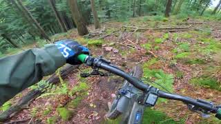
Recht steil geht es hinunter zum Unteren Bittersbrunnenweg, mit teilweise engen Kurven.
Der Trail ist relativ wenig befahren, abschnittsweise kann es daher sein, dass der Weg relativ schlecht zu erkennen ist und/oder dass Kleinzeug auf der Linie liegt.

This trail is unsanctioned.

Tags
Faint trailRock gardens

Recent Activity on Trail

Past Week
  • 0 rides
  •  
6 Months
  • 3 rides
  • 18 miles avg distance
All
  • 13 rides
  • Last: Sep 13, 2026
c1c2c3c4
January
February
March
April
May
June
July
August
September
October
November
December
update trails status or condition

Ringwallsturz Trail Reports

statusdatedescription
Apr 10, 2026 @ 1:01am (Europe/Berlin)
Apr 9, 2026
reporter Beim Forstweg am Ausstieg sind gerade Holzfällarbeiten, evtl. dann auch auf dem Trail.
May 5, 2025 @ 9:37am
May 5, 2025
Jan 26, 2025 @ 1:34am
Jan 26, 2025
Sep 28, 2022 @ 12:41pm
Sep 28, 2022
reporter
Den Trail von Kleinzeug befreit und die Linie besser sichtbar gemacht. Ich habe versucht, die Linie mit Ästen abzugrenzen, teilweise kann es...
Apr 19, 2022 @ 1:55pm
Apr 19, 2022
reporter Es liegt ziemlich viel Kleinzeug und Geröll auf dem Weg, ein Ausstieg ist auch nicht so 100% sichtbar.
more »
Status:
on Apr 10, 2026
Dry
Avg: 3.98 (1 votes)
Your vote: 0

view (38)
close
      Directions to ringwallsturz trailhead (49.426250, 8.707300)

      Photos

      No photos have been added for Ringwallsturz yet, add a photo.

      Videos

      2 more »
      Ziegelhausen MTB Enduro Tour | Ringwallsturz |...
      mtb
      16:05 | 97 | Jan 1, 2023 , Heidelberg
      youtuber Ringwallsturz - Weißer Stein/Heiligenberg
      mtb
      0:10 | 199 | Sep 28, 2022 , Heidelberg
      4.0 ★★★★★
      1 Ratings
      5 ★
      4 ★ 100%
      3 ★
      2 ★
      1 ★

      2 Reviews & Comments

      chrstph chrstph
      Soweit gut zu fahren, kurz vor Ende etwas loses Geröll dass man mal wieder zusammen puzzeln könnte. Am Einstieg aufpassen der wird von manchen als Waldtoilette genutzt …
      cdir cdir
      Hardly a trail any more, especially with the leaves overlaying it. Pretty overgrown, and hard to distinguish from the forest in general.

      We hope you've been enjoying Trailforks!

      Create a FREE account to view all trail reviews and much more.

      • #528218 - 518 views

      Frequently Asked Questions

      ▼ Where is Ringwallsturz located?
      Ringwallsturz is located in Weißer Stein, Heidelberg, Germany. It is part of the Weißer Stein trail network. The trailhead is located at coordinates 49.42625, 8.7073.
      ▼ How hard is Ringwallsturz?
      Ringwallsturz is rated as Blue difficulty. The average grade is 23.1%.
      ▼ What is the elevation gain for Ringwallsturz?
      The trail has 152 ft of elevation descent. The elevation ranges from 1,302 ft to 1,453 ft.
      ▼ Is Ringwallsturz a point to point trail?
      Yes, Ringwallsturz is a point to point trail. The direction is Downhill Only. The trail type is singletrack.
      ▼ How long is Ringwallsturz?
      Ringwallsturz is 656 ft long. The trail type is singletrack.
      ▼ Are dogs allowed on Ringwallsturz?
      Yes, dogs are allowed on Ringwallsturz. Please keep dogs on a leash where required and clean up after them.
      ▼ How do I access Ringwallsturz? Where is the closest parking trailhead?
      The closest parking and trailhead locations to Ringwallsturz are: View all parking locations in the area.
      ▼ How long does it take to ride Ringwallsturz?
      Based on recorded activities, it takes an average of 1 minute to ride Ringwallsturz. The trail is 656 ft long. Actual times will vary based on fitness level, conditions, and pace. View recent activity logs for more details.
      ▼ How busy is Ringwallsturz?
      Ringwallsturz is a moderately popular trail. There have been 35 recorded activities on this trail. The trail has received 38 check-ins. View recent activity on this trail.

      Hit the Trail

      Open in App

      Get this trail on your phone instantly.

      open trail in app

      Download Trail

      Save to wishlist, Garmin & download.
      save the trail

      Find Related Routes

      Find routes and users activities that include this trail.
      find routes for this trail

      You must enter a description before submitting.

