more stats
1,650 ft
Distance
-275 ft
Descent
00:01:27
Avg time
-276 ft
Altitude change
6,954 ft
Altitude min
7,230 ft
Altitude max
7,230 ft
Altitude start
6,955 ft
Altitude end
-16.8%
Grade
-43.8%
Grade max
-2.3%
Grade min
1,611 ft
Distance down
39 ft
Distance flat
00:01:27
Avg time

Rodeline Upper Section Details

  • Activities
    • Mountain Bike
    • E-Bike
  • Riding Area
  • Difficulty Rating
  • Voted Difficulty
    Blue (2 votes)
  • Local Popularity
    90 in Mountain Biking [+]
    • 90 in E-Biking
  • Global Ranking
    #29169 in Mountain Biking [+]
    • #13366 in E-Biking
  • Trail Type
    Machine Groomed
  • Bike Type
    DH, AM
  • Direction
    Downhill Only
    Popular Direction Shown
  • Physical Rating
    Easy
  • Trail Visibility
    Always easy to follow
  • eBike Allowed
    Yes up to Class 1
  • TTFs on Trail
    Berm, Jump, Roller Coaster
  • Year Opened
    2020

DIRECTION
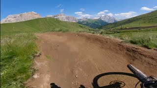
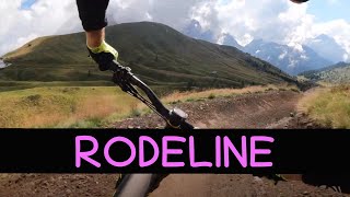
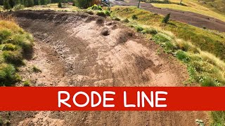
Flow trail split into 4 sections connecting the Salei Refuge to the Pian de Frataces with the Pradel - Rodella Gondola and Pian Frataces - Gherdecia Gondola.
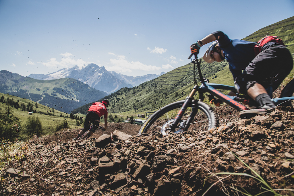
DESCRIPTION
Long trail from Col Rodella, whose initial and final sections are flow. The Upper Section is fast, featuring banked turns, some table jumps, and an easier section through dwarf pine trees.

photo

Trail Supporters

Bike Park

Recent Activity on Trail

Past Week
  • 15 rides
  • 21 miles average
6 Months
  • 35 rides
  • 27 miles avg distance
All
  • 428 rides
  • Last: Jun 29, 2026
c1c2c3c4
January
February
March
April
May
June
July
August
September
October
November
December
update trails status or condition

Rodeline Upper... Trail Reports

statusdatedescription
Jul 3, 2026 @ 2:51pm (Europe/Rome)
1 day
Closed
Jul 2, 2026 @ 8:18am (Europe/Rome)
2 days
reporter TRAIL CLOSED: NO EXIT AT THE END DUE TO MAINTENANCE WORKS! FOLLOW THE DIRECTIONS!
Jun 30, 2026 @ 8:07am (Europe/Rome)
Jun 29, 2026
reporter Closed for some works, follow the directions. ALTERNATIVE ROUTE
Jun 27, 2026 @ 7:21pm (Europe/Rome)
Jun 27, 2026
Jun 21, 2026 @ 3:30pm (Europe/Rome)
Jun 21, 2026
reporter
more »
Status:
on Jul 3, 2026
Avg: 4.13 (17 votes)
Your vote: 0

view (3,253)
close
3D
Trail Conditions
  • Unknown
  • Snow Groomed
  • Snow Packed
  • Snow Covered
  • Snow Cover Partial
  • Freeze/thaw Cycle
  • Icy
  • Prevalent Mud
  • Wet
  • Variable
  • Ideal
  • Dry
  • Very Dry
Trail Flow (Ridden Direction)
Trailforks scans users ridelogs to determine the most popular direction each trail is ridden. A good flowing trail network will have most trails flowing in a single direction according to their intension.
The colour categories are based on what percentage of riders are riding a trail in its intended direction.
  • > 96%
  • > 90%
  • > 80%
  • > 70%
  • > 50%
  • < 50%
  • bi-directional trail
  • no data
Trail Last Ridden
Trailforks scans ridelogs to determine the last time a trail was ridden.
  • < 2 days
  • < 1 week
  • < 2 weeks
  • < 1 month
  • < 6 months
  • > 6 months
Trail Ridden Direction
The intended direction a trail should be ridden.
  • Downhill Only
  • Downhill Primary
  • Both Directions
  • Uphill Primary
  • Uphill Only
  • One Direction
Contribute Details
Colors indicate trail is missing specified detail.
  • Description
  • Photos
  • Description & Photos
  • Videos
Trail Popularity ?
Trailforks scans ridelogs to determine which trails are ridden the most in the last 9 months. Trails are compared with nearby trails in the same city region with a possible 25 colour shades. Think of this as a heatmap, more rides = more kinetic energy = warmer colors.
  • most popular
  • popular
  • less popular
  • not popular
ATV/ORV/OHV Filter
Max Vehicle Width
inches
US Cell Coverage
Legend
cell carrier legend

Radar Time
Activity Recordings
Trailforks uses anonymized public activity data. ?
Activity Recordings
Trailforks uses anonymized public activity data. ?
Personal Heatmap
Activity Types
all / none
Options
2
Date range month
Winter Trails
Warning A routing network for winter maps does not exist. Selecting trails using the winter trails layer has been disabled.
Missing Trails
Most Popular
Least Popular
Trails are colored based on popularity. The more popular a trail is, the more red. Less popular trails trend towards green.
Jump Magnitude Heatmap
Heatmap of where riders jump on trails. Zoom in to see individual jumps, click circles to view jump details.
BC Backroad Status

Service Road Atlas is a free to use, community-driven service for viewing and creating reports on the numerous back-country service roads around B.C. and Alberta.

map legend
Slope Aspect
Direction the slope faces
Flat N NE E SE S SW W NW
Trails Deemphasized
Trails are shown in grey.
disable
Only show trails with no bike usage.
Enable
Suggested Layers
Based on selected activity type

    Save the current map location and zoom level as your default home location whenever this page is loaded.

    Save
        Directions to rodeline-upper-section trailhead (46.504140, 11.754060)

        Photos

        18 more »
        87 |
        Mar 14, 2024 @ 3:23am
        Mar 14, 2024
        43 |
        Sep 8, 2022 @ 11:43am
        Sep 8, 2022
        52 |
        Sep 8, 2022 @ 11:44am
        Sep 8, 2022
        49 |
        Sep 8, 2022 @ 11:46am
        Sep 8, 2022

        Videos

        6 more »
        youtuber Rodeline - Fassa Bike District | Sellaronda...
        6:05 | 264 | Aug 23, 2023 , Canazei
        youtuber MTB Dolomiti 13.08.2022 sentiero RODELINE
        3:11 | 190 | Aug 14, 2022 , Canazei
        youtuber MTB Dolomiti Sellaronda 20.09.2023 sentiero...
        3:06 | 110 | Sep 24, 2023 , Canazei
        youtuber MTB Dolomiti Sellaronda 24.09.2022 sentiero...
        3:07 | 220 | Oct 2, 2022 , Canazei

        Routes with this trail

        10 miles 3,373 ft 8 Loop
        Use this route to follow by bike Loop 1 of the UCI ENDURO World Cup Val di Fassa Trentino 2026

        1 Review & Comments


        We hope you've been enjoying Trailforks!

        Create a FREE account to view trail comments and much more.

        • By mgmatteo & contributors
        • #310422 - 1,797 views

        Frequently Asked Questions About Rodeline Upper Section

        Where is Rodeline Upper Section located?
        Rodeline Upper Section is located in Fassa Bike District, Canazei, Italy. It is part of the Fassa Bike District trail network. The trailhead is located at coordinates 46.50414, 11.75406.
        How hard is Rodeline Upper Section?
        Rodeline Upper Section is rated as Blue difficulty. The physical rating is Easy. The average grade is 16.8%.
        What is the elevation gain for Rodeline Upper Section?
        The trail has 84 m of elevation descent. The elevation ranges from 2,120 m to 2,204 m.
        Is Rodeline Upper Section a point to point trail?
        Yes, Rodeline Upper Section is a point to point trail. The direction is Downhill Only. The trail type is machine groomed.

        Hit the Trail

        Open in App

        Get this trail on your phone instantly.
        open trail in app

        Download Trail

        Save to wishlist, Garmin & download.
        save the trail

        Find Related Routes

        Find routes and users activities that include this trail.
        find routes for this trail

        You must enter a description before submitting.