

more stats
1,736 ft
Distance
7 ft
Climb
-185 ft
Descent
00:03:44
Avg time
-178 ft
Altitude change
276 ft
Altitude min
454 ft
Altitude max
454 ft
Altitude start
276 ft
Altitude end
-10.3%
Grade
-39.5%
Grade max
11.6%
Grade min
226 ft
Distance climb
1,224 ft
Distance down
282 ft
Distance flat
00:03:44
Avg time

Roller Coaster Details

  • Activities
    • Mountain Bike
    • E-Bike
    • Hike
    • Trail Running
  • Riding Area
    Birdsboro Preserve
    Birdsboro, Pennsylvania
  • Difficulty Rating
  • Local Popularity
    65 in Mountain Biking heatmap [+]
    • 60 in E-Biking
    • 60 in Trail Running
    • 85 in Hiking
  • Global Ranking
    #86581 in Mountain Biking [+]
    • #110202 in E-Biking
    • #138470 in Trail Running
    • #94462 in Hiking
  • State Ranking
    #1,190 in Mountain Biking · Pennsylvania [+]
    • #542 in E-Biking
    • #2,192 in Trail Running
    • #1,643 in Hiking
  • Trail Type
    Singletrack
  • Bike Type
    AM, XC
  • Direction
    Downhill Only
    Popular Direction Shown
  • Trail Visibility
    Sometimes hard to follow
  • Dogs Allowed
    Yes
  • eBike Allowed
  • TTFs on Trail
    Roller Coaster
  • Land Owner
    Birdsboro Municipal Authority

extremely steep sections of trails with no go around. only to be ridden downhill. this trail is very close to the edge of the cliff faces, so take extra caution and limit your speed when traversing. Be sure to check out the steep sections before committing, trees are often down and it's difficult to stop mid trail if there is an unexpected obstacle in the way.

Tags
ExposureFaint trailRollers

Traditionally Indigenous Territory

Recent Activity on Trail

Past Week
  • 3 rides
  • 10 miles average
6 Months
  • 48 rides
  • 10 miles avg distance
All
  • 402 rides
  • Last: Nov 19, 2026
c1c2c3c4
January
February
March
April
May
June
July
August
September
October
November
December
Status:
on Oct 31, 2026
Dry
Avg: 4.26 (9 votes)
Your vote: 0

view (1,924)
close
      Directions to roller-coaster-273139 trailhead (40.252030, -75.825260)

      Photos

      20 more »
      mtb
      62 |
      Jul 1, 2026 @ 8:54am
      Jul 1, 2026
      mtb
      308 |
      May 12, 2023 @ 3:58am
      May 12, 2023
      mtb
      242 |
      May 12, 2023 @ 3:43am
      May 12, 2023
      report
      mtb
      67 |
      Mar 19, 2026 @ 11:33am
      Mar 19, 2026

      Videos

      1 more »
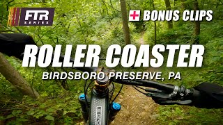
      youtuber Upper and Lower Roller Coaster – Birdsboro...
      mtb
      4:07 | 427 | Aug 29, 2023 , Birdsboro

      Routes with this trail

      more »
      17 miles • 2,953 ft • 21 •
      park at calico rd you can use dam trail to the dam if you do not want to hike a bike at misty mountain hop
      12 miles • 2,918 ft • 25 • Loop •
      Almost all the goods at Birdsboro
      27 miles • 3,996 ft • 32 • Loop •
      looparounds birdsboro preserve
      4.5 ★★★★★
      9 Ratings
      5 ★ 56%
      4 ★ 33%
      3 ★ 11%
      2 ★
      1 ★

      6 Reviews & Comments

      fishtailn5oh
      Yeesh. So I see now I rode this backwards. I had actually found this trail going the correct direction, but there was no sign up that I saw and there was what looked like a spray painted do not enter sign on a tree a little ways in. So I turned around and ended up hitting it from the dirt surfer intersection.

      I know now for next time, but whatever was painted on that tree threw me.
      PJSemp07
      Rode this earlier today and felt compelled to create an account just to say: this trail can be really dangerous. If you lose control and ditch (to the right of the trail going downhill), you absolutely could fall to your death.. please be careful, I personally don’t think I’ll ride this again, if you choose to check it out, maybe walk it or go really slow first..
      Fatboy2000 Fatboy2000
      HORSE RIDERS and HIKERS please be aware that this is not a safe trail for you. it is very Steep and even steeper off trail. The Adim BAMBA is playing games and jeopardizing everyone's saftey.

      We hope you've been enjoying Trailforks!

      Create a FREE account to view all trail reviews and much more.

      • By cherbein03TF Pro BTW & contributors
      • #273139 - 2,317 views

      Frequently Asked Questions

      ▼ Where is Roller Coaster located?
      Roller Coaster is located in Birdsboro Preserve, Birdsboro, Pennsylvania, United States. It is part of the Birdsboro Preserve trail network. The trailhead is located at coordinates 40.25203, -75.82526.
      ▼ How hard is Roller Coaster?
      Roller Coaster is rated as Black Diamond difficulty. The average grade is 10.3%.
      ▼ What is the elevation gain for Roller Coaster?
      Roller Coaster has 7 ft of elevation gain. The trail has 185 ft of elevation descent. The elevation ranges from 276 ft to 454 ft.
      ▼ Is Roller Coaster a point to point trail?
      Yes, Roller Coaster is a point to point trail. The direction is Downhill Only. The trail type is singletrack.
      ▼ How long is Roller Coaster?
      Roller Coaster is 1,736 ft long. The trail type is singletrack.
      ▼ Are dogs allowed on Roller Coaster?
      Yes, dogs are allowed on Roller Coaster. Please keep dogs on a leash where required and clean up after them.
      ▼ When is the best time of year to ride Roller Coaster?
      Based on activity log data, the most popular months to ride Roller Coaster are:
      • August (28 activities)
      • September (27 activities)
      • November (22 activities)
      Check the reports page for current trail conditions.
      ▼ How do I access Roller Coaster? Where is the closest parking trailhead?
      The closest parking and trailhead locations to Roller Coaster are: View all parking locations in the area.
      ▼ How long does it take to ride Roller Coaster?
      Based on recorded activities, it takes an average of 4 minutes to ride Roller Coaster. The trail is 1,736 ft long. Actual times will vary based on fitness level, conditions, and pace. View recent activity logs for more details.
      ▼ How busy is Roller Coaster?
      Roller Coaster is a moderately popular trail. There have been 1,861 recorded activities on this trail. The trail has received 1,924 check-ins. View recent activity on this trail.

      Hit the Trail

      Open in App

      Get this trail on your phone instantly.

      open trail in app

      Download Trail

      Save to wishlist, Garmin & download.
      save the trail

      Find Related Routes

      Find routes and users activities that include this trail.
      find routes for this trail

      You must enter a description before submitting.

