more stats
4,360 ft
Distance
29 ft
Climb
-118 ft
Descent
00:06:21
Avg time
-89 ft
Altitude change
838 ft
Altitude min
951 ft
Altitude max
951 ft
Altitude start
863 ft
Altitude end
-2%
Grade
-24.2%
Grade max
20.6%
Grade min
656 ft
Distance climb
2,707 ft
Distance down
994 ft
Distance flat
00:06:21
Avg time

Rollercoaster Trail Details

  • Activities
    • Mountain Bike
    • Hike
    • Trail Running
  • Riding Area
    Frick Park
    Pittsburgh, Pennsylvania
  • Difficulty Rating
  • Voted Difficulty
    Green (1 vote)
  • Local Popularity
    95 in Mountain Biking heatmap [+]
    • 85 in Trail Running
    • 80 in Hiking
  • Global Ranking
    #38855 in Mountain Biking [+]
    • #111706 in Trail Running
    • #107295 in Hiking
  • State Ranking
    #489 in Mountain Biking · Pennsylvania [+]
    • #1,716 in Trail Running
    • #1,890 in Hiking
  • Hiking SAC Scale
    T1 Hiking
  • Trail Type
    Singletrack
  • Bike Type
    AM, XC, Fat
  • Direction
    Both Directions
    Popular Direction Shown
  • Climb Difficulty
    Blue
  • Physical Rating
    Moderate
  • Trail Visibility
    Always easy to follow
  • Dogs Allowed
    Yes
  • TTFs on Trail
    Berm, Bridge, Jump, Log Ride, Roller Coaster
  • Land Owner
    City of Pittsburgh

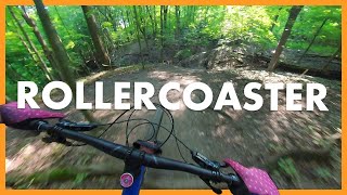
This is the downhill direction of Rollercoaster trail, which is named for its several swooping and fast mini descents followed by rapid rises. Follow it along, crossing the gravel Firelane Extension trail once and then ending on the same gravel trail. The loop on the west side of Fire Lane Extension trail was recently rebuilt to be more sustainable with a flowy, fast, and fun new section that includes several log piles and small jumps.

This trail is one of the longer contour line singletrack trails in the park. That said, you can also connect it to IMBA trail and Concrete Block trail to form different loops.

Access Info

The primary entrance starts off of the upper section of IMBA trail.

Tags

Local Trail Association

Traditionally Indigenous Territory

Recent Activity on Trail

Past Week
  • 6 rides
  • 10 miles average
6 Months
  • 142 rides
  • 11 miles avg distance
All
  • 913 rides
  • Last: Nov 22, 2026
c1c2c3c4
January
February
March
April
May
June
July
August
September
October
November
December
update trails status or condition

Rollercoaster Trail Trail Reports

statusdatedescription
Aug 6, 2026 @ 10:03am (America/Detroit)
Aug 6, 2026
No standing water but roots are super slick thanks to humidity
Jun 3, 2026 @ 11:17am (America/New_York)
Jun 3, 2026
reporter
Mar 21, 2026 @ 12:12pm (America/New_York)
Mar 21, 2026
reporter Trails are drying up for Spring, but some muddy sections remain.
Jan 8, 2026 @ 11:11am (America/New_York)
Jan 8, 2026
reporter Annual Freeze / Thaw cycle in full effect. Trails are too soft and muddy for use unless they are frozen.
Nov 1, 2025 @ 1:37pm (America/New_York)
Nov 1, 2025
more »
Status:
on Aug 6, 2026
Wet
Avg: 4.26 (14 votes)
Your vote: 0

view (5,411)
close
      Directions to rollercoaster-trail-55807 trailhead (40.433870, -79.903240)

      Photos

      3 more »
      mtb
      129 |
      May 1, 2024 @ 6:40pm
      May 1, 2024
      mtb
      491 |
      Nov 18, 2010 @ 8:19am
      Nov 18, 2010
      report
      mtb
      135 |
      Apr 6, 2023 @ 5:10am
      Apr 6, 2023

      Videos

      8 more »
      Roller Coaster
      mtb
      269 | Apr 12, 2023 , Pittsburgh
      Roller Coaster 2022 | Frick Park | POV MTB
      mtb
      4:55 | 262 | Aug 25, 2022 , Pittsburgh
      Roller Coaster
      mtb
      5:29 | 226 | Oct 16, 2021 , Pittsburgh
      Roller Coaster 2020 // Frick Park // Uncut
      mtb
      6:14 | 318 | Oct 9, 2020 , Pittsburgh

      Routes with this trail

      more »
      ★ 4.0 • 4 miles • 303 ft • 20 •
      dinky bridge 9mile rollercoaster brandema
      ★ 2.0 • 4 miles • 375 ft • 8 •
      This is my personal favorite route through Frick Park which minimizes the boring double track climbs back...
      4.5 ★★★★★
      14 Ratings
      5 ★ 50%
      4 ★ 43%
      3 ★ 7%
      2 ★
      1 ★

      1 Review & Comments

      MichaelZX5LEv
      Fun trail! Just an FYI, when you get to the flow section, be careful going around the large berm. The berm is good but coming out of it, there is a tree and a large root on your right. I went over the bars today while carrying a lot of speed out of it after catching that root. I hope the trail builders carry the berm a little farther around to help avoid that.

      We hope you've been enjoying Trailforks!

      Create a FREE account to view all trail reviews and much more.

      • By justmtnb44TF Pro Trail PGH & contributors
      • #55807 - 5,895 views

      Frequently Asked Questions

      ▼ Where is Rollercoaster Trail located?
      Rollercoaster Trail is located in Frick Park, Pittsburgh, Pennsylvania, United States. It is part of the Frick Park trail network. The trailhead is located at coordinates 40.43387, -79.90324.
      ▼ How hard is Rollercoaster Trail?
      Rollercoaster Trail is rated as Blue difficulty. The physical rating is Moderate. The average grade is 2%. The climb difficulty is rated Blue.
      ▼ What is the elevation gain for Rollercoaster Trail?
      Rollercoaster Trail has 29 ft of elevation gain. The trail has 118 ft of elevation descent. The elevation ranges from 838 ft to 951 ft.
      ▼ Is Rollercoaster Trail a point to point trail?
      Rollercoaster Trail is not a point to point trail. The direction is Both Directions. The trail type is singletrack.
      ▼ How long is Rollercoaster Trail?
      Rollercoaster Trail is 4,360 ft long. The trail type is singletrack.
      ▼ Are dogs allowed on Rollercoaster Trail?
      Yes, dogs are allowed on Rollercoaster Trail. Please keep dogs on a leash where required and clean up after them.
      ▼ When is the best time of year to ride Rollercoaster Trail?
      Based on activity log data, the most popular months to ride Rollercoaster Trail are:
      • July (66 activities)
      • October (59 activities)
      • August (55 activities)
      Check the reports page for current trail conditions.
      ▼ How do I access Rollercoaster Trail? Where is the closest parking trailhead?
      The closest parking and trailhead locations to Rollercoaster Trail are: View all parking locations in the area.
      ▼ How long does it take to ride Rollercoaster Trail?
      Based on recorded activities, it takes an average of 6 minutes to ride Rollercoaster Trail. The trail is 4,360 ft long. Actual times will vary based on fitness level, conditions, and pace. View recent activity logs for more details.
      ▼ How busy is Rollercoaster Trail?
      Rollercoaster Trail is a very popular trail. There have been 5,085 recorded activities on this trail. The trail has received 5,411 check-ins. View recent activity on this trail.

      Hit the Trail

      Open in App

      Get this trail on your phone instantly.

      open trail in app

      Download Trail

      Save to wishlist, Garmin & download.
      save the trail

      Find Related Routes

      Find routes and users activities that include this trail.
      find routes for this trail

      You must enter a description before submitting.