

more stats
2.0 miles
Distance
4 ft
Climb
-1,309 ft
Descent
00:23:47
Avg time
-1,304 ft
Altitude change
1,070 ft
Altitude min
2,382 ft
Altitude max
2,381 ft
Altitude start
1,076 ft
Altitude end
-12.2%
Grade
-57.1%
Grade max
3.7%
Grade min
328 ft
Distance climb
2 miles
Distance down
830 ft
Distance flat
00:23:47
Avg time

Ross Trail Details

  • Activities
    • Mountain Bike
    • E-Bike
    • Hike
    • Trail Running
  • Riding Area
    Coopers Gap (Rothrock State Forest)
    State College, Pennsylvania
  • Difficulty Rating
  • Local Popularity
    60 in Mountain Biking [+]
    • 60 in E-Biking
    • 85 in Trail Running
    • 5 in Hiking
  • Global Ranking
    #108127 in Mountain Biking [+]
    • #125589 in E-Biking
    • #100534 in Trail Running
    • #313974 in Hiking
  • State Ranking
    #1,509 in Mountain Biking · Pennsylvania [+]
    • #749 in E-Biking
    • #1,521 in Trail Running
    • #5,369 in Hiking
  • Trail Type
    Singletrack
  • Bike Type
    DH, AM, XC, Fat
  • Direction
    Downhill Primary
    Popular Direction Shown
  • Climb Difficulty
    Double Black Diamond
  • Physical Rating
    Hard
  • Season
    Winter, Summer Fall
  • Dogs Allowed
    Yes
  • eBike Allowed
  • Land Owner

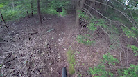
This trail has an average 12% grade that is all single track and rocky. Definitely only a down trail, one way to get back down once having been up to the old Greenwood Furnace Fire tower. Once you have dropped off the very steep section onto the flatter area look out for a blazed non descript pile of rocks that will turn you off to your right vs. following the old logging road out

Access Info

Off Greenwood Tower Rd

Tags

Local Trail Association

Traditionally Indigenous Territory

Recent Activity on Trail

Past Week
  • 0 rides
  •  
6 Months
  • 3 rides
  • 14 miles avg distance
All
  • 28 rides
  • Last: Sep 7, 2026
c1c2c3c4
January
February
March
April
May
June
July
August
September
October
November
December
update trails status or condition

Ross Trail Trail Reports

statusdatedescription
Jul 4, 2025 @ 11:31am
Jul 4, 2025
Very over grown in the beginning of trail. A few trees down.
Oct 19, 2024 @ 11:00am
Oct 19, 2024
Leafy with some pesky branches down. Beware of the downed tree after the chute
Jul 16, 2024 @ 9:13am
Jul 16, 2024
All recently constructed rogue features have been removed. Ride with caution as someone has been sabotaging the trail
Jul 16, 2024 @ 9:13am
Jul 16, 2024
Recently constructed rogue features have all been removed. Ride with caution as someone has been sabotaging the trail
May 20, 2024 @ 2:53pm
May 20, 2024
Water running down the trail
more »
Status:
on Jul 4, 2025
Ideal
Avg: 4.24 (6 votes)
Your vote: 0

view (250)
close
      Directions to ross-trail trailhead (40.681550, -77.738640)

      Photos

      6 more »
      mtb
      357 |
      Jan 4, 2019 @ 5:09pm
      Jan 4, 2019
      report
      mtb
      194 |
      Jun 26, 2023 @ 6:55am
      Jun 26, 2023
      report
      mtb
      182 |
      Oct 19, 2022 @ 4:43pm
      Oct 19, 2022
      report
      mtb
      234 |
      Mar 3, 2018 @ 6:58pm
      Mar 3, 2018

      Videos

      1 more »
      Ross Trail DH -Rothrock state park
      mtb
      8:15 | 786 | Jun 13, 2019 , State College

      Routes with this trail

      26 miles • 3,296 ft • 19 • Loop •
      Peep, Pig Pile, Ross Trail This is a challenging 26 mile loop with some fun downhills thrown in. It could...

      Trail Products

      4.5 ★★★★★
      6 Ratings
      5 ★ 67%
      4 ★ 17%
      3 ★ 17%
      2 ★
      1 ★

      4 Reviews & Comments

      AdamMmtb03 AdamMmtb03
      Some insecure pos dragged some huge logs onto the trail right after the first berm. We tried to move them but couldn't. Threw some sticks and stuff just uphill of the logs, hopefully you see those first.
      MooDock
      The trail has been significantly altered and is garbage. No longer worth coming to ride. Used to be an outstanding trail for offseason DH training. If you’re in the area hit us up there are way better places to ride.
      trixy trixy
      A little bit of work and this trail would be great again. Five star views from the fire tower.

      We hope you've been enjoying Trailforks!

      Create a FREE account to view all trail reviews and much more.

      • By SaclydesdaleTF Pro NMBA & contributors
      • #24427 - 4,466 views

      Frequently Asked Questions

      ▼ Where is Ross Trail located?
      Ross Trail is located in Coopers Gap (Rothrock State Forest), State College, Pennsylvania, United States. It is part of the Coopers Gap (Rothrock State Forest) trail network. The trailhead is located at coordinates 40.68155, -77.73864.
      ▼ How hard is Ross Trail?
      Ross Trail is rated as Double Black Diamond difficulty. The physical rating is Hard. The average grade is 12.2%. The climb difficulty is rated Double Black Diamond.
      ▼ What is the elevation gain for Ross Trail?
      Ross Trail has 4 ft of elevation gain. The trail has 1,309 ft of elevation descent. The elevation ranges from 1,070 ft to 2,382 ft.
      ▼ Is Ross Trail a point to point trail?
      Ross Trail is not a point to point trail. The direction is Downhill Primary. The trail type is singletrack.
      ▼ How long is Ross Trail?
      Ross Trail is 2.0 miles long. The trail type is singletrack.
      ▼ Are dogs allowed on Ross Trail?
      Yes, dogs are allowed on Ross Trail. Please keep dogs on a leash where required and clean up after them.
      ▼ When is the best time of year to ride Ross Trail?
      Ross Trail is best visited during: Winter, Summer Fall.
      ▼ How do I access Ross Trail? Where is the closest parking trailhead?
      The closest parking and trailhead locations to Ross Trail are: View all parking locations in the area.
      ▼ How long does it take to ride Ross Trail?
      Based on recorded activities, it takes an average of 24 minutes to ride Ross Trail. The trail is 2.0 miles long. Actual times will vary based on fitness level, conditions, and pace. View recent activity logs for more details.
      ▼ How busy is Ross Trail?
      Ross Trail is a moderately popular trail. There have been 239 recorded activities on this trail. The trail has received 250 check-ins. View recent activity on this trail.

      Hit the Trail

      Open in App

      Get this trail on your phone instantly.

      open trail in app

      Download Trail

      Save to wishlist, Garmin & download.
      save the trail

      Find Related Routes

      Find routes and users activities that include this trail.
      find routes for this trail

      You must enter a description before submitting.

