more stats
10.2 miles
Distance
3,515 ft
Climb
-1,886 ft
Descent
2 miles
High Point
1,629 ft
Altitude change
8,780 ft
Altitude min
8,780 ft
Altitude start
10,410 ft
Altitude end
3%
Grade
-54.8%
Grade max
43.4%
Grade min
6 miles
Distance climb
3 miles
Distance down
3,681 ft
Distance flat

Trail Details

  • Activities
    • Hike
    • Horse
    • Trail Running
  • Riding Area
  • Ref Number
    #43
  • Difficulty Rating
  • Local Popularity
    95 in Hiking [+]
    • 5 in Trail Running
    • 5 in Horseback
  • Global Ranking
    #27517 in Hiking [+]
    • #14415 in Trail Running
  • Hiking SAC Scale
    T1 Hiking
  • Trail Type
    Singletrack
  • Direction
    Both Directions
  • eBike Allowed
  • OSM Way

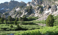
This section of the Ruby Crest Trail is up and down and has many lakes that can be viewed from the trail such as Dollar, Lamoille, Liberty, Favre, Castle and North Furlong in that order.
The trail starts at Lamoille Canyon at 8780 feet in elevation and goes up to 10,445 feet at Liberty Pass. Then it drops down to Favre Lake at 9,510 feet. The trail goes back up to the saddle by North Furlong at 10,135 feet and then drops back down again by North Furlong Lake and then climbs again to Wines Peak at 10,893 feet.

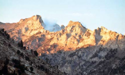
View by Liberty Pass of Snow Lake Peak.This section of the trail has gorgeous views at every turn. Some of the best views are of Lamoille Canyon and Dollar Lakes. There is also an awesome overlook above Liberty Lake that is one of the best views in the Ruby Mountains. The views from on top of Wines Peak are great also as the Rubies flatten out a little on top plus you have numerous peaks and ridgelines stretched out in front of you.

Trail Supporters
Traditionally Indigenous Territory

Recent Activity on Trail

Past Week
  • 0 rides
  •  
6 Months
  • 5 rides
  • 7 miles avg distance
All
  • 9 rides
  •  
c1c2c3c4
January
February
March
April
May
June
July
August
September
October
November
December
update trails status or condition

Ruby Crest NRT... Trail Reports

Status:
on Aug 25, 2026
Dry
no votes yet
Your vote: 0

view (47)
close
      Directions to ruby-crest-nrt-lamoille trailhead (40.603950, -115.375910)

      Photos

      No photos have been added for Ruby Crest NRT (Lamoille) yet, add a photo.

      Videos

      no videos have been added for Ruby Crest NRT (Lamoille) yet, add a video.

      Articles

      Elko, NV: Ruby Crest National Recreation Trail
      Sep 19, 2013 from backpacker.com
      Dazzling high-country lakes, glacier-carved cirques and miles of stunning alpine scenery render this secluded 38-mile National Recreation Trail a...
      Grand Traverses: Ruby Crest
      Jun 21, 2013 from backpacker.com
      Soak up the alpine solitude in the "Swiss Alps of Nevada".

      Reviews / Comments

      No reviews yet, be the first to write a review or ask a question.
      Use trail reports to comment on trail conditions.


      We hope you've been enjoying Trailforks!

      Create a FREE account to view all trail reviews and much more.

      This trails GPS track was originally sourced from OpenStreetMap and will always be available for download in OSM Format.

      Frequently Asked Questions

      Where is Ruby Crest NRT (Lamoille) located?
      Ruby Crest NRT (Lamoille) is located in Ruby Mountains Wilderness (Central), Elko, Nevada, United States. It is part of the Ruby Mountains Wilderness (Central) trail network. The trailhead is located at coordinates 40.60395, -115.37591.
      How hard is Ruby Crest NRT (Lamoille)?
      Ruby Crest NRT (Lamoille) is rated as Blue difficulty. The average grade is 3%.
      What is the elevation gain for Ruby Crest NRT (Lamoille)?
      Ruby Crest NRT (Lamoille) has 3,515 ft of elevation gain. The trail has 1,886 ft of elevation descent. The elevation ranges from 8,780 ft to 10,889 ft.
      Is Ruby Crest NRT (Lamoille) a point to point trail?
      Ruby Crest NRT (Lamoille) is not a point to point trail. The direction is Both Directions. The trail type is singletrack.
      How long is Ruby Crest NRT (Lamoille)?
      Ruby Crest NRT (Lamoille) is 10.2 miles long. The trail type is singletrack.
      Are dogs allowed on Ruby Crest NRT (Lamoille)?
      There is no information about dogs being allowed on Ruby Crest NRT (Lamoille). Check with local trail managers or the trail page for the latest access rules.
      How do I access Ruby Crest NRT (Lamoille)? Where is the closest parking trailhead?
      The closest parking and trailhead locations to Ruby Crest NRT (Lamoille) are: View all parking locations in the area.
      How busy is Ruby Crest NRT (Lamoille)?
      Ruby Crest NRT (Lamoille) is a very popular trail. There have been 47 recorded activities on this trail. The trail has received 47 check-ins. View recent activity on this trail.

      Hit the Trail

      Open in App

      Get this trail on your phone instantly.

      open trail in app

      Download Trail

      Save to wishlist, Garmin & download.
      save the trail

      Find Related Routes

      Find routes and users activities that include this trail.
      find routes for this trail

      You must enter a description before submitting.