more stats
3,891 ft
Distance
87 ft
Climb
-59 ft
Descent
00:09:10
Avg time
28 ft
Altitude change
1,359 ft
Altitude min
1,411 ft
Altitude max
1,374 ft
Altitude start
1,401 ft
Altitude end
0.7%
Grade
-11.9%
Grade max
13.8%
Grade min
1,909 ft
Distance climb
1,280 ft
Distance down
702 ft
Distance flat
00:09:10
Avg time

Frog Pond Loop Details

  • Activities
    • Mountain Bike
    • E-Bike
    • Gravel Bike
    • Winter Fat Bike
    • Hike
    • Trail Running
  • Riding Area
    Valley Falls State Park
    Fairmont, West Virginia
  • AKA
    Scott's Loop
  • Difficulty Rating
  • Local Popularity
    55 in Mountain Biking [+]
    • 35 in E-Biking
    • 60 in Trail Running
    • 5 in Hiking
    • 5 in Winter Fat Biking
    • 5 in Gravel Biking
  • Global Ranking
    #103898 in Mountain Biking [+]
    • #237385 in Trail Running
    • #88365 in Hiking
  • Trail Exposure
    Normal
  • Blaze Color
  • Trail Type
    Singletrack
  • Bike Type
    AM, XC, Fat, Gravel
  • Climb Difficulty
    Green
  • Physical Rating
    Easy
  • Trail Visibility
    Sometimes hard to follow
  • Family Friendly
    Yes
  • Dogs Allowed
    Yes
  • eBike Allowed
    Yes up to Class 1
  • TTFs on Trail
    Rock Garden
  • Lighting
    No
  • Land Owner
    West Virginia State Parks

Formerly Scott's Loop, this is a mellow trail around the big flat in the backside of Valley Valls. This is a much more enjoyable climb than staying on Rhododendron. There's a few small short rock gardens that can be tricky if wet, and few awkward switchbacks. After you cross the ridge, theres on more tech rock garden then is up and down back to Dogwood. Trail comes off of rhododendron right above
rocky trail and connects back into dogwood.

Trail Supporters
Local Trail Association

Recent Activity on Trail

Past Week
  • 0 rides
  •  
6 Months
  • 1 rides
  • 22 miles avg distance
All
  • 26 rides
  • Last: Sep 15, 2026
c1c2c3c4
January
February
March
April
May
June
July
August
September
October
November
December
update trails status or condition

Frog Pond Loop Trail Reports

statusdatedescription
Jun 25, 2026 @ 10:14am (America/Detroit)
Jun 25, 2026
1 large tree down
May 1, 2026 @ 5:18pm (America/New_York)
May 1, 2026
May 26, 2025 @ 12:31pm
May 26, 2025
All downed trees cleared, needs quick leaf blow and stick clear. Rode great!
May 15, 2025 @ 5:19pm
May 15, 2025
Six trees down, with one rideable, needs quick leaf blow and stick clear. Wetter than normal due to rain but still rode great.
Nov 7, 2021 @ 6:09am
Nov 7, 2021
For me impossible to follow riding clockwise - leaf covered and poorly marked
more »
Status:
on Jun 25, 2026
Ideal
Avg: 3.86 (2 votes)
Your vote: 0

view (164)
close
      Directions to frog-pond-loop-71915 trailhead (39.397360, -80.077480)

      Photos

      No photos have been added for Frog Pond Loop yet, add a photo.

      Videos

      1 more »
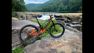
      August 2021 Valley Falls State Park Mountain...
      mtb
      13:17 | 366 | Aug 19, 2021 , Fairmont

      Routes with this trail

      16 miles 3,455 ft 28 Race
      the 2017 Valley falls enduro routes. After stage 2 there were shuttles to the ranger station each time....
      14 miles 2,763 ft 11 Loop Race
      2020 Valley Falls Enduro Couse 4 descents - 1. The Whole Shebang, 2. Boundary/Red Fox/Deer Trail, 3. Wild...
      3.5
      2 Ratings
      5
      4 50%
      3 50%
      2
      1

      1 Review & Comments


      We hope you've been enjoying Trailforks!

      Create a FREE account to view all trail reviews and much more.

      Frequently Asked Questions About Frog Pond Loop

      Where is Frog Pond Loop located?
      Frog Pond Loop is located in Valley Falls State Park, Fairmont, West Virginia, United States. It is part of the Valley Falls State Park trail network. The trailhead is located at coordinates 39.39736, -80.07748.
      How hard is Frog Pond Loop?
      Frog Pond Loop is rated as Blue difficulty. The physical rating is Easy. The average grade is 0.7%. The climb difficulty is rated Green.
      What is the elevation gain for Frog Pond Loop?
      Frog Pond Loop has 87 ft of elevation gain. The trail has 59 ft of elevation descent. The elevation ranges from 1,359 ft to 1,411 ft.
      How long is Frog Pond Loop?
      Frog Pond Loop is 3,891 ft long. The trail type is singletrack.
      Are dogs allowed on Frog Pond Loop?
      Yes, dogs are allowed on Frog Pond Loop. Please keep dogs on a leash where required and clean up after them.
      When is the best time of year to ride Frog Pond Loop?
      Based on activity log data, the most popular months to ride Frog Pond Loop are:
      • June (9 activities)
      • August (2 activities)
      • September (2 activities)
      Check the reports page for current trail conditions.
      How do I access Frog Pond Loop? Where is the closest parking trailhead?
      The closest parking and trailhead locations to Frog Pond Loop are: View all parking locations in the area.
      How long does it take to ride Frog Pond Loop?
      Based on recorded activities, it takes an average of 10 minutes to ride Frog Pond Loop. The trail is 3,891 ft long. Actual times will vary based on fitness level, conditions, and pace. View recent activity logs for more details.
      How busy is Frog Pond Loop?
      Frog Pond Loop is a moderately popular trail. There have been 155 recorded activities on this trail. The trail has received 163 check-ins. View recent activity on this trail.

      Hit the Trail

      Open in App

      Get this trail on your phone instantly.

      open trail in app

      Download Trail

      Save to wishlist, Garmin & download.
      save the trail

      Find Related Routes

      Find routes and users activities that include this trail.
      find routes for this trail

      You must enter a description before submitting.