more stats
2,398 ft
Distance
-231 ft
Descent
00:08:51
Avg time
-233 ft
Altitude change
1,522 ft
Altitude min
1,755 ft
Altitude max
1,755 ft
Altitude start
1,522 ft
Altitude end
-9.7%
Grade
-25.7%
Grade max
1.8%
Grade min
43 ft
Distance climb
1,936 ft
Distance down
420 ft
Distance flat
00:08:51
Avg time

Section 2 (upper) Details

  • Activities
    • Mountain Bike
    • Hike
    • Trail Running
  • Riding Area
    Simpcw
    Chu Chua, British Columbia
  • Difficulty Rating
  • Local Popularity
    65 in Mountain Biking [+]
    • 5 in Trail Running
    • 5 in Hiking
  • Global Ranking
    #201657 in Mountain Biking [+]
    • #326691 in Trail Running
    • #292711 in Hiking
  • Trail Type
    Singletrack
  • Bike Type
    AM
  • Direction
    Downhill Primary
    Popular In Reverse
  • Climb Difficulty
    Black Diamond
  • Physical Rating
    Moderate
  • Dogs Allowed
    Yes
  • TTFs on Trail
    Drop

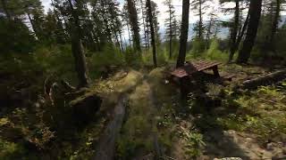
old walking trail re purposed as bike trail. trail starting at the end of Axehead and finishing at fish trap. fast with rocky sections as well as an optional rock drop in the middle.

Trail Supporters
  • Sponsor
Local Trail Association
Traditionally Indigenous Territory

Recent Activity on Trail

Past Week
  • 0 rides
  •  
6 Months
  • 0 rides
  •  
All
  • 23 rides
  • Last: Sep 23, 2025
c1c2c3c4
January
February
March
April
May
June
July
August
September
October
November
December
update trails status or condition

Section 2 (upper) Trail Reports

statusdatedescription
Sep 6, 2025 @ 10:02am
Sep 6, 2025
Also applies to Fish Trap trail: Numerous trees down throughout the trail network. I cleared what I could but left the big stuff for the people...
Apr 28, 2025 @ 7:42pm
Apr 28, 2025
brushed and blown off
Mar 29, 2024 @ 9:54pm
Mar 29, 2024
reporter brushed and raked
May 14, 2023 @ 6:51am
May 14, 2023
Perfect conditions
Apr 4, 2021 @ 11:56am
Apr 4, 2021
4 or 5 trees down across the trail. Could be cut with a hand saw.
more »
Status:
on Sep 6, 2025
Dry
no votes yet
Your vote: 0

view (80)
close
3D
Trail Conditions
  • Unknown
  • Snow Groomed
  • Snow Packed
  • Snow Covered
  • Snow Cover Partial
  • Freeze/thaw Cycle
  • Icy
  • Prevalent Mud
  • Wet
  • Variable
  • Ideal
  • Dry
  • Very Dry
Trail Flow (Ridden Direction)
Trailforks scans users ridelogs to determine the most popular direction each trail is ridden. A good flowing trail network will have most trails flowing in a single direction according to their intension.
The colour categories are based on what percentage of riders are riding a trail in its intended direction.
  • > 96%
  • > 90%
  • > 80%
  • > 70%
  • > 50%
  • < 50%
  • bi-directional trail
  • no data
Trail Last Ridden
Trailforks scans ridelogs to determine the last time a trail was ridden.
  • < 2 days
  • < 1 week
  • < 2 weeks
  • < 1 month
  • < 6 months
  • > 6 months
Trail Ridden Direction
The intended direction a trail should be ridden.
  • Downhill Only
  • Downhill Primary
  • Both Directions
  • Uphill Primary
  • Uphill Only
  • One Direction
Contribute Details
Colors indicate trail is missing specified detail.
  • Description
  • Photos
  • Description & Photos
  • Videos
Trail Popularity ?
Trailforks scans ridelogs to determine which trails are ridden the most in the last 9 months. Trails are compared with nearby trails in the same city region with a possible 25 colour shades. Think of this as a heatmap, more rides = more kinetic energy = warmer colors.
  • most popular
  • popular
  • less popular
  • not popular
ATV/ORV/OHV Filter
Max Vehicle Width
inches
US Cell Coverage
Legend
cell carrier legend

Radar Time
Activity Recordings
Trailforks uses anonymized public activity data. ?
Activity Recordings
Trailforks uses anonymized public activity data. ?
Personal Heatmap
Activity Types
all / none
Options
2
Date range month
Winter Trails
Warning A routing network for winter maps does not exist. Selecting trails using the winter trails layer has been disabled.
Missing Trails
Most Popular
Least Popular
Trails are colored based on popularity. The more popular a trail is, the more red. Less popular trails trend towards green.
Jump Magnitude Heatmap
Heatmap of where riders jump on trails. Zoom in to see individual jumps, click circles to view jump details.
BC Backroad Status

Service Road Atlas is a free to use, community-driven service for viewing and creating reports on the numerous back-country service roads around B.C. and Alberta.

map legend
Slope Aspect
Direction the slope faces
Flat N NE E SE S SW W NW
Trails Deemphasized
Trails are shown in grey.
disable
Only show trails with no bike usage.
Enable
Suggested Layers
Based on selected activity type

    Save the current map location and zoom level as your default home location whenever this page is loaded.

    Save
        Directions to section-2-upper trailhead (51.308900, -120.142680)

        Photos

        2 more »
        100 |
        Mar 7, 2021 @ 1:35pm
        Mar 7, 2021
        100 |
        Mar 7, 2021 @ 1:35pm
        Mar 7, 2021

        Videos

        1 more »
        section 2
        3:22 | 111 | Sep 14, 2023 , Chu Chua

        Routes with this trail

        2 miles 739 ft 7 Point to Point
        this is the main climbing route to get to the main trail hub from here you can go down 1 of 3 trails or...

        1 Review & Comments


        We hope you've been enjoying Trailforks!

        Create a FREE account to view trail comments and much more.

        • By valour59TF Pro Simpcw SAPBS & contributors
        • #103173 - 766 views

        Frequently Asked Questions About Section 2 (upper)

        Where is Section 2 (upper) located?
        Section 2 (upper) is located in Simpcw, Chu Chua, British Columbia, Canada. It is part of the Simpcw trail network. The trailhead is located at coordinates 51.3089, -120.14268.
        How hard is Section 2 (upper)?
        Section 2 (upper) is rated as Green difficulty. The physical rating is Moderate. The average grade is 9.7%. The climb difficulty is rated Black Diamond.
        What is the elevation gain for Section 2 (upper)?
        The trail has 231 ft of elevation descent. The elevation ranges from 1,522 ft to 1,755 ft.
        Is Section 2 (upper) a point to point trail?
        Section 2 (upper) is not a point to point trail. The direction is Downhill Primary. The trail type is singletrack.

        Hit the Trail

        Open in App

        Get this trail on your phone instantly.
        open trail in app

        Download Trail

        Save to wishlist, Garmin & download.
        save the trail

        Find Related Routes

        Find routes and users activities that include this trail.
        find routes for this trail

        You must enter a description before submitting.