
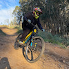

more stats
3,481 ft
Distance
-610 ft
Descent
00:05:02
Avg time
-610 ft
Altitude change
748 ft
Altitude min
1,359 ft
Altitude max
1,358 ft
Altitude start
748 ft
Altitude end
-17.5%
Grade
-48.8%
Grade max
-0.8%
Grade min
30 ft
Distance climb
3,415 ft
Distance down
36 ft
Distance flat
00:05:02
Avg time

Secuoyas Details

  • Activities
    • Mountain Bike
    • E-Bike
    • Hike
    • Trail Running
  • Riding Area
    Monte Tejas
    Torrelavega
  • Difficulty Rating
  • Voted Difficulty
    Blue (1 vote)
  • Local Popularity
    85 in Mountain Biking heatmap [+]
    • 80 in E-Biking
    • 5 in Trail Running
    • 5 in Hiking
  • Global Ranking
    #73463 in Mountain Biking [+]
    • #79417 in E-Biking
    • #228109 in Trail Running
    • #207505 in Hiking
  • National Ranking
    #5,040 in Mountain Biking · Spain [+]
    • #14,480 in E-Biking
    • #16,800 in Trail Running
    • #12,150 in Hiking
  • Hiking SAC Scale
    T1 Hiking
  • Trail Type
    Singletrack
  • Bike Type
    AM, XC
  • Direction
    Downhill Only
    Popular Direction Shown
  • Trail Visibility
    Always easy to follow
  • Dogs Allowed
    Yes
  • eBike Allowed
    Yes up to Class 1
  • TTFs on Trail
    Berm, Jump

Sendero de trazado divertido con tramos de mucho flow. Actualmente sin mantenimiento, pero el uso continuado no permite que se cierre.

Tags
BermsJumps

Recent Activity on Trail

Past Week
  • 0 rides
  •  
6 Months
  • 4 rides
  • 15 miles avg distance
All
  • 31 rides
  • Last: Sep 26, 2026
c1c2c3c4
January
February
March
April
May
June
July
August
September
October
November
December
update trails status or condition

Secuoyas Trail Reports

statusdatedescription
Aug 21, 2026 @ 8:05am (Europe/Madrid)
Aug 20, 2026
reporter Algo de vegetación, no le vendría mal un desbroce, pero se baja bastante bien
Mar 21, 2026 @ 10:08am (Europe/Madrid)
Mar 21, 2026
Oct 27, 2025 @ 9:43am (Europe/Madrid)
Oct 27, 2025
Un poco cerrado por la maleza, pero se baja bien
Oct 25, 2025 @ 10:11am (Europe/Madrid)
Oct 25, 2025
Oct 18, 2025 @ 9:56am (Europe/Madrid)
Oct 18, 2025
more »
Status:
on Aug 21, 2026
Variable
Avg: 4.32 (6 votes)
Your vote: 0

view (232)
close
      Directions to secuoyas trailhead (43.251700, -4.038260)

      Photos

      2 more »
      mtb
      99 |
      Jan 4, 2024 @ 8:04am
      Jan 4, 2024
      mtb
      108 |
      Jan 4, 2024 @ 3:49am
      Jan 4, 2024

      Videos

      no videos have been added for Secuoyas yet, add a video.

      Routes with this trail

      more »
      22 miles • 6,258 ft • 9 • Loop •
      Vuelta a la pedazo de zona endurera que es el Monte Tejas, con un par de novedades bajo el brazo y...
      4.7 ★★★★★
      6 Ratings
      5 ★ 83%
      4 ★
      3 ★ 17%
      2 ★
      1 ★

      6 Reviews & Comments

      Ivantxu Ivantxu
      Quizás si cada uno que pasamos limpiamos un poco en la primera que hagamos, estaría mejor, la semana pasada he limpiado toda la parte superior y de 6 Riders que bajaron ninguno se paró a ayudar, incluso alguno venia gritando paso. Darle una vuelta!!
      luckymixes luckymixes
      Actualmente necesita mucho mantenimiento, una pena porque el sendero es una maravilla. Zonas muy cerradas de zarzas que hacen difícil disfrutar. Imprescindible pantalón largo.
      Crisjaca Crisjaca
      Sin más, lo siento, pero tal y como está ahora, no lo repetiría, quizás mas limpio...

      We hope you've been enjoying Trailforks!

      Create a FREE account to view all trail reviews and much more.

      • By pablo-gloTF Pro & contributors
      • #320252 - 775 views

      Frequently Asked Questions

      ▼ Where is Secuoyas located?
      Secuoyas is located in Monte Tejas, Torrelavega, Spain. It is part of the Monte Tejas trail network. The trailhead is located at coordinates 43.2517, -4.03826.
      ▼ How hard is Secuoyas?
      Secuoyas is rated as Blue difficulty. The average grade is 17.5%.
      ▼ What is the elevation gain for Secuoyas?
      The trail has 610 ft of elevation descent. The elevation ranges from 748 ft to 1,359 ft.
      ▼ Is Secuoyas a point to point trail?
      Yes, Secuoyas is a point to point trail. The direction is Downhill Only. The trail type is singletrack.
      ▼ How long is Secuoyas?
      Secuoyas is 3,481 ft long. The trail type is singletrack.
      ▼ Are dogs allowed on Secuoyas?
      Yes, dogs are allowed on Secuoyas. Please keep dogs on a leash where required and clean up after them.
      ▼ How do I access Secuoyas? Where is the closest parking trailhead?
      The closest parking and trailhead locations to Secuoyas are: View all parking locations in the area.
      ▼ How long does it take to ride Secuoyas?
      Based on recorded activities, it takes an average of 5 minutes to ride Secuoyas. The trail is 3,481 ft long. Actual times will vary based on fitness level, conditions, and pace. View recent activity logs for more details.
      ▼ How busy is Secuoyas?
      Secuoyas is a very popular trail. There have been 216 recorded activities on this trail. The trail has received 232 check-ins. View recent activity on this trail.

      Hit the Trail

      Open in App

      Get this trail on your phone instantly.

      open trail in app

      Download Trail

      Save to wishlist, Garmin & download.
      save the trail

      Find Related Routes

      Find routes and users activities that include this trail.
      find routes for this trail

      You must enter a description before submitting.

