more stats
7.8 miles
Distance
512 ft
Climb
-611 ft
Descent
00:51:39
Avg time
-98 ft
Altitude change
1,352 ft
Altitude min
1,513 ft
Altitude max
1,507 ft
Altitude start
1,407 ft
Altitude end
-0.2%
Grade
-22.3%
Grade max
21.2%
Grade min
3 miles
Distance climb
3 miles
Distance down
2 miles
Distance flat
00:51:39
Avg time

Seeley Pass Details

  • Activities
    • Mountain Bike
    • E-Bike
    • Winter Fat Bike
    • Hike
    • Trail Running
    • Snowshoe
  • Riding Area
    CAMBA Seeley Cluster
    Seeley, Wisconsin
  • Difficulty Rating
  • Local Popularity
    100 in Mountain Biking heatmap [+]
    • 75 in E-Biking
    • 100 in Trail Running
    • 95 in Hiking
    • 5 in Snowshoeing
    • 5 in Winter Fat Biking
  • Global Ranking
    #26914 in Mountain Biking [+]
    • #48564 in E-Biking
    • #84134 in Trail Running
    • #110308 in Hiking
    • #3965 in Snowshoeing
    • #448 in Winter Fat Biking
  • State Ranking
    #296 in Mountain Biking · Wisconsin [+]
    • #226 in E-Biking
    • #513 in Trail Running
    • #856 in Hiking
    • #59 in Snowshoeing
    • #10 in Winter Fat Biking
  • Trail Type
    Singletrack
  • Bike Type
    XC, Fat
  • Direction
    Both Directions
  • Climb Difficulty
    Blue
  • Physical Rating
    Moderate
  • Trail Visibility
    Always easy to follow
  • Dogs Allowed
    Yes
  • eBike Allowed
  • Land Owner
    Sawyer County Forest

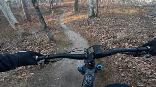
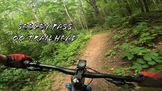
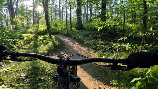
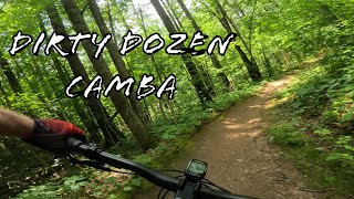
One of the most popular trails in the CAMBA system, Seeley Pass is made for cranking out the miles. It's not effortless, but everything flows seamlessly. The Martel's Pothole section received a facelift in 2014, so there is now a fun, two-way reroute that bypasses the steep plunge to the bottom that now serves as an uphill only, leg-burner of a climb, in addition to a new Jump Line.

Tags

Local Trail Association

Recent Activity on Trail

Past Week
  • 0 rides
  •  
6 Months
  • 81 rides
  • 42.0 km avg distance
All
  • 276 rides
  • Last: Nov 13, 2026
c1c2c3c4
January
February
March
April
May
June
July
August
September
October
November
December
update trails status or condition

Seeley Pass Trail Reports

statusdatedescription
Nov 7, 2026 @ 4:34pm (America/Chicago)
Nov 7, 2026
reporter
Martell’s Pothole Blowdown: Lori and I were 90% through the rotten ~15” diameter blowdown (with the 15 “ Silky BigBoy back pack saw) when...
Aug 25, 2026 @ 11:58am (America/Chicago)
Aug 25, 2026
Jul 6, 2026 @ 7:33pm (America/Chicago)
Jul 6, 2026
Riding perfect, minimal undergrowth, one low hanging branch.
May 2, 2026 @ 10:08am (America/Chicago)
May 2, 2026
Mar 21, 2026 @ 10:12am (America/Chicago)
Mar 21, 2026
more »
Status:
on Nov 7, 2026
Ideal
Avg: 4.35 (10 votes)
Your vote: 0

view (1,452)
close
      Directions to seeley-pass trailhead (46.109610, -91.297750)

      Photos

      91 more »
      mtb
      18 |
      Jun 11, 2024 @ 5:40pm
      Jun 11, 2024
      mtb
      28 |
      Jun 11, 2024 @ 4:10pm
      Jun 11, 2024
      mtb
      23 |
      Jun 11, 2024 @ 3:32pm
      Jun 11, 2024
      mtb
      59 |
      Jun 12, 2024 @ 3:36pm
      Jun 12, 2024

      Videos

      5 more »
      Late Fall Riding on Seeley Pass
      mtb
      2:14 | 66 | Nov 18, 2025 , Seeley
      Seeley Pass, OO Trailhead to Janet Road
      mtb
      4:40 | 84 | Oct 16, 2025 , Seeley
      Dirty Dozen on Seeley Pass MTB Trail
      mtb
      3:06 | 234 | Sep 21, 2025 , Seeley
      Dirty Dozen, Seeley Pass CAMBA Trails
      mtb
      3:21 | 352 | Jul 20, 2024 , Seeley

      Technical Trail Features (TTF)

      Routes with this trail

      more »
      90 miles • 5,940 ft • 8 • Race •
      Course route gpx file released on 6/12 from Cheq100 race.
      62 miles • 4,091 ft • 4 • Race •
      2019 60 mile course route released on 6/12/19 from Cheq100 race.
      62 miles • 4,091 ft • 4 • Loop • Race •
      Chequamegon 100 - 60 mile route
      4.7 ★★★★★
      10 Ratings
      5 ★ 70%
      4 ★ 30%
      3 ★
      2 ★
      1 ★

      2 Reviews & Comments

      TheWholeTrail
      Fun trail, now with a good jump line in the middle of it. Mostly smooth flowing single track. I am quite sure that the climb/descent numbers on this listing are incorrect. I think it averages more like 50’ per mile.
      Citydweller65
      Nice flowing single track with small jumps and banked turns throughout. Mostly smooth dirt surface without many root/stump/rock obstacles. The climbs and descents seem to be evenly spaced throughout. When heading south, there's a one way "expert" section with a bypass around. The expert section is a series of rolling jumps and a small drop feature (which can be bypassed) that is very fun. Overall a fun, well maintained trail that will keep you on your toes throughout.

      We hope you've been enjoying Trailforks!

      Create a FREE account to view all trail reviews and much more.

      • By teleturn2TF Pro & contributors
      • #52890 - 5,010 views

      Frequently Asked Questions

      ▼ Where is Seeley Pass located?
      Seeley Pass is located in CAMBA Seeley Cluster, Seeley, Wisconsin, United States. It is part of the CAMBA Seeley Cluster trail network. The trailhead is located at coordinates 46.10961, -91.29775.
      ▼ How hard is Seeley Pass?
      Seeley Pass is rated as Blue difficulty. The physical rating is Moderate. The average grade is 0.2%. The climb difficulty is rated Blue.
      ▼ What is the elevation gain for Seeley Pass?
      Seeley Pass has 512 ft of elevation gain. The trail has 611 ft of elevation descent. The elevation ranges from 1,352 ft to 1,513 ft.
      ▼ Is Seeley Pass a point to point trail?
      Seeley Pass is not a point to point trail. The direction is Both Directions. The trail type is singletrack.
      ▼ How long is Seeley Pass?
      Seeley Pass is 7.8 miles long. The trail type is singletrack.
      ▼ Are dogs allowed on Seeley Pass?
      Yes, dogs are allowed on Seeley Pass. Please keep dogs on a leash where required and clean up after them.
      ▼ When is the best time of year to ride Seeley Pass?
      Based on activity log data, the most popular months to ride Seeley Pass are:
      • June (60 activities)
      • August (42 activities)
      • July (27 activities)
      Check the reports page for current trail conditions.
      ▼ How do I access Seeley Pass? Where is the closest parking trailhead?
      The closest parking and trailhead locations to Seeley Pass are: View all parking locations in the area.
      ▼ How long does it take to ride Seeley Pass?
      Based on recorded activities, it takes an average of 52 minutes to ride Seeley Pass. The trail is 7.8 miles long. Actual times will vary based on fitness level, conditions, and pace. View recent activity logs for more details.
      ▼ How busy is Seeley Pass?
      Seeley Pass is a very popular trail. There have been 1,328 recorded activities on this trail. The trail has received 1,452 check-ins. View recent activity on this trail.

      Hit the Trail

      Open in App

      Get this trail on your phone instantly.

      open trail in app

      Download Trail

      Save to wishlist, Garmin & download.
      save the trail

      Find Related Routes

      Find routes and users activities that include this trail.
      find routes for this trail

      You must enter a description before submitting.