
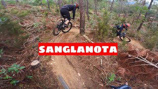


more stats
1.7 miles
Distance
25 ft
Climb
-783 ft
Descent
00:17:41
Avg time
-759 ft
Altitude change
629 ft
Altitude min
1,388 ft
Altitude max
1,388 ft
Altitude start
630 ft
Altitude end
-8.4%
Grade
-47.1%
Grade max
9.4%
Grade min
719 ft
Distance climb
1 mile
Distance down
751 ft
Distance flat
00:17:41
Avg time

Senglanota Details

  • Activities
    • Mountain Bike
    • E-Bike
  • Riding Area
    Riudarenes
    Santa Coloma de Farners
  • Difficulty Rating
  • Voted Difficulty
    Blue (2 votes)
  • Local Popularity
    90 in Mountain Biking [+]
    • 90 in E-Biking
  • Global Ranking
    #89296 in Mountain Biking [+]
    • #64926 in E-Biking
  • National Ranking
    #6,372 in Mountain Biking · Spain [+]
    • #8,354 in E-Biking
  • Trail Type
    Singletrack
  • Bike Type
    AM
  • Direction
    Downhill Only
    Popular Direction Shown
  • Trail Visibility
    Always easy to follow
  • Dogs Allowed
    Yes
  • eBike Allowed
    Yes up to Class 1

No community description for Senglanota trail has been added yet!

AI Generated Description

Senglanota is a 3 km popular blue difficulty singletrack trail located near Santa Coloma de Farners. This multi-use trail can be used downhill only. Trail visibility is always easy to follow. On average it takes 17 minutes to complete this trail.

Tags

Recent Activity on Trail

Past Week
  • 3 rides
  • 18 miles average
6 Months
  • 40 rides
  • 23 miles avg distance
All
  • 234 rides
  • Last: Oct 25, 2026
c1c2c3c4
January
February
March
April
May
June
July
August
September
October
November
December
update trails status or condition

Senglanota Trail Reports

statusdatedescription
May 6, 2026 @ 10:13pm (Europe/Madrid)
May 6, 2026
Apr 30, 2026 @ 11:02am (Europe/Andorra)
Apr 30, 2026
Just ha plogut el 30/04/26 a primera hora.
Apr 18, 2026 @ 4:55pm (Europe/Madrid)
Apr 18, 2026
Bajada larga y variable en condiciones: seca la mayoría del tiempo, bosque con algún arroyo el resto. El nivel de éste track es más alto de...
Feb 7, 2026 @ 11:33am (Europe/Andorra)
Feb 7, 2026
reporter
Oct 5, 2025 @ 10:19am (Europe/Madrid)
Oct 5, 2025
reporter
more »
Status:
on May 6, 2026
Dry
Avg: 3.58 (14 votes)
Your vote: 0

view (2,423)
close
      Directions to senglanota trailhead (41.846730, 2.648990)

      Photos

      4 more »
      mtb
      97 |
      Mar 24, 2025 @ 4:38am
      Mar 24, 2025
      mtb
      87 |
      Sep 19, 2022 @ 8:27am
      Sep 19, 2022
      mtb
      98 |
      Sep 13, 2022 @ 8:46am
      Sep 13, 2022
      mtb
      128 |
      Feb 6, 2022 @ 8:22am
      Feb 6, 2022

      Videos

      6 more »
      Santa Coloma de Farners, senglanota, #vtt...
      mtb
      8:20 | 227 | May 23, 2025 , Santa Coloma de Farners
      LA SENGLANOTA | Trialera completa Santa Coloma...
      mtb
      12:54 | 364 | Jan 26, 2023 , Santa Coloma de Farners
      youtuber SENGLANOTA - SANTA COLOMA DE FARNERS - ENDURO MTB
      mtb
      0:38 | 757 | Dec 14, 2022 , Santa Coloma de Farners
      KOM en Sanglanota XXL.  Tramo de 10min súper...
      mtb
      11:04 | 308 | Apr 26, 2022 , Santa Coloma de Farners

      Routes with this trail

      21 miles • 4,573 ft • 29 • Loop •
      RUTA ENDURO PER SANTA COLOMA BEST TRAILS
      3.5 ★★★★★
      14 Ratings
      5 ★ 14%
      4 ★ 36%
      3 ★ 36%
      2 ★ 7%
      1 ★ 7%

      5 Reviews & Comments

      Atzucat Atzucat
      El corriol està xulo, el problema que he tingut és el que track marcava per un lloc per a on el camí estava desaparegut i en canvi el camí net era diferent al del track.
      PLFamiliesOG91 PLFamiliesOG91
      Esta molt currada...pedaleo a tope y Flow, no le gustara aquel público sin potencia en patas o la escusa de no llevar Ebike.. final en algun punto un pelín dejada x lo demas perfect!
      ompamo ompamo
      Moltes opcions millors per la zona... No la repetiria.

      We hope you've been enjoying Trailforks!

      Create a FREE account to view all trail reviews and much more.

      • By esemoreno78TF Pro & contributors
      • #493506 - 1,850 views

      Frequently Asked Questions

      ▼ Where is Senglanota located?
      Senglanota is located in Riudarenes, Santa Coloma de Farners, Spain. It is part of the Riudarenes trail network. The trailhead is located at coordinates 41.84673, 2.64899.
      ▼ How hard is Senglanota?
      Senglanota is rated as Blue difficulty. The average grade is 8.4%.
      ▼ What is the elevation gain for Senglanota?
      Senglanota has 25 ft of elevation gain. The trail has 783 ft of elevation descent. The elevation ranges from 629 ft to 1,388 ft.
      ▼ Is Senglanota a point to point trail?
      Yes, Senglanota is a point to point trail. The direction is Downhill Only. The trail type is singletrack.
      ▼ How long is Senglanota?
      Senglanota is 1.7 miles long. The trail type is singletrack.
      ▼ Are dogs allowed on Senglanota?
      Yes, dogs are allowed on Senglanota. Please keep dogs on a leash where required and clean up after them.
      ▼ When is the best time of year to ride Senglanota?
      Based on activity log data, the most popular months to ride Senglanota are:
      • April (33 activities)
      • October (25 activities)
      • March (21 activities)
      Check the reports page for current trail conditions.
      ▼ How do I access Senglanota? Where is the closest parking trailhead?
      The closest parking and trailhead locations to Senglanota are: View all parking locations in the area.
      ▼ How long does it take to ride Senglanota?
      Based on recorded activities, it takes an average of 18 minutes to ride Senglanota. The trail is 1.7 miles long. Actual times will vary based on fitness level, conditions, and pace. View recent activity logs for more details.
      ▼ How busy is Senglanota?
      Senglanota is a very popular trail. There have been 2,088 recorded activities on this trail. The trail has received 2,423 check-ins. View recent activity on this trail.

      Hit the Trail

      Open in App

      Get this trail on your phone instantly.

      open trail in app

      Download Trail

      Save to wishlist, Garmin & download.
      save the trail

      Find Related Routes

      Find routes and users activities that include this trail.
      find routes for this trail

      You must enter a description before submitting.

