Supporters, Builders, Maintainers & Land Managers of Shadow Trail

BC ParksLand Manager
Shadow Details
-
Activities
- Downhill Ski
- Backcountry Ski
-
Riding AreaGibsons Pass Ski Area
Princeton, British Columbia -
Difficulty Rating
-
Winter only trail
-
Trail TypeSki Run (Piste)
-
DirectionDownhill Only
-
Global Ranking#692 in Skiing
-
Local Popularity100 in Skiing [+]
- 5 in Skiing
-
Land OwnerManning Park Resort
-
OSM Way
No description for Shadow trail has been added yet!
Shadow is a 835 m blue ski run (piste) trail located near Princeton British Columbia. This downhill ski primary trail can be used downhill only.
Traditionally Indigenous Territory
More Stats for Shadow downhill ski trail trail
-
Altitude change-740 ft
-
Altitude min5,062 ft
-
Altitude start5,802 ft
-
Altitude end5,062 ft
-
Grade-27.01%
-
Grade max-46.084%
-
Grade min-12.531%
-
Distance climb24 ft
-
Distance down2,714 ft
- view trail stats
-
Layers w
- Map Content
- More Layers
- Pro
- Pro
- Pro
- Pro
- Pro
- Pro
- Pro
- Pro
-
Upgrade to

- Unknown
- Snow Groomed
- Snow Packed
- Snow Covered
- Snow Cover Partial
- Freeze/thaw Cycle
- Icy
- Prevalent Mud
- Wet
- Variable
- Ideal
- Dry
- Very Dry
The colour categories are based on what percentage of riders are riding a trail in its intended direction.
- > 96%
- > 90%
- > 80%
- > 70%
- > 50%
- < 50%
- bi-directional trail
- no data
- < 2 days
- < 1 week
- < 2 weeks
- < 1 month
- < 6 months
- > 6 months
- Downhill Only
- Downhill Primary
- Both Directions
- Uphill Primary
- Uphill Only
- One Direction
- Description
- Photos
- Description & Photos
- Videos
- most popular
- popular
- less popular
- not popular

- mountain biking recent
- mountain biking (>6 month)
- hiking (1 year)
- moto (1 year)
- Downhill Ski
- Backcountry Ski
- Nordic Ski
- Snowmobile
Save the current map location and zoom level as your default home location whenever this page is loaded.
SaveShadow Trail Reports
Trail reports are used to indicate a trails current condition and inform builders and other riders about any issues on a trail.
Recent Ridelog Activity on Trail
- 0 rides
- 39 rides
- 18 miles avg distance
- 287 rides
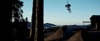
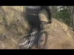
Photos
Reviews / Comments
No reviews yet, be the first to write a review or ask a question.
Use trail reports to comment on trail conditions.
We hope you've been enjoying Trailforks!
Create a FREE account to view trail comments and much more.
Videos
Nearby Trails
- Snag 0 ft
- Poland Lake Ski Trail 0 ft
- Apple Bowl Hike 0 ft
- Featherstone Special 853 ft
- Featherstone 915 ft
Gibsons Pass Ski Area
- By brenthillier
 NSMBA TRAILFORKS & contributors
 - #203706 - 399 views
You must enter a description before submitting.