
more stats
5,167 ft
Distance
11 ft
Climb
-870 ft
Descent
00:08:16
Avg time
-859 ft
Altitude change
4,560 ft
Altitude min
5,419 ft
Altitude max
5,419 ft
Altitude start
4,560 ft
Altitude end
-16.6%
Grade
-50.8%
Grade max
11.4%
Grade min
131 ft
Distance climb
5,036 ft
Distance down
00:08:16
Avg time

Simploke Details

  • Activities
    • Mountain Bike
    • E-Bike
    • Hike
    • Trail Running
  • Riding Area
  • Difficulty Rating
  • Voted Difficulty
    Red (1 vote)
  • Local Popularity
    90 in Mountain Biking [+]
    • 95 in E-Biking
    • 5 in Trail Running
    • 5 in Hiking
  • Global Ranking
    #250212 in Mountain Biking [+]
    • #43943 in E-Biking
    • #366749 in Trail Running
    • #357962 in Hiking
  • National Ranking
    #27,074 in Mountain Biking · Spain [+]
    • #3,216 in E-Biking
    • #39,422 in Trail Running
    • #36,742 in Hiking
  • Hiking SAC Scale
    T1 Hiking
  • Trail Exposure
    Normal
  • Trail Type
    Singletrack
  • Bike Type
    AM
  • Direction
    Downhill Primary
    Popular Direction Shown
  • Climb Difficulty
    Blue
  • Physical Rating
    Moderate
  • Trail Visibility
    Always easy to follow
  • Dogs Allowed
    Yes
  • eBike Allowed
    Yes up to Class 1

No community description for Simploke trail has been added yet!

AI Generated Description

Simploke is a 2 km popular red difficulty singletrack trail located near Peguerinos. This multi-use trail can be used downhill primary and has a moderate overall physical rating with a 4 m blue climb. Exposure: Normal Injury Risk. Adaptive MTB rating: amtb blue. Trail visibility is always easy to follow. On average it takes 8 minutes to complete this trail.

Tags

Recent Activity on Trail

Past Week
  • 0 rides
  •  
6 Months
  • 7 rides
  • 25 miles avg distance
All
  • 44 rides
  • Last: Nov 2, 2026
c1c2c3c4
January
February
March
April
May
June
July
August
September
October
November
December
update trails status or condition

Simploke Trail Reports

statusdatedescription
Sep 27, 2026 @ 10:21am (Europe/Madrid)
Sep 27, 2026
Las zetas del final alguno ha hecho recto pero se pueden hacer
Mar 29, 2026 @ 9:39am (Europe/Madrid)
Mar 29, 2026
sigue el arbol caido, aparte esta muy sucia por los fuertes vientos y la parte de las zetas ultimas, las dos primeras estan atrochadas y reventado...
Mar 1, 2026 @ 11:42am (Europe/Madrid)
Mar 1, 2026
arbol caido en mitad de la trazada en la zona de pedaleo
Jan 11, 2026 @ 8:59pm (Europe/Madrid)
Jan 11, 2026
Oct 19, 2025 @ 10:12am (Europe/Madrid)
Oct 19, 2025
Con la lluvia el terreno estaba ideal y los helechos muy otoñales, muy chula la zona de curvas
more »
Status:
on Sep 27, 2026
Very Dry
Avg: 3 (1 votes)
Your vote: 0

view (216)
close
      Directions to simploke trailhead (40.619500, -4.189010)

      Photos

      No photos have been added for Simploke yet, add a photo.

      Videos

      6 more »
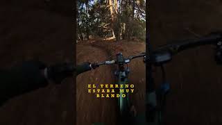
      youtuber ‍♂️⛰ Simploke  | Abantos | San Lorenzo...
      mtb
      8:31 | 103 | Nov 15, 2025 , Peguerinos
      youtuber Parecemos los de Verano Azul ‍♂️​...
      mtb
      14:00 | 50 | Nov 14, 2025 , Peguerinos
      Así fue mi primera vez en el SIMPLOKE, la...
      mtb
      0:10 | 201 | Nov 10, 2025 , Peguerinos
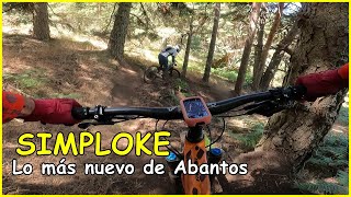
      youtuber SIMPLOKE lo más nuevo de Abantos | Living...
      mtb
      7:45 | 94 | Oct 27, 2025 , Peguerinos
      3.0 ★★★★★
      1 Ratings
      5 ★
      4 ★
      3 ★ 100%
      2 ★
      1 ★

      1 Review & Comments

      LZ1975 LZ1975
      Por incllinación de algunos tramos y dificultad, la veo más roja que azul.

      We hope you've been enjoying Trailforks!

      Create a FREE account to view all trail reviews and much more.

      • By VMquVTF Pro & contributors
      • #848514 - 552 views

      Frequently Asked Questions

      ▼ Where is Simploke located?
      Simploke is located in Peguerinos, Spain. It is part of the Peguerinos trail network. The trailhead is located at coordinates 40.6195, -4.18901.
      ▼ How hard is Simploke?
      Simploke is rated as Red difficulty. The physical rating is Moderate. The average grade is 16.6%. The climb difficulty is rated Blue.
      ▼ What is the elevation gain for Simploke?
      Simploke has 11 ft of elevation gain. The trail has 870 ft of elevation descent. The elevation ranges from 4,560 ft to 5,419 ft.
      ▼ Is Simploke a point to point trail?
      Simploke is not a point to point trail. The direction is Downhill Primary. The trail type is singletrack.
      ▼ How long is Simploke?
      Simploke is 5,167 ft long. The trail type is singletrack.
      ▼ Are dogs allowed on Simploke?
      Yes, dogs are allowed on Simploke. Please keep dogs on a leash where required and clean up after them.
      ▼ When is the best time of year to ride Simploke?
      Based on activity log data, the most popular months to ride Simploke are:
      • October (7 activities)
      • July (5 activities)
      • August (5 activities)
      Check the reports page for current trail conditions.
      ▼ How do I access Simploke? Where is the closest parking trailhead?
      The closest parking and trailhead locations to Simploke are: View all parking locations in the area.
      ▼ How long does it take to ride Simploke?
      Based on recorded activities, it takes an average of 8 minutes to ride Simploke. The trail is 5,167 ft long. Actual times will vary based on fitness level, conditions, and pace. View recent activity logs for more details.
      ▼ How busy is Simploke?
      Simploke is a very popular trail. There have been 215 recorded activities on this trail. The trail has received 216 check-ins. View recent activity on this trail.

      Hit the Trail

      Open in App

      Get this trail on your phone instantly.

      open trail in app

      Download Trail

      Save to wishlist, Garmin & download.
      save the trail

      Find Related Routes

      Find routes and users activities that include this trail.
      find routes for this trail

      You must enter a description before submitting.

