more stats
2,864 ft
Distance
-139 ft
Descent
00:09:43
Avg time
-139 ft
Altitude change
2,094 ft
Altitude min
2,234 ft
Altitude max
2,234 ft
Altitude start
2,096 ft
Altitude end
-4.8%
Grade
-15.5%
Grade max
3.7%
Grade min
164 ft
Distance climb
2,392 ft
Distance down
312 ft
Distance flat
00:09:43
Avg time

Skilly Details

  • Activities
    • Mountain Bike
  • Riding Area
    Cherokee
    , North Carolina
  • Difficulty Rating
  • Local Popularity
    70 in Mountain Biking
  • Global Ranking
    #96173 in Mountain Biking
  • Trail Type
    Singletrack
  • Bike Type
    DH, AM, XC, DJ
  • Direction
    Downhill Only
  • Physical Rating
    Moderate
  • Dogs Allowed
    Yes
  • eBike Allowed
    Yes up to Class 1
  • TTFs on Trail
    Berm, Drop, Jump, Gap Jump, Ladder Bridge, Rock Garden, Wallride

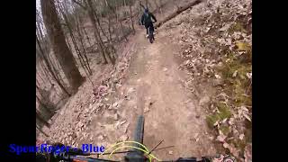
Formerly known as Kate's Wave, this trail received an update July of 2020 and was turned into an advanced terrain skills trail with tons of jumps, two 4 foot+ drops, a small wooden wallride, and a wooden lily pad gap double at the end. All the advanced features are optional and have a ride around.

Recent Activity on Trail

Past Week
  • 2 rides
  • 7 miles average
6 Months
  • 40 rides
  • 11 miles avg distance
All
  • 374 rides
  • Last: Jun 13, 2026
c1c2c3c4
January
February
March
April
May
June
July
August
September
October
November
December
update trails status or condition

Skilly Trail Reports

Status:
on Mar 19, 2026
Ideal
Avg: 4.26 (5 votes)
Your vote: 0

view (4,094)
close
3D
Trail Conditions
  • Unknown
  • Snow Groomed
  • Snow Packed
  • Snow Covered
  • Snow Cover Partial
  • Freeze/thaw Cycle
  • Icy
  • Prevalent Mud
  • Wet
  • Variable
  • Ideal
  • Dry
  • Very Dry
Trail Flow (Ridden Direction)
Trailforks scans users ridelogs to determine the most popular direction each trail is ridden. A good flowing trail network will have most trails flowing in a single direction according to their intension.
The colour categories are based on what percentage of riders are riding a trail in its intended direction.
  • > 96%
  • > 90%
  • > 80%
  • > 70%
  • > 50%
  • < 50%
  • bi-directional trail
  • no data
Trail Last Ridden
Trailforks scans ridelogs to determine the last time a trail was ridden.
  • < 2 days
  • < 1 week
  • < 2 weeks
  • < 1 month
  • < 6 months
  • > 6 months
Trail Ridden Direction
The intended direction a trail should be ridden.
  • Downhill Only
  • Downhill Primary
  • Both Directions
  • Uphill Primary
  • Uphill Only
  • One Direction
Contribute Details
Colors indicate trail is missing specified detail.
  • Description
  • Photos
  • Description & Photos
  • Videos
Trail Popularity ?
Trailforks scans ridelogs to determine which trails are ridden the most in the last 9 months. Trails are compared with nearby trails in the same city region with a possible 25 colour shades. Think of this as a heatmap, more rides = more kinetic energy = warmer colors.
  • most popular
  • popular
  • less popular
  • not popular
ATV/ORV/OHV Filter
Max Vehicle Width
inches
US Cell Coverage
Legend
cell carrier legend

Radar Time
Activity Recordings
Trailforks uses anonymized public activity data. ?
Activity Recordings
Trailforks uses anonymized public activity data. ?
Personal Heatmap
Activity Types
all / none
Options
2
Date range month
Winter Trails
Warning A routing network for winter maps does not exist. Selecting trails using the winter trails layer has been disabled.
Missing Trails
Most Popular
Least Popular
Trails are colored based on popularity. The more popular a trail is, the more red. Less popular trails trend towards green.
Jump Magnitude Heatmap
Heatmap of where riders jump on trails. Zoom in to see individual jumps, click circles to view jump details.
BC Backroad Status

Service Road Atlas is a free to use, community-driven service for viewing and creating reports on the numerous back-country service roads around B.C. and Alberta.

map legend
Slope Aspect
Direction the slope faces
Flat N NE E SE S SW W NW
Trails Deemphasized
Trails are shown in grey.
disable
Only show trails with no bike usage.
Enable
Suggested Layers
Based on selected activity type

    Save the current map location and zoom level as your default home location whenever this page is loaded.

    Save
        Directions to skilly trailhead (35.480580, -83.327180)

        Photos

        2 more »
        196 |
        Jan 1, 2019 @ 11:10am
        Jan 1, 2019
        132 |
        May 25, 2022 @ 3:27pm
        May 25, 2022

        Videos

        3 more »
        FIRE MOUNTAIN TRAILS - CHEROKEE, NC - MTB ALL...
        31:30 | 204 | Jul 29, 2023 , Cherokee
        Towing Biking With Bobo into the biggest...
        10:13 | 696 | Oct 29, 2020 , Cherokee
        Fire Mountain Trails - New For 2020 - Skilly...
        8:17 | 601 | Sep 8, 2020 , Cherokee

        Trail Lists

        Routes with this trail

        5.0 11 miles 1,783 ft 15
        Go Nuts Biking presents Nuts On Fire Enduro at Fire Mountain on July 24, 2022.
        7 miles 1,145 ft 9 Loop
        First time on this trail system.
        23 miles 3,736 ft 25 Point to Point Race
        3rd Coast Productions head to the sacred lands of Cherokee, NC for the Atsila Gatusi Enduro. Translated to...

        2 Reviews & Comments


        We hope you've been enjoying Trailforks!

        Create a FREE account to view trail comments and much more.

        • By toddTF Pro Trailforks & contributors
        • #135032 - 2,350 views

        Frequently Asked Questions About Skilly

        Where is Skilly located?
        Skilly is located in Cherokee, North Carolina, United States. It is part of the Cherokee trail network. The trailhead is located at coordinates 35.48058, -83.32718.
        How hard is Skilly?
        Skilly is rated as Black Diamond difficulty. The physical rating is Moderate. The average grade is 4.8%.
        What is the elevation gain for Skilly?
        The trail has 139 ft of elevation descent. The elevation ranges from 2,094 ft to 2,234 ft.
        Is Skilly a point to point trail?
        Yes, Skilly is a point to point trail. The direction is Downhill Only. The trail type is singletrack.

        Hit the Trail

        Open in App

        Get this trail on your phone instantly.
        open trail in app

        Download Trail

        Save to wishlist, Garmin & download.
        save the trail

        Find Related Routes

        Find routes and users activities that include this trail.
        find routes for this trail

        You must enter a description before submitting.