

more stats
1,644 ft
Distance
-30 ft
Descent
00:01:48
Avg time
-30 ft
Altitude change
2,031 ft
Altitude min
2,061 ft
Altitude max
2,061 ft
Altitude start
2,031 ft
Altitude end
-1.8%
Grade
-7.4%
Grade max
3.5%
Grade min
36 ft
Distance climb
869 ft
Distance down
663 ft
Distance flat
00:01:48
Avg time

Skyline Trail Details

  • Activities
    • Mountain Bike
    • Hike
    • Trail Running
  • Riding Area
    Central Edmonton (South)
    Northwest Edmonton, Alberta
  • Difficulty Rating
  • Voted Difficulty
    Blue (1 vote)
  • Local Popularity
    80 in Mountain Biking heatmap [+]
    • 85 in Trail Running
    • 5 in Hiking
  • Global Ranking
    #34449 in Mountain Biking [+]
    • #79643 in Trail Running
    • #207378 in Hiking
  • Provincial Ranking
    #562 in Mountain Biking · Alberta [+]
    • #1,474 in Trail Running
    • #3,430 in Hiking
  • Trail Type
    Singletrack
  • Bike Type
    XC
  • Direction
    Both Directions
  • Climb Difficulty
    Blue
  • Physical Rating
    Moderate
  • Dogs Allowed
    Yes

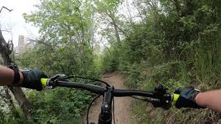
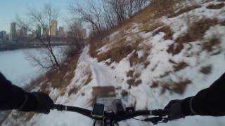
A significant portion of the old trail is closed and this is the remaining section of skyline.

Tags

Local Trail Association

Recent Activity on Trail

Past Week
  • 5 rides
  • 13 miles average
6 Months
  • 88 rides
  • 15 miles avg distance
All
  • 1,381 rides
  • Last: Nov 18, 2026
c1c2c3c4
January
February
March
April
May
June
July
August
September
October
November
December
update trails status or condition

Skyline Trail Trail Reports

statusdatedescription
May 24, 2026 @ 8:25am (America/Edmonton)
May 24, 2026
This portion of trail is gone. After crossing under the bridge you can get back on the trail.
Sep 24, 2025 @ 6:31pm (America/Edmonton)
Sep 24, 2025
Sep 3, 2025 @ 6:12pm
Sep 3, 2025
Jul 31, 2025 @ 9:03am
Jul 31, 2025
Jul 15, 2025 @ 4:43pm
Jul 15, 2025
Trail gets way too overgrown and full of homeless junk in the summer time. It has become quite neglected. Skip it and go straight to Edmonton Queen
more »
Status:
on May 24, 2026
Avg: 3.7 (11 votes)
Your vote: 0

view (9,777)
close
      Directions to skyline-trail trailhead (53.534210, -113.486680)

      Photos

      27 more »
      mtb
      103 |
      Sep 14, 2020 @ 11:32am
      Sep 14, 2020
      mtb
      160 |
      Jun 15, 2020 @ 10:49am
      Jun 15, 2020
      mtb
      139 |
      May 30, 2020 @ 3:56pm
      May 30, 2020
      mtb
      111 |
      May 30, 2020 @ 12:47pm
      May 30, 2020

      Videos

      8 more »
      Mill Creek Ravine & Nellie McClung Park...
      mtb
      9:49 | 384 | Oct 9, 2020 , Northwest Edmonton
      Skyline Trail
      mtb
      0:41 | 700 | Jun 4, 2019 , Northwest Edmonton
      Skyline NB
      mtb
      445 | Oct 7, 2017 , Northwest Edmonton
      Skyline
      mtb
      373 | Oct 7, 2017 , Northwest Edmonton

      Routes with this trail

      more »
      ★ 5.0 • 26 miles • 1,882 ft • 116 • Point to Point •
      This route is the connection of single track trails from Science Park in NE Edmonton to underneath the...
      7 miles • 624 ft • 25 • Point to Point •
      Ol' Timers to end of Pipe Dream. A good mix of some of the most technical terrain on the east end.
      17 miles • 1,196 ft • 45 •
      Fun loop around UofA April 2023
      3.6 ★★★★★
      11 Ratings
      5 ★ 18%
      4 ★ 45%
      3 ★ 18%
      2 ★ 9%
      1 ★ 9%

      9 Reviews & Comments

      sum333
      The "new" Skyline is still a good trail more people should ride this! Just sucks you have to go over the large patch of wire mesh at the end. I always carry my bike over. Just looks like it could potentially destroy some tires. Dont know if there is any solution to this, or maybe its completely safe to ride over and im just paranoid..
      Scona-Gabe Scona-Gabe
      Ok this trail I hate to admit might be kaput, I love it but the bridge slumped down the cliff and there are parts almost impassable. Pity. Might be a rehab project but it would take some work.
      Scona-Gabe Scona-Gabe
      Still mostly rideable despite the erosion.

      We hope you've been enjoying Trailforks!

      Create a FREE account to view all trail reviews and much more.

      • By mtnbikermitchTF Pro & contributors
      • #12128 - 11,933 views

      Frequently Asked Questions

      ▼ Where is Skyline Trail located?
      Skyline Trail is located in Central Edmonton (South), Northwest Edmonton, Alberta, Canada. It is part of the Central Edmonton (South) trail network. The trailhead is located at coordinates 53.53421, -113.48668.
      ▼ How hard is Skyline Trail?
      Skyline Trail is rated as Blue difficulty. The physical rating is Moderate. The average grade is 1.8%. The climb difficulty is rated Blue.
      ▼ What is the elevation gain for Skyline Trail?
      The trail has 30 ft of elevation descent. The elevation ranges from 2,031 ft to 2,061 ft.
      ▼ Is Skyline Trail a point to point trail?
      Skyline Trail is not a point to point trail. The direction is Both Directions. The trail type is singletrack.
      ▼ How long is Skyline Trail?
      Skyline Trail is 1,644 ft long. The trail type is singletrack.
      ▼ Are dogs allowed on Skyline Trail?
      Yes, dogs are allowed on Skyline Trail. Please keep dogs on a leash where required and clean up after them.
      ▼ How do I access Skyline Trail? Where is the closest parking trailhead?
      The closest parking and trailhead locations to Skyline Trail are: View all parking locations in the area.
      ▼ How long does it take to ride Skyline Trail?
      Based on recorded activities, it takes an average of 2 minutes to ride Skyline Trail. The trail is 1,644 ft long. Actual times will vary based on fitness level, conditions, and pace. View recent activity logs for more details.
      ▼ How busy is Skyline Trail?
      Skyline Trail is a very popular trail. There have been 9,281 recorded activities on this trail. The trail has received 9,777 check-ins. View recent activity on this trail.

      Hit the Trail

      Open in App

      Get this trail on your phone instantly.

      open trail in app

      Download Trail

      Save to wishlist, Garmin & download.
      save the trail

      Find Related Routes

      Find routes and users activities that include this trail.
      find routes for this trail

      You must enter a description before submitting.


