more stats
1,752 ft
Distance
-305 ft
Descent
00:04:19
Avg time
-305 ft
Altitude change
1,280 ft
Altitude min
1,585 ft
Altitude max
1,585 ft
Altitude start
1,280 ft
Altitude end
-17.4%
Grade
-33%
Grade max
-1.5%
Grade min
1,709 ft
Distance down
43 ft
Distance flat
00:04:19
Avg time

Slayer Details

  • Activities
    • Mountain Bike
    • Hike
    • Trail Running
  • Riding Area
    Burke Mountain
    Coquitlam, British Columbia
  • Difficulty Rating
  • Voted Difficulty
    Black Diamond (1 vote)
  • Local Popularity
    90 in Mountain Biking [+]
    • 85 in Trail Running
    • 85 in Hiking
  • Global Ranking
    #46236 in Mountain Biking [+]
    • #49889 in Trail Running
    • #64183 in Hiking
  • Hiking SAC Scale
    T1 Hiking
  • Trail Type
    Singletrack
  • Bike Type
    DH, AM, XC
  • Direction
    Downhill Only
    Popular Direction Shown
  • Climb Difficulty
    Blue
  • Physical Rating
    Moderate
  • Trail Visibility
    Always easy to follow
  • Dogs Allowed
    Yes

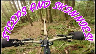
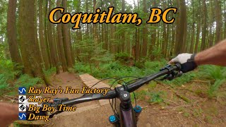
A few punchy climbs sprinkled among some root-filled, technical descents. See how well you can keep your momentum up

Access Info

This trail is the left most option at the point where 2 trails intersect, there is a sign on the tree.

This trail is unsanctioned.

Trail Supporters

Recent Activity on Trail

Past Week
  • 2 rides
  • 7 miles average
6 Months
  • 74 rides
  • 6 miles avg distance
All
  • 855 rides
  • Last: Jul 1, 2026
c1c2c3c4
January
February
March
April
May
June
July
August
September
October
November
December
update trails status or condition

Slayer Trail Reports

Status:
on Jun 3, 2026
Avg: 3.92 (20 votes)
Your vote: 0

view (4,450)
close
3D
Trail Conditions
  • Unknown
  • Snow Groomed
  • Snow Packed
  • Snow Covered
  • Snow Cover Partial
  • Freeze/thaw Cycle
  • Icy
  • Prevalent Mud
  • Wet
  • Variable
  • Ideal
  • Dry
  • Very Dry
Trail Flow (Ridden Direction)
Trailforks scans users ridelogs to determine the most popular direction each trail is ridden. A good flowing trail network will have most trails flowing in a single direction according to their intension.
The colour categories are based on what percentage of riders are riding a trail in its intended direction.
  • > 96%
  • > 90%
  • > 80%
  • > 70%
  • > 50%
  • < 50%
  • bi-directional trail
  • no data
Trail Last Ridden
Trailforks scans ridelogs to determine the last time a trail was ridden.
  • < 2 days
  • < 1 week
  • < 2 weeks
  • < 1 month
  • < 6 months
  • > 6 months
Trail Ridden Direction
The intended direction a trail should be ridden.
  • Downhill Only
  • Downhill Primary
  • Both Directions
  • Uphill Primary
  • Uphill Only
  • One Direction
Contribute Details
Colors indicate trail is missing specified detail.
  • Description
  • Photos
  • Description & Photos
  • Videos
Trail Popularity ?
Trailforks scans ridelogs to determine which trails are ridden the most in the last 9 months. Trails are compared with nearby trails in the same city region with a possible 25 colour shades. Think of this as a heatmap, more rides = more kinetic energy = warmer colors.
  • most popular
  • popular
  • less popular
  • not popular
ATV/ORV/OHV Filter
Max Vehicle Width
inches
US Cell Coverage
Legend
cell carrier legend

Radar Time
Activity Recordings
Trailforks uses anonymized public activity data. ?
Activity Recordings
Trailforks uses anonymized public activity data. ?
Personal Heatmap
Activity Types
all / none
Options
2
Date range month
Winter Trails
Warning A routing network for winter maps does not exist. Selecting trails using the winter trails layer has been disabled.
Missing Trails
Most Popular
Least Popular
Trails are colored based on popularity. The more popular a trail is, the more red. Less popular trails trend towards green.
Jump Magnitude Heatmap
Heatmap of where riders jump on trails. Zoom in to see individual jumps, click circles to view jump details.
BC Backroad Status

Service Road Atlas is a free to use, community-driven service for viewing and creating reports on the numerous back-country service roads around B.C. and Alberta.

map legend
Slope Aspect
Direction the slope faces
Flat N NE E SE S SW W NW
Trails Deemphasized
Trails are shown in grey.
disable
Only show trails with no bike usage.
Enable
Suggested Layers
Based on selected activity type

    Save the current map location and zoom level as your default home location whenever this page is loaded.

    Save
        Directions to slayer trailhead (49.311320, -122.736490)

        Photos

        21 more »
        530 |
        May 24, 2015 @ 8:15pm
        May 24, 2015
        33 |
        Feb 18, 2024 @ 2:45pm
        Feb 18, 2024
        123 |
        Aug 19, 2019 @ 5:35pm
        Aug 19, 2019
        326 |
        Jan 15, 2019 @ 8:16am
        Jan 15, 2019

        Videos

        11 more »
        MINT WINTER TRAILS! | BURKE MOUNTAIN | INTENSE...
        21:24 | 20 | Feb 15, 2026 , Coquitlam
        SLAYER | BURKE MOUNTAIN | INTENSE TAZER MX PRO...
        4:41 | 57 | Oct 10, 2025 , Coquitlam
        youtuber Ray Ray's Fun Factory and Slayer
        10:57 | 82 | Jul 21, 2025 , Coquitlam
        Six and Slayer
        6:59 | 139 | May 31, 2023 , Coquitlam

        Trail Products

        Reviews / Comments

        No reviews yet, be the first to write a review or ask a question.
        Use trail reports to comment on trail conditions.


        We hope you've been enjoying Trailforks!

        Create a FREE account to view trail comments and much more.

        • #1583 - 3,527 views

        Frequently Asked Questions About Slayer

        Where is Slayer located?
        Slayer is located in Burke Mountain, Coquitlam, British Columbia, Canada. It is part of the Burke Mountain trail network. The trailhead is located at coordinates 49.31132, -122.73649.
        How hard is Slayer?
        Slayer is rated as Black Diamond difficulty. The physical rating is Moderate. The average grade is 17.4%. The climb difficulty is rated Blue.
        What is the elevation gain for Slayer?
        The trail has 93 m of elevation descent. The elevation ranges from 390 m to 483 m.
        Is Slayer a point to point trail?
        Yes, Slayer is a point to point trail. The direction is Downhill Only. The trail type is singletrack.

        Hit the Trail

        Open in App

        Get this trail on your phone instantly.
        open trail in app

        Download Trail

        Save to wishlist, Garmin & download.
        save the trail

        Find Related Routes

        Find routes and users activities that include this trail.
        find routes for this trail

        You must enter a description before submitting.