more stats
1.2 miles
Distance
-929 ft
Descent
00:10:01
Avg time
-929 ft
Altitude change
4,276 ft
Altitude min
5,205 ft
Altitude max
5,205 ft
Altitude start
4,275 ft
Altitude end
-14.8%
Grade
-45.3%
Grade max
-3.6%
Grade min
1 mile
Distance down
00:10:01
Avg time

Sloam Details

  • Activities
    • Mountain Bike
    • E-Bike
  • Riding Area
    Gillard
    Kelowna, British Columbia
  • Difficulty Rating
  • Local Popularity
    70 in Mountain Biking [+]
    • 85 in E-Biking
  • Global Ranking
    #80481 in Mountain Biking [+]
    • #23533 in E-Biking
  • Provincial Ranking
    #3,975 in Mountain Biking · British Columbia [+]
    • #1,559 in E-Biking
  • Trail Type
    Singletrack
  • Bike Type
    DH, AM, XC
  • Direction
    Downhill Only
    Popular Direction Shown
  • Physical Rating
    Easy
  • Dogs Allowed
    Yes
  • eBike Allowed
  • TTFs on Trail
    A-Frame, Bridge, Drop, Jump, Rock Face
  • Year Opened
    2013
  • Land Owner
    Rec Sites and Trail BC

Loamy and rooty. A little tech with a little flow and some wooden features mixed in. You will need a 4x4 to drive to the trail head. Overall a fun way to start your ride at Gillard.

Local Trail Association
Traditionally Indigenous Territory

Recent Activity on Trail

Past Week
  • 0 rides
  •  
6 Months
  • 30 rides
  • 15 miles avg distance
All
  • 164 rides
  • Last: Oct 6, 2026
c1c2c3c4
January
February
March
April
May
June
July
August
September
October
November
December
update trails status or condition

Sloam Trail Reports

statusdatedescription
May 17, 2026 @ 1:58pm (America/Vancouver)
May 17, 2026
Snow on the top half of the trail. Fun but will take a bit more hot weather to fully clear.
May 1, 2026 @ 10:39am (America/Vancouver)
May 1, 2026
Trees cleared, enjoy
Apr 23, 2026 @ 11:17am (America/Creston)
Apr 23, 2026
Trees down in multiple spots, one batch needs a chain saw. Some small ice patches near that top
Apr 19, 2026 @ 5:22pm (America/Vancouver)
Apr 19, 2026
Several trees down, don’t go flying through! Bit of ice and snow but still rideable in that regard.
Sep 14, 2025 @ 8:49am (America/Vancouver)
Sep 14, 2025
more »
Status:
on May 17, 2026
Variable
Avg: 4 (14 votes)
Your vote: 0

view (1,094)
close
      Directions to sloam trailhead (49.737980, -119.462120)

      Photos

      18 more »
      mtb
      135 |
      Jul 14, 2023 @ 8:32pm
      Jul 14, 2023
      mtb
      146 |
      Jul 14, 2023 @ 8:32pm
      Jul 14, 2023
      mtb
      268 |
      Nov 18, 2021 @ 9:27am
      Nov 18, 2021
      mtb
      235 |
      Nov 18, 2021 @ 9:27am
      Nov 18, 2021

      Videos

      1 more »
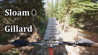
      The Only Loamer In This Dustbowl | Sloam - Gillard
      mtb
      8:12 | 386 | Aug 8, 2023 , Kelowna

      Technical Trail Features (TTF)

      Routes with this trail

      29 miles • 4,465 ft • 35 •
      Devilville Downhill - Climb Crawford trails to the KVR. Commute the KVR to the Gillard DH area, continue...
      22 miles • 3,898 ft • 43 •
      This route is a loop from Crawford to Gillard via Sloam. Bit of an epic with plenty of climbing to satisfy...
      13 miles • 3,892 ft • 25 • Loop •
      Ride Plan for blue Gillard. Map is off for getting from Therapist to Wobbly.
      3.9 ★★★★★
      14 Ratings
      5 ★ 36%
      4 ★ 36%
      3 ★ 14%
      2 ★ 7%
      1 ★ 7%

      4 Reviews & Comments

      Gluz Gluz
      If you thought the KVR was high this is way higher... like 400m or so higher. So worth it. What a fun trail! Deep in the trees, loamy dirt, dark spots, and eventually a few clearings to see how high you actually are. Rad.
      Foussa
      Good fun, was still quite wet even in July but good muck
      fuckingsteve fuckingsteve
      Trailhead totally reachable by bike if you're even moderately fit. Total blast!

      We hope you've been enjoying Trailforks!

      Create a FREE account to view all trail reviews and much more.

      • By smokeTF Pro Simpcw & contributors
      • #19203 - 5,214 views

      Frequently Asked Questions

      ▼ Where is Sloam located?
      Sloam is located in Gillard, Kelowna, British Columbia, Canada. It is part of the Gillard trail network. The trailhead is located at coordinates 49.73798, -119.46212.
      ▼ How hard is Sloam?
      Sloam is rated as Black Diamond difficulty. The physical rating is Easy. The average grade is 14.8%.
      ▼ What is the elevation gain for Sloam?
      The trail has 929 ft of elevation descent. The elevation ranges from 4,276 ft to 5,205 ft.
      ▼ Is Sloam a point to point trail?
      Yes, Sloam is a point to point trail. The direction is Downhill Only. The trail type is singletrack.
      ▼ How long is Sloam?
      Sloam is 1.2 miles long. The trail type is singletrack.
      ▼ Are dogs allowed on Sloam?
      Yes, dogs are allowed on Sloam. Please keep dogs on a leash where required and clean up after them.
      ▼ When is the best time of year to ride Sloam?
      Based on activity log data, the most popular months to ride Sloam are:
      • June (27 activities)
      • July (16 activities)
      • May (12 activities)
      Check the reports page for current trail conditions.
      ▼ How do I access Sloam? Where is the closest parking trailhead?
      The closest parking and trailhead locations to Sloam are: View all parking locations in the area.
      ▼ How long does it take to ride Sloam?
      Based on recorded activities, it takes an average of 10 minutes to ride Sloam. The trail is 1.2 miles long. Actual times will vary based on fitness level, conditions, and pace. View recent activity logs for more details.
      ▼ How busy is Sloam?
      Sloam is a very popular trail. There have been 1,130 recorded activities on this trail. The trail has received 1,094 check-ins. View recent activity on this trail.

      Hit the Trail

      Open in App

      Get this trail on your phone instantly.

      open trail in app

      Download Trail

      Save to wishlist, Garmin & download.
      save the trail

      Find Related Routes

      Find routes and users activities that include this trail.
      find routes for this trail

      You must enter a description before submitting.