
more stats
2,397 ft
Distance
-389 ft
Descent
00:06:48
Avg time
-389 ft
Altitude change
465 ft
Altitude min
854 ft
Altitude max
854 ft
Altitude start
465 ft
Altitude end
-16.248%
Grade
-31.875%
Grade max
1.098%
Grade min
2,282 ft
Distance down
115 ft
Distance flat
00:06:48
Avg time

Sniper Details

  • Activities
    • Mountain Bike
    • E-Bike
    • Hike
    • Trail Running
  • Riding Area
    West Sechelt
    Sechelt, British Columbia
  • AKA
    Dogtown
  • Difficulty Rating
  • Local Popularity
    70 in Mountain Biking heatmap [+]
    • 75 in E-Biking
    • 65 in Trail Running
    • 75 in Hiking
  • Global Ranking
    #47234 in Mountain Biking [+]
    • #17898 in E-Biking
    • #124314 in Trail Running
    • #111974 in Hiking
  • Provincial Ranking
    #2,331 in Mountain Biking · British Columbia [+]
    • #1,200 in E-Biking
    • #7,066 in Trail Running
    • #6,022 in Hiking
  • Trail Type
    Singletrack
  • Bike Type
    DH, AM
  • Direction
    Downhill Only
    Popular Direction Shown
  • Physical Rating
    Hard
  • Dogs Allowed
    Yes
  • eBike Allowed
    Yes up to Class 1
  • TTFs on Trail
    Bridge, Drop, Gap Jump, Rock Face, Skinny

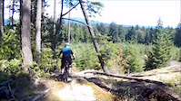
fresh cut single track with a couple rock faces and decent sized step down and two mandatory skinnies

Tags

Local Trail Association

Traditionally Indigenous Territory

Recent Activity on Trail

Past Week
  • 0 rides
  •  
6 Months
  • 14 rides
  • 7 miles avg distance
All
  • 80 rides
  • Last: Oct 31, 2026
c1c2c3c4
January
February
March
April
May
June
July
August
September
October
November
December
update trails status or condition

Sniper Trail Reports

statusdatedescription
Oct 31, 2026 @ 4:35pm (America/Vancouver)
Oct 31, 2026
Significant damage or rot on most features. Needs some love! Would be really cool if it was up and running.. it’s a sick trail! Entry is...
Feb 28, 2025 @ 4:57pm
Feb 28, 2025
Cleared the rest of the blow down, Sniper is now fully rideable.
Feb 28, 2025 @ 4:57pm
Feb 28, 2025
Cleared the rest of the blow down, Sniper is now fully rideable.
Jan 26, 2025 @ 9:42pm
Jan 26, 2025
Cleared the large downed tree and some other overgrowth.
Aug 18, 2024 @ 2:46pm
Aug 18, 2024
Missing and loose boards on stump drop.
more »
Status:
on Oct 31, 2026
Variable
Avg: 4.37 (10 votes)
Your vote: 0

view (410)
close
      Directions to sniper-6576 trailhead (49.483930, -123.823110)

      Photos

      29 more »
      mtb
      865 |
      Aug 21, 2017 @ 8:27am
      Aug 21, 2017
      mtb
      649 |
      Aug 21, 2017 @ 8:26am
      Aug 21, 2017
      mtb
      119 |
      Jun 17, 2024 @ 3:21pm
      Jun 17, 2024
      mtb
      110 |
      Apr 26, 2024 @ 9:55pm
      Apr 26, 2024

      Videos

      3 more »
      youtuber canada trip trail mix
      mtb
      9:49 | 400 | Sep 14, 2023 , Sechelt
      youtuber 'This Trail Gets WEIRD' | MTB
      mtb
      8:02 | 824 | May 2, 2021 , Sechelt
      Amazing fun trail, with bridges, drops and...
      mtb
      4:57 | 561 | Jul 2, 2018 , Sechelt
      4.6 ★★★★★
      10 Ratings
      5 ★ 70%
      4 ★ 20%
      3 ★ 10%
      2 ★
      1 ★

      8 Reviews & Comments

      magmagelato
      The first big skinny is in rough shape. Rotten and wobbly. Might have to be decommissioned soon, unfortunately. Otherwise, the trail is riding great, and all the rock rolls are super fun.
      jordt
      Massive black bear was sitting in the middle of the access trail today, he sat down and stared at me so I back and waited ten mins and he had gone on his way.

      Couple of the boards are coming loose on the gap jump.
      darthhayder
      Deff a spicy BC black as they should be, rad features and some decent techy descents. Access is a long hike a bike, but worth the push!

      We hope you've been enjoying Trailforks!

      Create a FREE account to view all trail reviews and much more.

      • By canadianenduroTF Pro & contributors
      • #6576 - 6,454 views

      Frequently Asked Questions

      ▼ Where is Sniper located?
      Sniper is located in West Sechelt, Sechelt, British Columbia, Canada. It is part of the West Sechelt trail network. The trailhead is located at coordinates 49.48393, -123.82311.
      ▼ How hard is Sniper?
      Sniper is rated as Black Diamond difficulty. The physical rating is Hard. The average grade is 16.248%.
      ▼ What is the elevation gain for Sniper?
      The trail has 389 ft of elevation descent. The elevation ranges from 465 ft to 854 ft.
      ▼ Is Sniper a point to point trail?
      Yes, Sniper is a point to point trail. The direction is Downhill Only. The trail type is singletrack.
      ▼ How long is Sniper?
      Sniper is 2,397 ft long. The trail type is singletrack.
      ▼ Are dogs allowed on Sniper?
      Yes, dogs are allowed on Sniper. Please keep dogs on a leash where required and clean up after them.
      ▼ How do I access Sniper? Where is the closest parking trailhead?
      The closest parking and trailhead locations to Sniper are: View all parking locations in the area.
      ▼ How long does it take to ride Sniper?
      Based on recorded activities, it takes an average of 7 minutes to ride Sniper. The trail is 2,397 ft long. Actual times will vary based on fitness level, conditions, and pace. View recent activity logs for more details.
      ▼ How busy is Sniper?
      Sniper is a very popular trail. There have been 393 recorded activities on this trail. The trail has received 410 check-ins. View recent activity on this trail.

      Hit the Trail

      Open in App

      Get this trail on your phone instantly.

      open trail in app

      Download Trail

      Save to wishlist, Garmin & download.
      save the trail

      Find Related Routes

      Find routes and users activities that include this trail.
      find routes for this trail

      You must enter a description before submitting.

