

more stats
1.5 miles
Distance
213 ft
Climb
-371 ft
Descent
00:24:08
Avg time
-157 ft
Altitude change
1,498 ft
Altitude min
1,736 ft
Altitude max
1,685 ft
Altitude start
1,529 ft
Altitude end
-2.1%
Grade
-32.4%
Grade max
47.3%
Grade min
3,179 ft
Distance climb
3,911 ft
Distance down
518 ft
Distance flat
00:24:08
Avg time

South Leaf Details

  • Activities
    • Mountain Bike
    • Horse
    • Hike
    • Trail Running
  • Riding Area
    El Corte de Madera Creek Preserve
    Redwood City, California
  • Difficulty Rating
  • Voted Difficulty
    Double Black Diamond (4 votes)
  • Local Popularity
    50 in Mountain Biking [+]
    • 5 in Trail Running
    • 20 in Hiking
    • 5 in Horseback
  • Global Ranking
    #80605 in Mountain Biking [+]
    • #108561 in Trail Running
    • #115628 in Hiking
    • #911 in Horseback
  • Trail Type
    Singletrack
  • Direction
    Both Directions
    Popular Direction Shown
  • Dogs Allowed
    Yes
  • eBike Allowed
  • Land Owner
    Midpeninsula Regional Open Space District

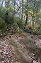
South Leaf is narrow and exposed in places. There is one washed out and rocky area that all but the most bold of riders will choose to walk. This trail has a lot of technical sections and should be avoided if you want to stay on the bike the entire time.

Local Trail Association
Traditionally Indigenous Territory

Recent Activity on Trail

Past Week
  • 5 rides
  • 23 miles average
6 Months
  • 49 rides
  • 22 miles avg distance
All
  • 421 rides
  • Last: Sep 13, 2026
c1c2c3c4
January
February
March
April
May
June
July
August
September
October
November
December
update trails status or condition

South Leaf Trail Reports

statusdatedescription
Apr 8, 2026 @ 6:00pm (America/Los_Angeles)
Apr 8, 2026
Fallen tree blocking the trail
Mar 22, 2026 @ 2:45pm (America/Los_Angeles)
Mar 22, 2026
Multiple trees down and blocking trails
Jul 11, 2025 @ 7:25pm
Jul 11, 2025
Couple trees down. Can walk/get around. Very overgrown in a lot of places. Almost to the point of losing the trail
Aug 18, 2024 @ 2:48pm
Aug 18, 2024
Large tree down across trail, blocking trail
Dec 16, 2023 @ 4:16pm
Dec 16, 2023
Overgrown. _Lots_ of plant litter.
more »
Status:
on Apr 8, 2026
Dry
Avg: 4.05 (13 votes)
Your vote: 0

view (1,405)
close
      Directions to south-leaf trailhead (37.401810, -122.333300)

      Photos

      5 more »
      mtb
      508 |
      Apr 11, 2022 @ 9:26pm
      Apr 11, 2022
      mtb
      554 |
      Apr 11, 2022 @ 9:26pm
      Apr 11, 2022
      report
      mtb
      407 |
      Sep 7, 2021 @ 6:43am
      Sep 7, 2021
      report
      mtb
      394 |
      Dec 4, 2020 @ 7:54pm
      Dec 4, 2020

      Videos

      1 more »
      Rock garden
      mtb
      0:06 | 496 | Jan 23, 2023 , Redwood City

      Routes with this trail

      2.0 20 miles 4,371 ft 8
      This is an eclectic mashup of trails in Preserve. It starts with and , two of Skeggs' most popular trails,...
      5.0 19 miles 3,396 ft 20 Loop
      Outside Lap of Skeggs with some of the fun downhills. Big Spin
      19 miles 4,181 ft 10
      This route includes most of the popular trails in Preserve ( , ), and and a few of the sleepers... ( , )....
      4.1
      13 Ratings
      5 54%
      4 23%
      3 8%
      2 8%
      1 8%

      13 Reviews & Comments

      alexpapa
      Pros:
      * Solitude
      * Tough technical features
      * Very nice deep redwood area at the creek crossing

      Cons:
      * Current conditions are not good
      * Not great flow. Nice features leading right into short ups.
      * Some annoying very steep loose parts, especially with the plant litter.
      * Not that cool of a downhill section with a long (and steep early on) climb out via Virginia Mill
      Sean0TkXdt
      Definitely a black, maybe double. Hardest trail in the park bur super fun. Hard not to hike a bike until you can figure out the flow in some places.
      Currently there are at least two trees down that you will need to get off bike to climb over.
      Worth it but be careful. There are spots with little room for error.
      TrailRider662636
      This trail is just skinny single track with a few drops-offs and few advanced features. Only requires intermediate skills to clear.

      We hope you've been enjoying Trailforks!

      Create a FREE account to view all trail reviews and much more.

      • By toddTF Pro Trailforks & contributors
      • #98515 - 5,339 views

      Frequently Asked Questions

      Where is South Leaf located?
      South Leaf is located in El Corte de Madera Creek Preserve, Redwood City, California, United States. It is part of the El Corte de Madera Creek Preserve trail network. The trailhead is located at coordinates 37.40181, -122.3333.
      How hard is South Leaf?
      South Leaf is rated as Black Diamond difficulty. The average grade is 2.1%.
      What is the elevation gain for South Leaf?
      South Leaf has 213 ft of elevation gain. The trail has 371 ft of elevation descent. The elevation ranges from 1,498 ft to 1,736 ft.
      Is South Leaf a point to point trail?
      South Leaf is not a point to point trail. The direction is Both Directions. The trail type is singletrack.
      How long is South Leaf?
      South Leaf is 1.5 miles long. The trail type is singletrack.
      Are dogs allowed on South Leaf?
      Yes, dogs are allowed on South Leaf. Please keep dogs on a leash where required and clean up after them.
      How do I access South Leaf? Where is the closest parking trailhead?
      The closest parking and trailhead locations to South Leaf are: View all parking locations in the area.
      How long does it take to ride South Leaf?
      Based on recorded activities, it takes an average of 25 minutes to ride South Leaf. The trail is 1.5 miles long. Actual times will vary based on fitness level, conditions, and pace. View recent activity logs for more details.
      How busy is South Leaf?
      South Leaf is a moderately popular trail. There have been 1,465 recorded activities on this trail. The trail has received 1,405 check-ins. View recent activity on this trail.

      Hit the Trail

      Open in App

      Get this trail on your phone instantly.

      open trail in app

      Download Trail

      Save to wishlist, Garmin & download.
      save the trail

      Find Related Routes

      Find routes and users activities that include this trail.
      find routes for this trail

      You must enter a description before submitting.



