


Open in App
Get this trail on your phone instantly.

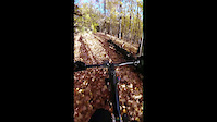
A very difficult and narrow single track on a slope for the most part running along the creek hill. The easier direction track starts in the north, with a quick grassy field stretch, over the-bridge, turn left with a steep rocky uphill section with a few breaks. Once up it goes along the ridge passing hardwoods with a dropped log here there, where it drops steeply to the Matheson underpass rock garden, there are two options walk it or go hard core and grind it. The climb out is likely a carry. This is one of the advanced features along the way. The next section is firs, pines, roots, some rock paths, four bridges, flowing sections, couple steeps climbs The track is very narrow in many places and a lot of it is on a steep slope with a very dangerous drop down to the creek bed which can kill you. Do not take this trail after a rain fall, There's a lot of erosion and you'll just make things worse for yourself.
Accessed right beside the small bridge to the south on the east side. Or from the north side of the bridge going under Eglington.
This trail is unsanctioned.
Please do not ride in the mud
| c1 | c2 | c3 | c4 |
|---|---|---|---|
January | February | March | April |
May | June | July | August |
September | October | November | December |

Service Road Atlas is a free to use, community-driven service for viewing and creating reports on the numerous back-country service roads around B.C. and Alberta.
Save the current map location and zoom level as your default home location whenever this page is loaded.
SaveWe hope you've been enjoying Trailforks!
Create a FREE account to view all trail reviews and much more.
You must enter a description before submitting.

