more stats
2.5 miles
Distance
48 ft
Climb
-1,868 ft
Descent
00:38:46
Avg time
-1,820 ft
Altitude change
1,532 ft
Altitude min
3,352 ft
Altitude max
3,352 ft
Altitude start
1,532 ft
Altitude end
-13.969%
Grade
-43.991%
Grade max
23.688%
Grade min
1,067 ft
Distance climb
2 miles
Distance down
392 ft
Distance flat
00:38:46
Avg time

Spooner Details

  • Activities
    • Mountain Bike
    • Hike
    • Trail Running
  • Riding Area
    Stewart Creek Trails
    Christina Lake, British Columbia
  • Difficulty Rating
  • Voted Difficulty
    Black Diamond (4 votes)
  • Local Popularity
    80 in Mountain Biking [+]
    • 5 in Trail Running
    • 5 in Hiking
  • Global Ranking
    #59169 in Mountain Biking [+]
    • #129677 in Trail Running
    • #122687 in Hiking
  • Trail Type
    Singletrack
  • Bike Type
    DH, AM
  • Direction
    Downhill Primary
    Popular Direction Shown
  • Climb Difficulty
    Blue
  • Physical Rating
    Moderate
  • Dogs Allowed
    Yes
  • eBike Allowed
  • TTFs on Trail
    A-Frame, Berm, Drop, Jump, Gap Jump, Ladder Bridge, Log Ride, Rock Face, Skinny, Teeter Totter

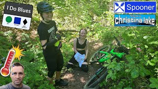
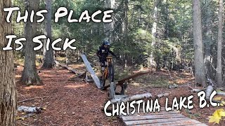
This trail is a classic single-track mountain bike trail providing steep descents and technical sections mixed up with some short punchy climbs and optional stunts. It provides great viewpoints looking east over Christina Lake. This is a Blue trail by Kootenay standards, so watch yourself. There are some technical rock gardens you don't want to be going too fast into as well as the odd blind corner or loose rock.

Access Info

Follow Hwy 3 west towards Grand Forks. Just after the Hwy 395, turn right onto Stewart Creek Rd. Follow for 9.6 km where there is a small pullout and the trailhead for Spooner Creek Trail. The trail descends from here down to West Lake Dr.

This trail is unsanctioned.

Recent Activity on Trail

Past Week
  • 0 rides
  •  
6 Months
  • 0 rides
  •  
All
  • 64 rides
  • Last: Jun 12, 2026
c1c2c3c4
January
February
March
April
May
June
July
August
September
October
November
December
update trails status or condition

Spooner Trail Reports

statusdatedescription
Jun 8, 2026 @ 10:26am (America/Vancouver)
Jun 8, 2026
Lots of trees down again, mostly on the last half of the trail.
Apr 13, 2026 @ 3:44pm (America/Vancouver)
Apr 13, 2026
Trail is totally snow free. Trails above Spooner are also probably snow free. Quite a few trees down though.
Jun 30, 2025 @ 7:36am
Jun 30, 2025
Trees have been removed so trail is clear. Super dry like usual.
May 25, 2025 @ 8:31pm
May 25, 2025
May 11, 2025 @ 2:53pm
May 11, 2025
Running fast and dry, no trees down all clear
more »
Status:
on Jun 8, 2026
Avg: 4.07 (9 votes)
Your vote: 0

view (310)
close
3D
Trail Conditions
  • Unknown
  • Snow Groomed
  • Snow Packed
  • Snow Covered
  • Snow Cover Partial
  • Freeze/thaw Cycle
  • Icy
  • Prevalent Mud
  • Wet
  • Variable
  • Ideal
  • Dry
  • Very Dry
Trail Flow (Ridden Direction)
Trailforks scans users ridelogs to determine the most popular direction each trail is ridden. A good flowing trail network will have most trails flowing in a single direction according to their intension.
The colour categories are based on what percentage of riders are riding a trail in its intended direction.
  • > 96%
  • > 90%
  • > 80%
  • > 70%
  • > 50%
  • < 50%
  • bi-directional trail
  • no data
Trail Last Ridden
Trailforks scans ridelogs to determine the last time a trail was ridden.
  • < 2 days
  • < 1 week
  • < 2 weeks
  • < 1 month
  • < 6 months
  • > 6 months
Trail Ridden Direction
The intended direction a trail should be ridden.
  • Downhill Only
  • Downhill Primary
  • Both Directions
  • Uphill Primary
  • Uphill Only
  • One Direction
Contribute Details
Colors indicate trail is missing specified detail.
  • Description
  • Photos
  • Description & Photos
  • Videos
Trail Popularity ?
Trailforks scans ridelogs to determine which trails are ridden the most in the last 9 months. Trails are compared with nearby trails in the same city region with a possible 25 colour shades. Think of this as a heatmap, more rides = more kinetic energy = warmer colors.
  • most popular
  • popular
  • less popular
  • not popular
ATV/ORV/OHV Filter
Max Vehicle Width
inches
US Cell Coverage
Legend
cell carrier legend

Radar Time
Activity Recordings
Trailforks uses anonymized public activity data. ?
Activity Recordings
Trailforks uses anonymized public activity data. ?
Personal Heatmap
Activity Types
all / none
Options
2
Date range month
Winter Trails
Warning A routing network for winter maps does not exist. Selecting trails using the winter trails layer has been disabled.
Missing Trails
Most Popular
Least Popular
Trails are colored based on popularity. The more popular a trail is, the more red. Less popular trails trend towards green.
Jump Magnitude Heatmap
Heatmap of where riders jump on trails. Zoom in to see individual jumps, click circles to view jump details.
BC Backroad Status

Service Road Atlas is a free to use, community-driven service for viewing and creating reports on the numerous back-country service roads around B.C. and Alberta.

map legend
Slope Aspect
Direction the slope faces
Flat N NE E SE S SW W NW
Trails Deemphasized
Trails are shown in grey.
disable
Only show trails with no bike usage.
Enable
Suggested Layers
Based on selected activity type

    Save the current map location and zoom level as your default home location whenever this page is loaded.

    Save
        Directions to spooner trailhead (49.070010, -118.268310)

        Photos

        41 more »
        564 |
        Dec 9, 2014 @ 6:55pm
        Dec 9, 2014
        598 |
        Apr 1, 2014 @ 11:54am
        Apr 1, 2014
        244 |
        May 10, 2021 @ 6:57am
        May 10, 2021
        215 |
        May 10, 2021 @ 6:56am
        May 10, 2021

        Videos

        9 more »
        youtuber How I Just About Killed My Kids!! Summer Heat...
        4:13 | 314 | Oct 6, 2022 , Christina Lake
        Riding Some Amazing North Shore styled...
        19:56 | 330 | Nov 5, 2021 , Christina Lake
        Spooner Creek Aug 3 Pt 2
        921 | Jul 5, 2015 , Christina Lake
        Spooner Creek Aug 3 Pt 1
        1034 | Jul 5, 2015 , Christina Lake

        Routes with this trail

        3 miles 3 Shuttled
        The best way to experience .

        7 Reviews & Comments


        We hope you've been enjoying Trailforks!

        Create a FREE account to view trail comments and much more.

        • #1967 - 7,813 views

        Frequently Asked Questions About Spooner

        Where is Spooner located?
        Spooner is located in Stewart Creek Trails, Christina Lake, British Columbia, Canada. It is part of the Stewart Creek Trails trail network. The trailhead is located at coordinates 49.07001, -118.26831.
        How hard is Spooner?
        Spooner is rated as Blue difficulty. The physical rating is Moderate. The average grade is 13.969%. The climb difficulty is rated Blue.
        What is the elevation gain for Spooner?
        Spooner has 15 m of elevation gain. The trail has 569 m of elevation descent. The elevation ranges from 467 m to 1,022 m.
        Is Spooner a point to point trail?
        Spooner is not a point to point trail. The direction is Downhill Primary. The trail type is singletrack.

        Hit the Trail

        Open in App

        Get this trail on your phone instantly.
        open trail in app

        Download Trail

        Save to wishlist, Garmin & download.
        save the trail

        Find Related Routes

        Find routes and users activities that include this trail.
        find routes for this trail

        You must enter a description before submitting.