more stats
2,113 ft
Distance
61 ft
Climb
-195 ft
Descent
00:08:18
Avg time
-134 ft
Altitude change
616 ft
Altitude min
768 ft
Altitude max
768 ft
Altitude start
633 ft
Altitude end
-6.3%
Grade
-46.4%
Grade max
37.4%
Grade min
512 ft
Distance climb
1,444 ft
Distance down
157 ft
Distance flat
00:08:18
Avg time

Sporting Details

  • Activities
    • Mountain Bike
    • E-Bike
    • Hike
    • Trail Running
  • Riding Area
    Finale Outdoor Region
    Finale Ligure
  • Ref Number
    #58
  • AKA
    San Bernardino Climb
  • Difficulty Rating
  • Local Popularity
    45 in Mountain Biking [+]
    • 50 in E-Biking
    • 90 in Trail Running
    • 65 in Hiking
  • Global Ranking
    #96317 in Mountain Biking [+]
    • #76301 in E-Biking
    • #19585 in Trail Running
    • #61747 in Hiking
  • Hiking SAC Scale
    T1 Hiking
  • Trail Type
    Singletrack
  • Bike Type
    AM, XC
  • Climb Difficulty
    Black Diamond
  • Physical Rating
    Hard
  • Trail Visibility
    Always easy to follow
  • Season
    All-year round
  • Dogs Allowed
    Yes
  • eBike Allowed
    Yes up to Class 1
  • Land Owner
    Finale Outdoor Region

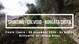
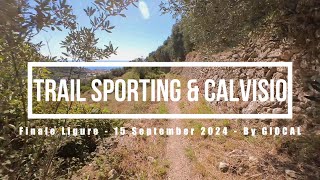
Following a nice, cobblestone track among olive trees and fields, it represents a nice connection to reach the top of San Bernardino without having to ride on tarmac roads.
It is mainly used by e-bikes given the steepness of the climb and the technical level required. Definitely rideable with a regular bike but a good training needed.

source: ...
Access Info

San Bernardino Area is reachable from the E80 highway accessing Finale Ligure, drive towards the sea cross the bridge on Via XXV Aprile

Disclaimer

Given its nature, the trail can change after weather happenings and season changes. Always pay attention.

Trail Supporters
Local Trail Association

Recent Activity on Trail

Past Week
  • 0 rides
  •  
6 Months
  • 32 rides
  • 20 miles avg distance
All
  • 168 rides
  • Last: Jun 5, 2026
c1c2c3c4
January
February
March
April
May
June
July
August
September
October
November
December
update trails status or condition

Sporting Trail Reports

statusdatedescription
Jun 13, 2026 @ 10:18am (Europe/Rome)
Jun 13, 2026
Dec 27, 2025 @ 10:31am (Europe/Rome)
Dec 27, 2025
ok, good condition
Sep 26, 2025 @ 5:57pm (Europe/Rome)
Sep 26, 2025
Fatto tante volte a piedi, oggi prima volta in bici. Molto bello. Blu/verde. Peccato sia corto
May 16, 2025 @ 2:10pm
May 16, 2025
Apr 24, 2025 @ 7:18am
Apr 24, 2025
There is a pile oft rocks blocking the way at the end of the steep rock section near the half way point. Be careful! The safest way is to carry...
more »
Status:
on Jun 13, 2026
Very Dry
Avg: 3.99 (7 votes)
Your vote: 0

view (1,285)
close
3D
Trail Conditions
  • Unknown
  • Snow Groomed
  • Snow Packed
  • Snow Covered
  • Snow Cover Partial
  • Freeze/thaw Cycle
  • Icy
  • Prevalent Mud
  • Wet
  • Variable
  • Ideal
  • Dry
  • Very Dry
Trail Flow (Ridden Direction)
Trailforks scans users ridelogs to determine the most popular direction each trail is ridden. A good flowing trail network will have most trails flowing in a single direction according to their intension.
The colour categories are based on what percentage of riders are riding a trail in its intended direction.
  • > 96%
  • > 90%
  • > 80%
  • > 70%
  • > 50%
  • < 50%
  • bi-directional trail
  • no data
Trail Last Ridden
Trailforks scans ridelogs to determine the last time a trail was ridden.
  • < 2 days
  • < 1 week
  • < 2 weeks
  • < 1 month
  • < 6 months
  • > 6 months
Trail Ridden Direction
The intended direction a trail should be ridden.
  • Downhill Only
  • Downhill Primary
  • Both Directions
  • Uphill Primary
  • Uphill Only
  • One Direction
Contribute Details
Colors indicate trail is missing specified detail.
  • Description
  • Photos
  • Description & Photos
  • Videos
Trail Popularity ?
Trailforks scans ridelogs to determine which trails are ridden the most in the last 9 months. Trails are compared with nearby trails in the same city region with a possible 25 colour shades. Think of this as a heatmap, more rides = more kinetic energy = warmer colors.
  • most popular
  • popular
  • less popular
  • not popular
ATV/ORV/OHV Filter
Max Vehicle Width
inches
US Cell Coverage
Legend
cell carrier legend

Radar Time
Activity Recordings
Trailforks uses anonymized public activity data. ?
Activity Recordings
Trailforks uses anonymized public activity data. ?
Personal Heatmap
Activity Types
all / none
Options
2
Date range month
Winter Trails
Warning A routing network for winter maps does not exist. Selecting trails using the winter trails layer has been disabled.
Missing Trails
Most Popular
Least Popular
Trails are colored based on popularity. The more popular a trail is, the more red. Less popular trails trend towards green.
Jump Magnitude Heatmap
Heatmap of where riders jump on trails. Zoom in to see individual jumps, click circles to view jump details.
BC Backroad Status

Service Road Atlas is a free to use, community-driven service for viewing and creating reports on the numerous back-country service roads around B.C. and Alberta.

map legend
Slope Aspect
Direction the slope faces
Flat N NE E SE S SW W NW
Trails Deemphasized
Trails are shown in grey.
disable
Only show trails with no bike usage.
Enable
Suggested Layers
Based on selected activity type

    Save the current map location and zoom level as your default home location whenever this page is loaded.

    Save
        Directions to sporting trailhead (44.183260, 8.341830)

        Photos

        3 more »
        34 |
        Jan 7, 2026 @ 4:21am
        Jan 7, 2026
        32 |
        Jan 7, 2026 @ 4:21am
        Jan 7, 2026
        24 |
        Jan 7, 2026 @ 4:21am
        Jan 7, 2026

        Videos

        5 more »
        Finale Ligure eMTBing - Trails Sporting -...
        10:27 | 42 | Dec 8, 2025 , Finale Ligure
        Finale Ligure eMTBing - Trail Sporting &...
        4:20 | 132 | Oct 2, 2024 , Finale Ligure
        Finale Ligure eMTBing - Trail Sporting &...
        5:32 | 116 | Feb 22, 2024 , Finale Ligure
        Finale Ligure eMTBing - Trail Sporting
        7:49 | 104 | Jan 25, 2024 , Finale Ligure

        3 Reviews & Comments


        We hope you've been enjoying Trailforks!

        Create a FREE account to view trail comments and much more.

        • By finaleoutdoorregion FOR & contributors
        • #87574 - 1,803 views

        Frequently Asked Questions About Sporting

        Where is Sporting located?
        Sporting is located in Finale Outdoor Region, Finale Ligure, Italy. It is part of the Finale Outdoor Region trail network. The trailhead is located at coordinates 44.18326, 8.34183.
        How hard is Sporting?
        Sporting is rated as Blue difficulty. The physical rating is Hard. The average grade is 6.3%. The climb difficulty is rated Black Diamond.
        What is the elevation gain for Sporting?
        Sporting has 61 ft of elevation gain. The trail has 195 ft of elevation descent. The elevation ranges from 616 ft to 768 ft.
        How long is Sporting?
        Sporting is 2,113 ft long. The trail type is singletrack.

        Hit the Trail

        Open in App

        Get this trail on your phone instantly.
        open trail in app

        Download Trail

        Save to wishlist, Garmin & download.
        save the trail

        Find Related Routes

        Find routes and users activities that include this trail.
        find routes for this trail

        You must enter a description before submitting.