

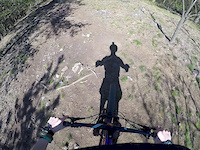

more stats
1,789 ft
Distance
6 ft
Climb
-430 ft
Descent
00:04:00
Avg time
-425 ft
Altitude change
595 ft
Altitude min
1,026 ft
Altitude max
1,020 ft
Altitude start
595 ft
Altitude end
-23.748%
Grade
-53.675%
Grade max
4.213%
Grade min
139 ft
Distance climb
1,571 ft
Distance down
80 ft
Distance flat
00:04:00
Avg time

Stříbrník Details

  • Activities
    • Mountain Bike
    • Hike
    • Trail Running
  • Riding Area
    Úholičky
    Praha - Západ
  • Difficulty Rating
  • Local Popularity
    55 in Mountain Biking [+]
    • 5 in Trail Running
    • 95 in Hiking
  • Global Ranking
    #92167 in Mountain Biking [+]
    • #3575 in Trail Running
    • #23197 in Hiking
  • Trail Type
    Wilderness Trail
  • Bike Type
    DH, AM, XC
  • Direction
    Downhill Only
    Popular Direction Shown
  • Physical Rating
    Hard
  • Dogs Allowed
    Yes
  • eBike Allowed
  • Year Opened
    2013

No community description for Stříbrník trail has been added yet!

AI Generated Description

Stříbrník is a 545 m moderately popular black diamond difficulty wilderness trail trail located near Praha - Západ. This mountain bike primary trail can be used downhill only and has a hard overall physical rating. On average it takes 4 minutes to complete this trail.

This trail is unsanctioned.

Recent Activity on Trail

Past Week
  • 0 rides
  •  
6 Months
  • 0 rides
  •  
All
  • 6 rides
  • Last: May 24, 2026
update trails status or condition

Stříbrník Trail Reports

statusdatedescription
Aug 16, 2024 @ 3:55pm
Aug 16, 2024
Pres hlavní pěšinu padlé tři stromy. Asi se má jet dále přes hřebínek, ale to jsem nestihl vyhodnotit
Mar 3, 2024 @ 7:21am
Mar 3, 2024
Oct 9, 2022 @ 5:18am
Oct 9, 2022
2.10.2022 - v druhé polovině trailu jsou na různých místech přes pěšinu padlé dva stromy.
Jun 23, 2020 @ 12:37pm
Jun 23, 2020
Celá trasa sjizdná, ale nakonci někdo dal mezi stromy pletivo, takže se nedá projet nad domy, ale musí se na vlakové nástupiště ...
Mar 25, 2019 @ 12:39am
Mar 25, 2019
more »
Status:
on Aug 16, 2024
Ideal
Avg: 4.1 (3 votes)
Your vote: 0

view (208)
close
      Directions to st-ibrnik trailhead (50.167310, 14.350910)

      Photos

      6 more »
      mtb
      239 |
      Jul 12, 2020 @ 12:27am
      Jul 12, 2020
      mtb
      236 |
      Jul 12, 2020 @ 12:27am
      Jul 12, 2020
      mtb
      275 |
      Jul 12, 2020 @ 12:27am
      Jul 12, 2020
      mtb
      374 |
      Aug 4, 2017 @ 2:22pm
      Aug 4, 2017

      Videos

      1 more »
      mtb
      3:36 | 616 | May 25, 2019 , Praha - Západ
      4.4
      3 Ratings
      5 33%
      4 67%
      3
      2
      1

      4 Reviews & Comments

      Siskys
      Pěkný trail s pár technickými pasážemi. Pozor na pěší, o víkendech je stezka dost populární.
      apaguha apaguha
      Spíš modro-černý než čistě černý trail, ale celkem zábava. Asi nejlepší v téhle obalsti pro Enduro/DH

      We hope you've been enjoying Trailforks!

      Create a FREE account to view all trail reviews and much more.

      • #96246 - 1,954 views

      Frequently Asked Questions

      Where is Stříbrník located?
      Stříbrník is located in Úholičky, Praha - Západ, Czech Republic. It is part of the Úholičky trail network. The trailhead is located at coordinates 50.16731, 14.35091.
      How hard is Stříbrník?
      Stříbrník is rated as Black Diamond difficulty. The physical rating is Hard. The average grade is 23.748%.
      What is the elevation gain for Stříbrník?
      Stříbrník has 6 ft of elevation gain. The trail has 430 ft of elevation descent. The elevation ranges from 595 ft to 1,026 ft.
      Is Stříbrník a point to point trail?
      Yes, Stříbrník is a point to point trail. The direction is Downhill Only. The trail type is wilderness trail.
      How long is Stříbrník?
      Stříbrník is 1,789 ft long. The trail type is wilderness trail.
      Are dogs allowed on Stříbrník?
      Yes, dogs are allowed on Stříbrník. Please keep dogs on a leash where required and clean up after them.
      How do I access Stříbrník? Where is the closest parking trailhead?
      The closest parking and trailhead locations to Stříbrník are: View all parking locations in the area.
      How long does it take to ride Stříbrník?
      Based on recorded activities, it takes an average of 3 minutes to ride Stříbrník. The trail is 1,789 ft long. Actual times will vary based on fitness level, conditions, and pace. View recent activity logs for more details.
      How busy is Stříbrník?
      Stříbrník is a moderately popular trail. There have been 198 recorded activities on this trail. The trail has received 208 check-ins. View recent activity on this trail.

      Hit the Trail

      Open in App

      Get this trail on your phone instantly.

      open trail in app

      Download Trail

      Save to wishlist, Garmin & download.
      save the trail

      Find Related Routes

      Find routes and users activities that include this trail.
      find routes for this trail

      You must enter a description before submitting.



