
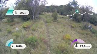
more stats
1.3 miles
Distance
-683 ft
Descent
00:18:13
Avg time
-682 ft
Altitude change
2,907 ft
Altitude min
3,590 ft
Altitude max
3,590 ft
Altitude start
2,907 ft
Altitude end
-9.7%
Grade
-29.5%
Grade max
0.5%
Grade min
121 ft
Distance climb
1 mile
Distance down
00:18:13
Avg time

Štanga Details

  • Activities
    • Mountain Bike
    • Hike
    • Trail Running
  • Riding Area
    Črne njive
    Ilirska Bistrica
  • Difficulty Rating
  • Local Popularity
    65 in Mountain Biking [+]
    • 5 in Trail Running
    • 5 in Hiking
  • Global Ranking
    #88177 in Mountain Biking [+]
    • #355547 in Trail Running
    • #343957 in Hiking
  • National Ranking
    #324 in Mountain Biking · Slovenia [+]
    • #289 in Trail Running
    • #303 in Hiking
  • Trail Type
    Singletrack
  • Bike Type
    AM, XC
  • Direction
    Downhill Primary
    Popular Direction Shown
  • Climb Difficulty
    Green
  • Physical Rating
    Moderate
  • Dogs Allowed
    Yes
  • TTFs on Trail
    Berm, Drop, Jump, Rock Garden

Natural with very nice view on the top

Tags
BermsDropsJumpsRock gardensViews

Local Trail Association

Recent Activity on Trail

Past Week
  • 1 rides
  • 12 miles average
6 Months
  • 5 rides
  • 15 miles avg distance
All
  • 69 rides
  • Last: Oct 29, 2026
update trails status or condition

Štanga Trail Reports

statusdatedescription
May 6, 2026 @ 9:26am (Europe/Ljubljana)
May 6, 2026
reporter Porezane veje, odstranjeno kamenje in veje, pograbljeno in pripravljeno. Trimmed, cleared with rake, all big rocks and sticks removed.
Nov 8, 2025 @ 10:17am (Europe/Ljubljana)
Nov 8, 2025
Sep 7, 2025 @ 11:06pm
Sep 7, 2025
All good.
Jun 4, 2025 @ 10:44am
Jun 4, 2025
V zgornjem delu po travniku je zaradi gozdarskih del nova vlaka - bodite pozorni, kje se trail odcepi desno.
Mar 4, 2025 @ 3:17pm
Mar 4, 2025
more »
Status:
on May 6, 2026
Ideal
Avg: 3.99 (7 votes)
Your vote: 0

view (332)
close
      Directions to stanga trailhead (45.564180, 14.324180)

      Photos

      9 more »
      mtb
      129 |
      May 1, 2022 @ 8:50am
      May 1, 2022
      mtb
      350 |
      Aug 1, 2021 @ 9:05am
      Aug 1, 2021
      mtb
      247 |
      Aug 13, 2020 @ 12:35am
      Aug 13, 2020
      mtb
      274 |
      Jul 30, 2020 @ 3:05am
      Jul 30, 2020

      Videos

      4 more »
      Kozlek Trail Preview
      mtb
      0:40 | 525 | Jul 27, 2020 , Ilirska Bistrica
      Polžek Tail Preview
      mtb
      0:33 | 352 | Jul 27, 2020 , Ilirska Bistrica
      Stanga Trail Preview
      mtb
      4:19 | 506 | Jul 17, 2020 , Ilirska Bistrica
      Stanga con SueZòBaic
      mtb
      5:40 | 434 | Oct 21, 2019 , Ilirska Bistrica

      Routes with this trail

      ★ 4.5 • 15 miles • 2,552 ft • 4 • Loop •
      Very fun ride,first some xc and then when you get onto the top come some fast downhill... great enduro loop
      4.0 ★★★★★
      7 Ratings
      5 ★ 14%
      4 ★ 71%
      3 ★ 14%
      2 ★
      1 ★

      1 Review & Comments

      Wernze
      Top Trail, really to recommend, top condotions, good view, one of Best trails i ever rode👍

      We hope you've been enjoying Trailforks!

      Create a FREE account to view all trail reviews and much more.

      • By nwaskaTF Pro GKD Borovci & contributors
      • #95002 - 3,260 views

      Frequently Asked Questions

      ▼ Where is Štanga located?
      Štanga is located in Črne njive, Ilirska Bistrica, Slovenia. It is part of the Črne njive trail network. The trailhead is located at coordinates 45.56418, 14.32418.
      ▼ How hard is Štanga?
      Štanga is rated as Blue difficulty. The physical rating is Moderate. The average grade is 9.7%. The climb difficulty is rated Green.
      ▼ What is the elevation gain for Štanga?
      The trail has 683 ft of elevation descent. The elevation ranges from 2,907 ft to 3,590 ft.
      ▼ Is Štanga a point to point trail?
      Štanga is not a point to point trail. The direction is Downhill Primary. The trail type is singletrack.
      ▼ How long is Štanga?
      Štanga is 1.3 miles long. The trail type is singletrack.
      ▼ Are dogs allowed on Štanga?
      Yes, dogs are allowed on Štanga. Please keep dogs on a leash where required and clean up after them.
      ▼ How do I access Štanga? Where is the closest parking trailhead?
      The closest parking and trailhead locations to Štanga are: View all parking locations in the area.
      ▼ How long does it take to ride Štanga?
      Based on recorded activities, it takes an average of 18 minutes to ride Štanga. The trail is 1.3 miles long. Actual times will vary based on fitness level, conditions, and pace. View recent activity logs for more details.
      ▼ How busy is Štanga?
      Štanga is a moderately popular trail. There have been 336 recorded activities on this trail. The trail has received 332 check-ins. View recent activity on this trail.

      Hit the Trail

      Open in App

      Get this trail on your phone instantly.

      open trail in app

      Download Trail

      Save to wishlist, Garmin & download.
      save the trail

      Find Related Routes

      Find routes and users activities that include this trail.
      find routes for this trail

      You must enter a description before submitting.

