


more stats
564 ft
Distance
-48 ft
Descent
00:00:46
Avg time
-48 ft
Altitude change
3,542 ft
Altitude min
3,589 ft
Altitude max
3,589 ft
Altitude start
3,543 ft
Altitude end
-8.4%
Grade
-17.4%
Grade max
-3.2%
Grade min
564 ft
Distance down
00:00:46
Avg time

Step Up Details

  • Activities
    • Mountain Bike
    • E-Bike
  • Riding Area
    Swansea Mountain Recreation Site
    Invermere, British Columbia
  • Difficulty Rating
  • Local Popularity
    100 in Mountain Biking heatmap [+]
    • 100 in E-Biking
  • Global Ranking
    #41175 in Mountain Biking [+]
    • #5905 in E-Biking
  • Provincial Ranking
    #2,007 in Mountain Biking · British Columbia [+]
    • #494 in E-Biking
  • Trail Type
    Singletrack
  • Bike Type
    DH, AM
  • Direction
    Downhill Only
    Popular Direction Shown
  • Physical Rating
    Moderate
  • Dogs Allowed
    Yes
  • eBike Allowed
    Yes up to Class 1
  • TTFs on Trail
    Gap Jump, Ladder Bridge

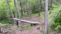
A set of step up jumps. Right side is is a large gap, left side is a smaller easy jump. You needs lots of speed for both jumps.

Tags
JumpsSkinnies

Trail Supporters

Local Trail Association

Traditionally Indigenous Territory

Recent Activity on Trail

Past Week
  • 1 rides
  • 6 miles average
6 Months
  • 160 rides
  • 9 miles avg distance
All
  • 1,010 rides
  • Last: Nov 15, 2026
c1c2c3c4
January
February
March
April
May
June
July
August
September
October
November
December
Status:
on Oct 16, 2026
Ideal
Avg: 4.08 (5 votes)
Your vote: 0

view (9,769)
close
      Directions to step-up-75495 trailhead (50.489690, -115.951360)

      Photos

      4 more »
      mtb
      147 |
      Aug 16, 2022 @ 11:25am
      Aug 16, 2022
      mtb
      161 |
      Aug 16, 2022 @ 11:25am
      Aug 16, 2022
      mtb
      122 |
      Apr 28, 2022 @ 9:28am
      Apr 28, 2022
      mtb
      158 |
      Jul 20, 2020 @ 5:12pm
      Jul 20, 2020

      Videos

      13 more »
      youtuber Hitting Some of the Biggest Features on Swansea
      mtb
      9:46 | 703 | Aug 2, 2020 , Invermere
      Step up on 'Step Up'
      mtb
      0:07 | 487 | Aug 15, 2020 , Invermere
      ROS Step Up Step Down clip - Moose mountain
      mtb
      0:12 | 659 | Jul 2, 2011 , Invermere
      gap/ step up
      mtb
      0:21 | 168 | Mar 18, 2008 , Invermere

      Routes with this trail

      more »
      ★ 5.0 • 20 miles • 7,361 ft • 17 •
      Every Trail on Swansea, pedal powered.
      8 miles • 2,504 ft • 7 • Loop •
      Climb up the road to the top then downhill the best of Swansea mountain
      10 miles • 3,494 ft • 13 •
      Frienduro Course from 2020.
      4.2 ★★★★★
      5 Ratings
      5 ★ 20%
      4 ★ 80%
      3 ★
      2 ★
      1 ★

      2 Reviews & Comments

      craigus42
      Just hit this a few days ago for the first time while riding alone. I had seen it last year but backed out of it while with mates..too much overthinking! I knew it was up ahead and put some power down and cleared it with ease It's about a 5m gap.
      Deinarson Deinarson
      Like the best things in life, it looks pretty sketchy but it feels really right. I didn’t hit this while riding Hoola Girl but opted to take a drop in from the road. From the road to the big jump with no brakes made for a seamless and sendy experience.

      We hope you've been enjoying Trailforks!

      Create a FREE account to view all trail reviews and much more.

      • By TneaultTF Pro CVCS & contributors
      • #75495 - 2,634 views

      Frequently Asked Questions

      ▼ Where is Step Up located?
      Step Up is located in Swansea Mountain Recreation Site, Invermere, British Columbia, Canada. It is part of the Swansea Mountain Recreation Site trail network. The trailhead is located at coordinates 50.48969, -115.95136.
      ▼ How hard is Step Up?
      Step Up is rated as Double Black Diamond difficulty. The physical rating is Moderate. The average grade is 8.4%.
      ▼ What is the elevation gain for Step Up?
      The trail has 48 ft of elevation descent. The elevation ranges from 3,542 ft to 3,589 ft.
      ▼ Is Step Up a point to point trail?
      Yes, Step Up is a point to point trail. The direction is Downhill Only. The trail type is singletrack.
      ▼ How long is Step Up?
      Step Up is 564 ft long. The trail type is singletrack.
      ▼ Are dogs allowed on Step Up?
      Yes, dogs are allowed on Step Up. Please keep dogs on a leash where required and clean up after them.
      ▼ How do I access Step Up? Where is the closest parking trailhead?
      The closest parking and trailhead locations to Step Up are: View all parking locations in the area.
      ▼ How long does it take to ride Step Up?
      Based on recorded activities, it takes an average of 1 minute to ride Step Up. The trail is 564 ft long. Actual times will vary based on fitness level, conditions, and pace. View recent activity logs for more details.
      ▼ How busy is Step Up?
      Step Up is a very popular trail. There have been 7,356 recorded activities on this trail. The trail has received 9,769 check-ins. View recent activity on this trail.

      Hit the Trail

      Open in App

      Get this trail on your phone instantly.

      open trail in app

      Download Trail

      Save to wishlist, Garmin & download.
      save the trail

      Find Related Routes

      Find routes and users activities that include this trail.
      find routes for this trail

      You must enter a description before submitting.