

more stats
4,943 ft
Distance
-707 ft
Descent
00:08:58
Avg time
-707 ft
Altitude change
288 ft
Altitude min
995 ft
Altitude max
995 ft
Altitude start
289 ft
Altitude end
-14.298%
Grade
-45.961%
Grade max
2.518%
Grade min
128 ft
Distance climb
4,390 ft
Distance down
425 ft
Distance flat
00:08:58
Avg time

Stromberg Trail Details

  • Activities
    • Mountain Bike
    • E-Bike
  • Riding Area
  • Difficulty Rating
  • Voted Difficulty
    Red (5 votes)
  • Local Popularity
    95 in Mountain Biking [+]
    • 95 in E-Biking
  • Global Ranking
    #24098 in Mountain Biking [+]
    • #2600 in E-Biking
  • National Ranking
    #867 in Mountain Biking · Germany [+]
    • #73 in E-Biking
  • Trail Type
    Singletrack
  • Bike Type
    DH, AM
  • Direction
    Downhill Only
    Popular Direction Shown
  • eBike Allowed
  • TTFs on Trail
    Berm, Drop, Jump, Gap Jump, Ladder Bridge

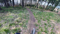
Upper part with many features and lots of roots. Middle and lower sections mixes flowy and fast parts with some steep parts. Most of the features have a chicken line. Ends at parking space near Sieg river.

Tags
BermsDropsFlowyJumpsRootySkinnies

Recent Activity on Trail

Past Week
  • 0 rides
  •  
6 Months
  • 3 rides
  • 36.3 km avg distance
All
  • 28 rides
  • Last: Oct 5, 2026
c1c2c3c4
January
February
March
April
May
June
July
August
September
October
November
December
update trails status or condition

Stromberg Trail Trail Reports

Status:
on Sep 14, 2025
Ideal
Avg: 4.49 (10 votes)
Your vote: 0

view (384)
close
      Directions to stromberg-trail trailhead (50.751678, 7.530146)

      Photos

      3 more »
      mtb
      409 |
      Sep 21, 2019 @ 10:21am
      Sep 21, 2019
      mtb
      388 |
      Sep 21, 2019 @ 10:20am
      Sep 21, 2019
      mtb
      376 |
      Sep 21, 2019 @ 10:19am
      Sep 21, 2019

      Videos

      2 more »
      RAW Offseason Shredding | Lukas Prangenberg
      mtb
      157 | Jun 22, 2025 , Eitorf
      Stromberg an der Sieg
      mtb
      2:04 | 929 | Jul 11, 2019 , Eitorf
      4.9 ★★★★★
      10 Ratings
      5 ★ 90%
      4 ★ 10%
      3 ★
      2 ★
      1 ★

      7 Reviews & Comments

      LeonBSo9ln
      Wer es ein bisschen ruppig mag aber auch teil weiße Flowig und auch gerne mal was Springt ist auf jedenfall bestens bedient mit dem Trail der 2 und der 3 Teil des Trails ist recht locker und flowig zu fahren aber im ersten Teil und Teil sind recht viele Sprünge und auch ein Road Gab nach dem dritten Teil kommt man dann eher in den Downhill Teil mit vielen Wurzeln Steinen Drops und auch recht steilen Passagen. Aber ich kann diesen Trail nur empfehlen für Leute die in der Nähe wohnen finde ich ist er ein Muss. LG
      mottfried
      Great natural Trail!
      Main line splits in a second one! Watch for the second line in the right side of the 3rd segment.
      patrykdh patrykdh
      Hey, I from Poland. My father live in Siegburg i will come to him for next few weeks.
      Are the German authorities planning any restrictions on cycling related to covid-19?

      Nice trail, If I come do Siegburg, I should try this trail!

      We hope you've been enjoying Trailforks!

      Create a FREE account to view all trail reviews and much more.

      • By checksix66TF Pro & contributors
      • #126685 - 3,779 views

      Frequently Asked Questions

      ▼ Where is Stromberg Trail located?
      Stromberg Trail is located in Eitorf, Germany. It is part of the Eitorf trail network. The trailhead is located at coordinates 50.75168, 7.53015.
      ▼ How hard is Stromberg Trail?
      Stromberg Trail is rated as Red difficulty. The average grade is 14.298%.
      ▼ What is the elevation gain for Stromberg Trail?
      The trail has 707 ft of elevation descent. The elevation ranges from 288 ft to 995 ft.
      ▼ Is Stromberg Trail a point to point trail?
      Yes, Stromberg Trail is a point to point trail. The direction is Downhill Only. The trail type is singletrack.
      ▼ How long is Stromberg Trail?
      Stromberg Trail is 4,943 ft long. The trail type is singletrack.
      ▼ Are dogs allowed on Stromberg Trail?
      There is no information about dogs being allowed on Stromberg Trail. Check with local trail managers or the trail page for the latest access rules.
      ▼ When is the best time of year to ride Stromberg Trail?
      Based on activity log data, the most popular months to ride Stromberg Trail are:
      • June (2 activities)
      • October (2 activities)
      • February (1 activities)
      Check the reports page for current trail conditions.
      ▼ How do I access Stromberg Trail? Where is the closest parking trailhead?
      The closest parking and trailhead locations to Stromberg Trail are: View all parking locations in the area.
      ▼ How long does it take to ride Stromberg Trail?
      Based on recorded activities, it takes an average of 9 minutes to ride Stromberg Trail. The trail is 4,943 ft long. Actual times will vary based on fitness level, conditions, and pace. View recent activity logs for more details.
      ▼ How busy is Stromberg Trail?
      Stromberg Trail is a very popular trail. There have been 310 recorded activities on this trail. The trail has received 384 check-ins. View recent activity on this trail.

      Hit the Trail

      Open in App

      Get this trail on your phone instantly.

      open trail in app

      Download Trail

      Save to wishlist, Garmin & download.
      save the trail

      Find Related Routes

      Find routes and users activities that include this trail.
      find routes for this trail

      You must enter a description before submitting.

