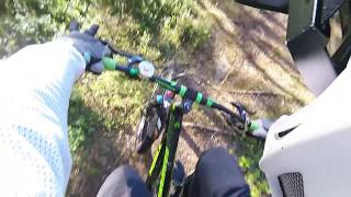
more stats
456 ft
Distance
8 ft
Climb
-20 ft
Descent
406 ft
High Point
-12 ft
Altitude change
385 ft
Altitude min
406 ft
Altitude start
394 ft
Altitude end
-2.7%
Grade
-11.1%
Grade max
5.1%
Grade min
180 ft
Distance climb
276 ft
Distance down

Stupet Details

  • Activities
    • Mountain Bike
    • E-Bike
    • Winter Fat Bike
    • Hike
    • Trail Running
  • Riding Area
  • Difficulty Rating
  • Local Popularity
    5 in Mountain Biking [+]
    • 5 in E-Biking
    • 5 in Trail Running
    • 5 in Hiking
    • 5 in Winter Fat Biking
  • Global Ranking
    #147196 in Mountain Biking [+]
    • #104434 in E-Biking
    • #133653 in Trail Running
    • #127059 in Hiking
  • Hiking SAC Scale
    T2 Mountain Hiking
  • Trail Type
    Singletrack
  • Bike Type
    DH, AM, Fat
  • Direction
    Downhill Only
  • Climb Difficulty
    Double Black Diamond
  • Physical Rating
    Extreme
  • Trail Visibility
    Sometimes hard to follow
  • Dogs Allowed
    Yes
  • eBike Allowed
    Yes up to Class 1
  • TTFs on Trail
    Rock Face

Norsk
Stien går ned fra ned fra svingen der bålplassen er, rett før nedover bakken, og går ned over,og går nesten rett mot stupet, og svinger sør over og går ned på stuped sør, der det er lavere, og går langs bunnen av stupet, og kommer opp i gjen til stien du var på.

English
The path descends from down from the bend where the campfire is, just before down the hill, and descends over, and goes almost straight towards the cliff , and turns south over and descends on the steep south, where it is lower, and goes along the bottom of the cliff, and comes up in return to the path you were on.

Local Trail Association

Recent Activity on Trail

Past Week
  • 0 rides
  •  
6 Months
  • 0 rides
  •  
All
  • 0 rides
  • Last: Sep 22, 2019
update trails status or condition

Stupet Trail Reports

statusdatedescription
May 15, 2017 @ 4:23pm
May 15, 2017
more »
Status:
on May 15, 2017
Variable
Avg: 4.13 (1 votes)
Your vote: 0

view (2)
close
      Directions to stupet trailhead (59.601290, 11.143880)

      Photos

      10 more »
      mtb
      25 |
      Oct 18, 2018 @ 7:18pm
      Oct 18, 2018
      mtb
      21 |
      Oct 18, 2018 @ 7:18pm
      Oct 18, 2018
      mtb
      32 |
      Oct 18, 2018 @ 7:17pm
      Oct 18, 2018
      mtb
      43 |
      Oct 18, 2018 @ 7:17pm
      Oct 18, 2018

      Videos

      1 more »
      youtuber 14.06.2017 p3 Prestegårdsskogen, Askim, Norway
      mtb
      458 | Jun 19, 2017 , Askim
      5.0 ★★★★★
      1 Ratings
      5 ★ 100%
      4 ★
      3 ★
      2 ★
      1 ★

      Reviews / Comments

      No reviews yet, be the first to write a review or ask a question.
      Use trail reports to comment on trail conditions.


      We hope you've been enjoying Trailforks!

      Create a FREE account to view all trail reviews and much more.

      Frequently Asked Questions

      ▼ Where is Stupet located?
      Stupet is located in Prestegårdsskogen, Askim, Norway. It is part of the Prestegårdsskogen trail network. The trailhead is located at coordinates 59.60129, 11.14388.
      ▼ How hard is Stupet?
      Stupet is rated as Black difficulty. The physical rating is Extreme. The average grade is 2.7%. The climb difficulty is rated Double Black Diamond.
      ▼ What is the elevation gain for Stupet?
      Stupet has 8 ft of elevation gain. The trail has 20 ft of elevation descent. The elevation ranges from 385 ft to 406 ft.
      ▼ Is Stupet a point to point trail?
      Yes, Stupet is a point to point trail. The direction is Downhill Only. The trail type is singletrack.
      ▼ How long is Stupet?
      Stupet is 456 ft long. The trail type is singletrack.
      ▼ Are dogs allowed on Stupet?
      Yes, dogs are allowed on Stupet. Please keep dogs on a leash where required and clean up after them.
      ▼ How do I access Stupet? Where is the closest parking trailhead?
      The closest parking and trailhead locations to Stupet are: View all parking locations in the area.
      ▼ How busy is Stupet?
      Stupet is a less popular trail with lighter traffic. The trail has received 2 check-ins. View recent activity on this trail.

      Hit the Trail

      Open in App

      Get this trail on your phone instantly.

      open trail in app

      Download Trail

      Save to wishlist, Garmin & download.
      save the trail

      Find Related Routes

      Find routes and users activities that include this trail.
      find routes for this trail

      You must enter a description before submitting.