
more stats
5,007 ft
Distance
-416 ft
Descent
00:08:12
Avg time
-416 ft
Altitude change
977 ft
Altitude min
1,393 ft
Altitude max
1,393 ft
Altitude start
978 ft
Altitude end
-8.3%
Grade
-28.9%
Grade max
4,662 ft
Distance down
348 ft
Distance flat
00:08:12
Avg time

Supervulcano Details

  • Activities
    • Mountain Bike
    • E-Bike
    • Hike
    • Trail Running
  • Riding Area
    Rive Rosse
    Brusnengo
  • Difficulty Rating
  • Voted Difficulty
    Blue (5 votes)
  • Local Popularity
    95 in Mountain Biking heatmap [+]
    • 90 in E-Biking
    • 5 in Trail Running
    • 5 in Hiking
  • Global Ranking
    #29323 in Mountain Biking [+]
    • #661 in E-Biking
  • National Ranking
    #2,836 in Mountain Biking · Italy [+]
    • #143 in E-Biking
  • Hiking SAC Scale
    T1 Hiking
  • Trail Exposure
    Normal
  • Trail Type
    Singletrack
  • Bike Type
    DH, AM, XC, Fat
  • Direction
    Downhill Only[+]
    Popular Direction Shown
    • Downhill Only for E-Biking
    • Both Directions for Trail Running
    • Both Directions for Hiking
  • Physical Rating
    Moderate
  • Trail Visibility
    Sometimes hard to follow
  • Dogs Allowed
    Yes
  • eBike Allowed
    Yes up to Class 1
  • TTFs on Trail
    Berm, Bridge, Drop, Rock Garden, Roller Coaster

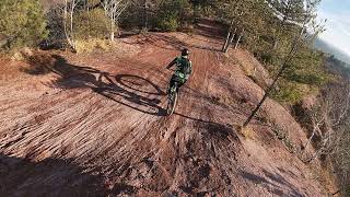
Iconica discesa nel tipico ambiente "sabbioso" delle Rive Rosse. La parte finale è invece nel bosco con un fondo su terra compatta.
Nella prima metà sono possibili molte varianti.

Recent Activity on Trail

Past Week
  • 2 rides
  • 16 miles average
6 Months
  • 21 rides
  • 17 miles avg distance
All
  • 269 rides
  • Last: Nov 15, 2026
c1c2c3c4
January
February
March
April
May
June
July
August
September
October
November
December
update trails status or condition

Supervulcano Trail Reports

Status:
on Nov 7, 2026
Wet
Avg: 4.32 (19 votes)
Your vote: 0

view (2,841)
close
      Directions to supervulcano trailhead (45.621630, 8.261070)

      Photos

      2 more »
      mtb
      98 |
      Mar 9, 2026 @ 3:53am
      Mar 9, 2026
      report
      mtb
      51 |
      Aug 29, 2026 @ 7:07am
      Aug 29, 2026
      report
      mtb
      88 |
      Nov 26, 2023 @ 10:31am
      Nov 26, 2023

      Videos

      3 more »
      Supervulcano - Riverosse (BI) - TERRENO VULCANICO!
      mtb
      10:23 | 48 | Feb 28, 2026 , Brusnengo
      Trail Super Vulcano - Rive Rosse (Biella)
      mtb
      6:29 | 129 | May 13, 2024 , Brusnengo
      Supervulcano Trail rive rosse 29-12-2021
      mtb
      7:59 | 372 | Feb 1, 2022 , Brusnengo
      4.4 ★★★★★
      19 Ratings
      5 ★ 63%
      4 ★ 26%
      3 ★ 5%
      2 ★
      1 ★ 5%

      5 Reviews & Comments

      solopaolo
      Trail suggestivo e molto vario. Si può affrontare in diversi modi e con diverse bici (XC, Trail, Enduro). Bellissima la prima sezione aperta con diverse varianti e l’ultima nel bosco, molto guidata e divertente
      Stefanof2Io9R
      Bel Trail, divertente e mai troppo difficile. C’è un unico passaggio roccioso più impegnativo a circa metà trail. Parte finale nel bosco da guidare bene.
      dave-82
      Uno dei trail iconici assolutamente da fare a Rive Rosse, fosse anche solo per il paesaggio!
      Vasta possibilità di scegliersi la linea nella parte centrale, ogni tanto pare quasi di esser una enorme pump track naturale!
      Parte finale flow con qualche saltino!

      We hope you've been enjoying Trailforks!

      Create a FREE account to view all trail reviews and much more.

      • By jbike46 & contributors
      • #214982 - 2,192 views

      Frequently Asked Questions

      ▼ Where is Supervulcano located?
      Supervulcano is located in Rive Rosse, Brusnengo, Italy. It is part of the Rive Rosse trail network. The trailhead is located at coordinates 45.62163, 8.26107.
      ▼ How hard is Supervulcano?
      Supervulcano is rated as Blue difficulty. The physical rating is Moderate. The average grade is 8.3%.
      ▼ What is the elevation gain for Supervulcano?
      The trail has 416 ft of elevation descent. The elevation ranges from 977 ft to 1,393 ft.
      ▼ Is Supervulcano a point to point trail?
      Yes, Supervulcano is a point to point trail. The direction is Downhill Only. The trail type is singletrack.
      ▼ How long is Supervulcano?
      Supervulcano is 5,007 ft long. The trail type is singletrack.
      ▼ Are dogs allowed on Supervulcano?
      Yes, dogs are allowed on Supervulcano. Please keep dogs on a leash where required and clean up after them.
      ▼ When is the best time of year to ride Supervulcano?
      Based on activity log data, the most popular months to ride Supervulcano are:
      • December (28 activities)
      • October (26 activities)
      • November (26 activities)
      Check the reports page for current trail conditions.
      ▼ How do I access Supervulcano? Where is the closest parking trailhead?
      The closest parking and trailhead locations to Supervulcano are: View all parking locations in the area.
      ▼ How long does it take to ride Supervulcano?
      Based on recorded activities, it takes an average of 8 minutes to ride Supervulcano. The trail is 5,007 ft long. Actual times will vary based on fitness level, conditions, and pace. View recent activity logs for more details.
      ▼ How busy is Supervulcano?
      Supervulcano is a very popular trail. There have been 2,855 recorded activities on this trail. The trail has received 2,841 check-ins. View recent activity on this trail.

      Hit the Trail

      Open in App

      Get this trail on your phone instantly.

      open trail in app

      Download Trail

      Save to wishlist, Garmin & download.
      save the trail

      Find Related Routes

      Find routes and users activities that include this trail.
      find routes for this trail

      You must enter a description before submitting.

