4,052 ft
Distance
39 ft
Climb
-304 ft
Descent
00:08:39
Avg time

Teapot Details

  • Activities
    • Mountain Bike
    • Hike
    • Trail Running
  • Riding Area
    Cumberland Forest
    Cumberland, British Columbia
  • Difficulty Rating
  • Trail Type
    Singletrack
  • Bike Type
    DH, AM, XC
  • Physical Rating
    Moderate
  • Season
    March to November
  • Dogs Allowed
    Yes
  • Ride in Rain
    Yes
  • Global Ranking
    #1684 in Mountain Biking [+]
    • #2203 in Trail Running
    • #14666 in Hiking
  • Local Popularity
    85 in Mountain Biking [+]
    • 70 in Trail Running
    • 65 in Hiking

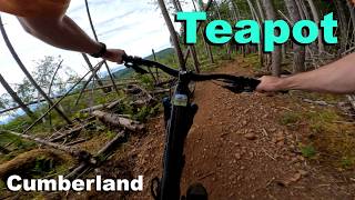
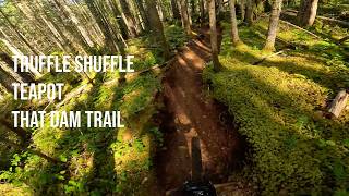
Teapot is a fun and flowy singletrack trail suited for everyone from XC hardtails to DH rippers. Access via, Sykes Bridge, Thirsty Beaver, Steam Donkey or Shortline.

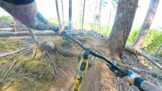
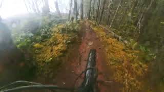
Relatively tight and twisty through forest with nice banked corners and some short steeper sections.

A must ride in Cumberland.

Access Info

Entrance is up roadway from Sykes Bridge.

Local Trail Association
Traditionally Indigenous Territory
More Stats for Teapot mountain bike trail trail
  • Altitude change
    -264 ft
  • Altitude min
    899 ft
  • Altitude max
    1,191 ft
  • Altitude start
    1,163 ft
  • Altitude end
    899 ft
  • Grade
    -6.521%
  • Grade max
    -27.902%
  • Grade min
    14.588%
  • Distance climb
    632 ft
  • Distance down
    2,684 ft
  • Distance flat
    736 ft
  • Avg time
    00:08:39
  • Avg reverse time
    00:13:24
  • view trail stats
Status:
on Mar 19, 2023
Variable
Avg: 3.9 (34 votes)
Your vote: 0

view (5,064)
close
3D
Trail Conditions
  • Unknown
  • Snow Groomed
  • Snow Packed
  • Snow Covered
  • Snow Cover Inadequate
  • Freeze/thaw Cycle
  • Icy
  • Prevalent Mud
  • Wet
  • Variable
  • Ideal
  • Dry
  • Very Dry
Trail Flow (Ridden Direction)
Trailforks scans users ridelogs to determine the most popular direction each trail is ridden. A good flowing trail network will have most trails flowing in a single direction according to their intension.
The colour categories are based on what percentage of riders are riding a trail in its intended direction.
  • > 96%
  • > 90%
  • > 80%
  • > 70%
  • > 50%
  • < 50%
  • bi-directional trail
  • no data
Trail Last Ridden
Trailforks scans ridelogs to determine the last time a trail was ridden.
  • < 2 days
  • < 1 week
  • < 2 weeks
  • < 1 month
  • < 6 months
  • > 6 months
Trail Ridden Direction
The intended direction a trail should be ridden.
  • Downhill Only
  • Downhill Primary
  • Both Directions
  • Uphill Primary
  • Uphill Only
  • One Direction
Contribute Details
Colors indicate trail is missing specified detail.
  • Description
  • Photos
  • Description & Photos
  • Videos
Trail Popularity ?
Trailforks scans ridelogs to determine which trails are ridden the most in the last 9 months. Trails are compared with nearby trails in the same city region with a possible 25 colour shades. Think of this as a heatmap, more rides = more kinetic energy = warmer colors.
  • most popular
  • popular
  • less popular
  • not popular
ATV/ORV/OHV Filter
Max Vehicle Width
inches

Radar Time
x Activity Recordings
Trailforks users anonymized public ridelogs from the past 6 months.
  • mountain biking recent
  • mountain biking (>6 month)
  • hiking (1 year)
  • moto (1 year)
Activity Recordings
Trailforks users anonymized public skilogs from the past 12 months.
  • Downhill Ski
  • Backcountry Ski
  • Nordic Ski
  • Snowmobile
Jump Magnitude Heatmap
Heatmap of where riders jump on trails. Zoom in to see individual jumps, click circles to view jump details.
Trails Deemphasized
Trails are shown in grey.
disable
Only show trails with NO bikes.
enable

Save the current map location and zoom level as your default home location whenever this page is loaded.

Save
      Directions to teapot trailhead (49.596200, -125.047750)
      update trails status or condition

      Teapot Trail Reports

      statusdatedescription
      Mar 19, 2023 @ 2:07pm
      Mar 19, 2023
      5” tree
      Mar 19, 2023 @ 1:48pm
      Mar 19, 2023
      Feb 25, 2023 @ 1:31am
      Feb 25, 2023
      Feb 4, 2023 @ 1:01am
      Feb 4, 2023
      Dec 21, 2022 @ 11:36am
      Dec 21, 2022
      Medium size tree down across the trail. Easy to walk over. I had a small hands are but it wasn’t barely enough to cut through this.
      view all reports »

      Recent Ridelog Activity on Trail

      Past Week
      • 15 rides
      • 10 miles avg distance
      6 Months
      • 356 rides
      • 11 miles avg distance
      All
      • 4,916 rides
      • Last: Mar 21, 2023

      Photos

      more »
      29 |
      Aug 23, 2019 @ 2:58pm
      Aug 23, 2019
      18 |
      Aug 23, 2019 @ 2:58pm
      Aug 23, 2019
      64 |
      Jun 26, 2017 @ 3:24pm
      Jun 26, 2017
      231 |
      Nov 30, 2014 @ 3:49pm
      Nov 30, 2014

      Trail Lists

      Routes with this trail

      more »
      titledistance
      Fiver live XC #38 miles
      UROC 2021 Fiver #2 route #211 miles
      2022 UROC Virtual Fiver #3 route11 miles
      Cumberland Bike12 miles

      3 Reviews & Comments

      • + 0
      zaykd213 (Jul 8, 2021 at 17:28)
      Trail closed mon-friday 5am-5pm
      [Reply]
      • + 1
      lostlunchbox (Jul 15, 2020 at 11:38)
      Trail ratings are hard with such a limited range of options, but this is more of an easy black/double blue imo especially with the tech climb section. Had a newbie friend worried that blue trails would be beyond his skill after trying to ride this on his first ride.
      Lower thirsty Beaver is an easier trail and is rated black to give some idea. Fun trail to connect with truffle shuffle.
      [Reply]
      • + 0
      BlueBaron97 (Jul 26, 2019 at 17:51)
      Fun trail. Steep sections. I am pushing my luck with this one at 67 years old, but I love it. Maybe I can ride the whole thing next time.
      [Reply]


      Login or Sign Up to Comment

      Videos

      more »
      Teapot
      5:42 | 259 | May 31, 2021 , Cumberland
      Teapot w/ Gimbal - Cumberland
      3:51 | 782 | May 5, 2019 , Cumberland
      Teapot
      2:01 | 236 | Mar 31, 2017 , Cumberland
      Night Ride in Fresh Snow   Jan 5 , 2015
      4:48 | 107 | Jan 5, 2016 , Cumberland
      • subscribe
      • flag
      • login to download gpx or kml files.