more stats
2,395 ft
Distance
-283 ft
Descent
00:02:59
Avg time
-285 ft
Altitude change
1,489 ft
Altitude min
1,774 ft
Altitude max
1,774 ft
Altitude start
1,490 ft
Altitude end
-11.9%
Grade
-32.3%
Grade max
0.7%
Grade min
2,329 ft
Distance down
66 ft
Distance flat
00:02:59
Avg time

DH - Techonite Details

  • Activities
    • Mountain Bike
  • Riding Area
    Giants Ridge
    Biwabik, Minnesota
  • Difficulty Rating
  • Local Popularity
    60 in Mountain Biking
  • Global Ranking
    #25621 in Mountain Biking
  • Trail Type
    Singletrack
  • Bike Type
    DH, AM
  • Trail Visibility
    Always easy to follow
  • eBike Allowed
  • TTFs on Trail
    Berm, Drop, Jump, Rock Face, Rock Garden
  • Year Opened
    2021

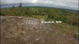
Exiting off the left side of Featherlys near the top, this trail is an advanced technical style trial. At the start of the trail, a split allows for choice of an easier or more difficult rock roll. Then the trail winds through tight berms on a steep slope, a perfect place to skid your own line through the trees. From there the trail winds through a flowy gully filled with jumps and hits before finishing off with a pick-your-own-line rock garden.

Access Info

Closed when the chairlift is not in operation.

Trail Supporters
  • past supporters

  • Pathfinder Trails
    2020 - 2021
    Builder

Bike Park

Recent Activity on Trail

Past Week
  • 2 rides
  • 23 miles average
6 Months
  • 4 rides
  • 17 miles avg distance
All
  • 114 rides
  • Last: Jun 7, 2026
c1c2c3c4
January
February
March
April
May
June
July
August
September
October
November
December
update trails status or condition

DH - Techonite Trail Reports

statusdatedescription
Jun 7, 2026 @ 10:16am (America/Chicago)
3 days
reporter
Jun 6, 2026 @ 10:23am (America/Chicago)
Jun 6, 2026
reporter
Jun 5, 2026 @ 10:43am (America/Chicago)
Jun 5, 2026
reporter
May 29, 2026 @ 9:50am (America/Chicago)
May 29, 2026
reporter More trails open today with dry conditions
May 23, 2026 @ 9:13am (America/Chicago)
May 23, 2026
reporter Trails closed due to overnight rain, expected to re-open 5/24/26
more »
Status:
on Jun 7, 2026
Dry
Avg: 4.13 (1 votes)
Your vote: 0

view (981)
close
3D
Trail Conditions
  • Unknown
  • Snow Groomed
  • Snow Packed
  • Snow Covered
  • Snow Cover Partial
  • Freeze/thaw Cycle
  • Icy
  • Prevalent Mud
  • Wet
  • Variable
  • Ideal
  • Dry
  • Very Dry
Trail Flow (Ridden Direction)
Trailforks scans users ridelogs to determine the most popular direction each trail is ridden. A good flowing trail network will have most trails flowing in a single direction according to their intension.
The colour categories are based on what percentage of riders are riding a trail in its intended direction.
  • > 96%
  • > 90%
  • > 80%
  • > 70%
  • > 50%
  • < 50%
  • bi-directional trail
  • no data
Trail Last Ridden
Trailforks scans ridelogs to determine the last time a trail was ridden.
  • < 2 days
  • < 1 week
  • < 2 weeks
  • < 1 month
  • < 6 months
  • > 6 months
Trail Ridden Direction
The intended direction a trail should be ridden.
  • Downhill Only
  • Downhill Primary
  • Both Directions
  • Uphill Primary
  • Uphill Only
  • One Direction
Contribute Details
Colors indicate trail is missing specified detail.
  • Description
  • Photos
  • Description & Photos
  • Videos
Trail Popularity ?
Trailforks scans ridelogs to determine which trails are ridden the most in the last 9 months. Trails are compared with nearby trails in the same city region with a possible 25 colour shades. Think of this as a heatmap, more rides = more kinetic energy = warmer colors.
  • most popular
  • popular
  • less popular
  • not popular
ATV/ORV/OHV Filter
Max Vehicle Width
inches
US Cell Coverage
Legend
cell carrier legend

Radar Time
Activity Recordings
Trailforks uses anonymized public activity data. ?
Activity Recordings
Trailforks uses anonymized public activity data. ?
Personal Heatmap
Activity Types
all / none
Options
2
Date range month
Winter Trails
Warning A routing network for winter maps does not exist. Selecting trails using the winter trails layer has been disabled.
Missing Trails
Most Popular
Least Popular
Trails are colored based on popularity. The more popular a trail is, the more red. Less popular trails trend towards green.
Jump Magnitude Heatmap
Heatmap of where riders jump on trails. Zoom in to see individual jumps, click circles to view jump details.
BC Backroad Status

Service Road Atlas is a free to use, community-driven service for viewing and creating reports on the numerous back-country service roads around B.C. and Alberta.

map legend
Slope Aspect
Direction the slope faces
Flat N NE E SE S SW W NW
Trails Deemphasized
Trails are shown in grey.
disable
Only show trails with no bike usage.
Enable
Suggested Layers
Based on selected activity type

    Save the current map location and zoom level as your default home location whenever this page is loaded.

    Save
        Directions to dh-techonite trailhead (47.574590, -92.311440)

        Photos

        2 more »
        154 |
        Sep 18, 2022 @ 6:08pm
        Sep 18, 2022
        192 |
        Apr 19, 2022 @ 9:33am
        Apr 19, 2022

        Videos

        4 more »
        youtuber First Park Day of the Season – Techonite at...
        7:22 | 374 | Jun 28, 2022 , Biwabik
        Giant's Ridge Bike Park Tech & Jump...
        12:23 | 130 | Mar 23, 2024 , Biwabik
        Techonite | Giants Ridge | Biwabik, MN
        2:44 | 383 | Sep 23, 2021 , Biwabik
        youtuber All I can say is...This Bike Park ROCKS! ||...
        8:57 | 391 | Aug 17, 2021 , Biwabik

        1 Review & Comments


        We hope you've been enjoying Trailforks!

        Create a FREE account to view trail comments and much more.

        Nearby Trails

        • By giantsridgeTF Pro GR MTN Ops & contributors
        • #452455 - 1,333 views

        Frequently Asked Questions About DH - Techonite

        Where is DH - Techonite located?
        DH - Techonite is located in Giants Ridge, Biwabik, Minnesota, United States. It is part of the Giants Ridge trail network. The trailhead is located at coordinates 47.57459, -92.31144.
        How hard is DH - Techonite?
        DH - Techonite is rated as Black Diamond difficulty. The average grade is 11.9%.
        What is the elevation gain for DH - Techonite?
        The trail has 283 ft of elevation descent. The elevation ranges from 1,489 ft to 1,774 ft.
        How long is DH - Techonite?
        DH - Techonite is 2,395 ft long. The trail type is singletrack.

        Hit the Trail

        Open in App

        Get this trail on your phone instantly.
        open trail in app

        Download Trail

        Save to wishlist, Garmin & download.
        save the trail

        Find Related Routes

        Find routes and users activities that include this trail.
        find routes for this trail

        You must enter a description before submitting.